
Home | About OHS | Historical Marker Program
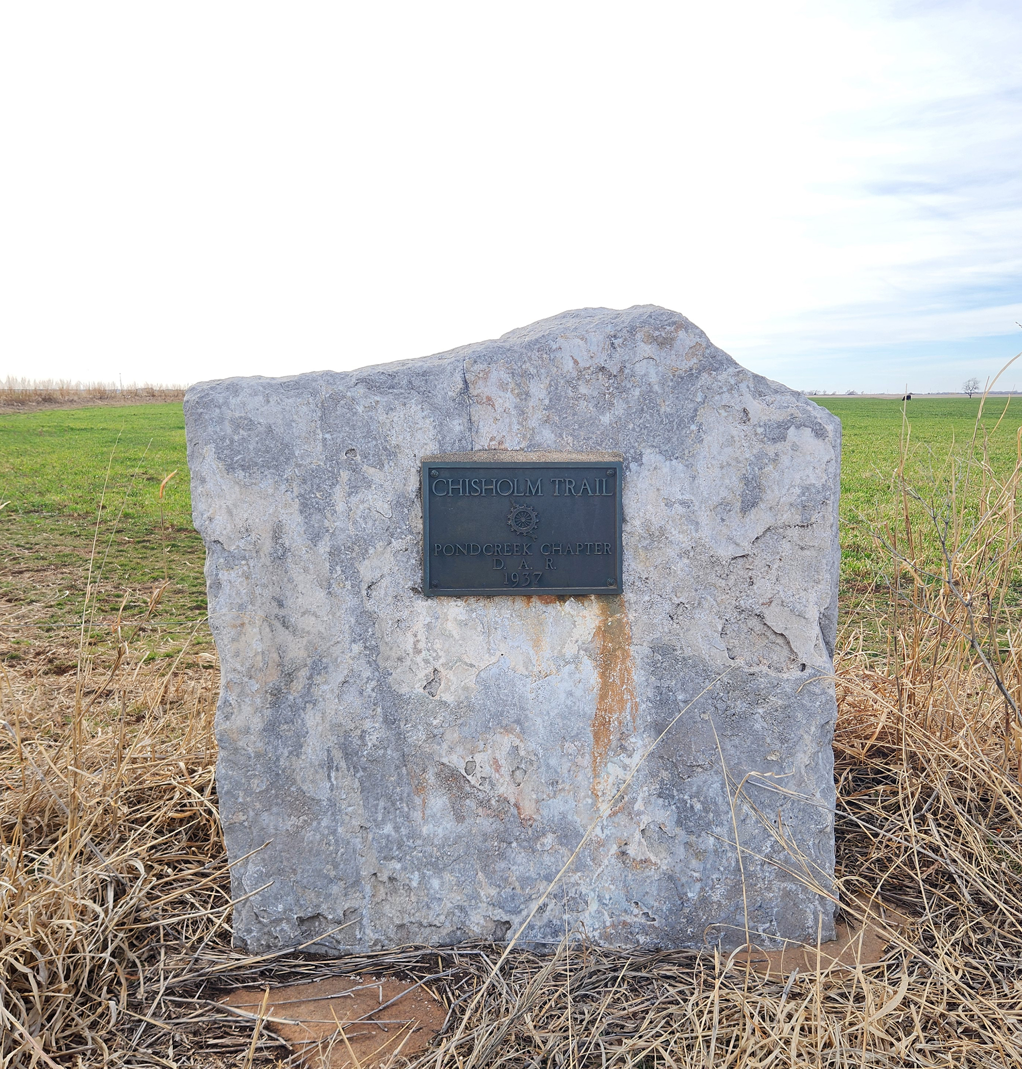
Location: One mile north of Pond Creek on Highway 81, on the west side of the road (DAR)
Coordinates: 36.6807398,-97.804301
Sponsored by: Daughters of the American Revolution
Material: Stone with bronze plaque
Topics: American Indians, Indian and Frontier Trade, Transportation, Westward Expansion 1803–1861, Territorial Period 1861–1907, Ranching
A pioneer merchant, trader, and explorer, Jesse Chisholm, a Cherokee, established the trail through western Indian Territory before the Civil War. Texas cattlemen used the trail until the late 1880s to move millions of cattle to northern markets. The trail ran from Montague County, Texas, to Abilene, Kansas.
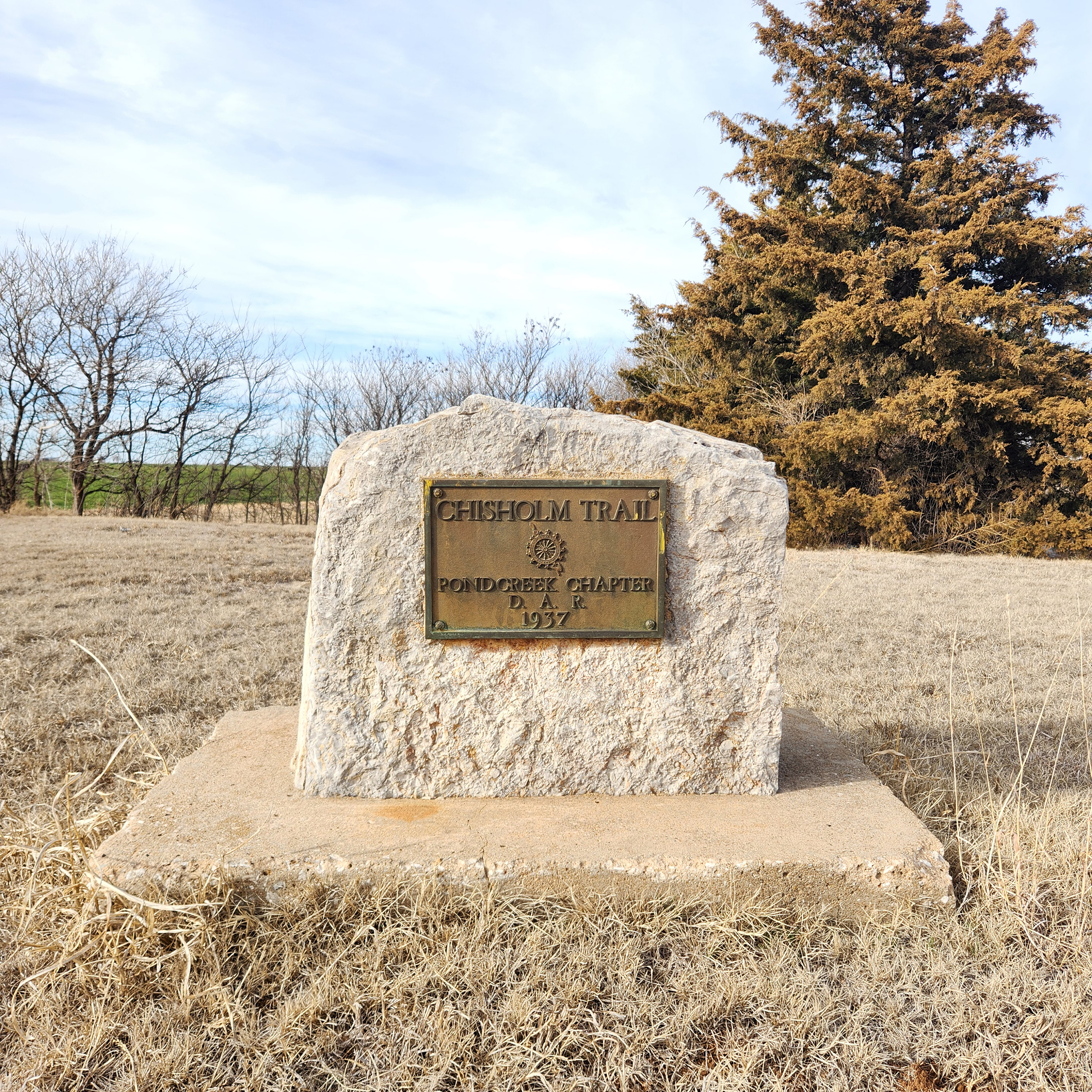
Location: Approximately 400 feet west of Eighth Street in Pond Creek on Highway 81, on the north side of the road (DAR)
Coordinates: 36.666028, -97.812611
Sponsored by: Daughters of the American Revolution
Material: Stone with bronze plaque
Topics: American Indians, Indian and Frontier Trade, Transportation, Westward Expansion 1803–1861, Territorial Period 1861–1907
A pioneer merchant, trader, and explorer, Jesse Chisholm, a Cherokee, established the trail through western Indian Territory before the Civil War. Texas cattlemen used the trail until the late 1880s to move millions of cattle to northern markets. The trail ran from Montague County, Texas, to Abilene, Kansas.
Le Flore County
Lincoln County
Logan County
Love County
Marshall County
Mayes County
McClain County
McCurtain County
McIntosh County
Murray County
Muskogee County
Noble County
Okfuskee County
Oklahoma County
Okmulgee County
Osage County
Ottawa County
Pawnee County
Payne County
Pittsburg County
Pontotoc County
Pottawatomie County
Pushmataha County
Roger Mills County
Rogers County
Seminole County
Sequoyah County
Stephens County
Texas County
Tillman County
Tulsa County
Wagoner County
Washington County
Washita County
Woods County
Woodward County
Historical Marker Program
Search Results
Your search returned 2 results.
Chisholm Trail
Grant CountyLocation: One mile north of Pond Creek on Highway 81, on the west side of the road (DAR)
Coordinates: 36.6807398,-97.804301
Sponsored by: Daughters of the American Revolution
Material: Stone with bronze plaque
Topics: American Indians, Indian and Frontier Trade, Transportation, Westward Expansion 1803–1861, Territorial Period 1861–1907, Ranching
A pioneer merchant, trader, and explorer, Jesse Chisholm, a Cherokee, established the trail through western Indian Territory before the Civil War. Texas cattlemen used the trail until the late 1880s to move millions of cattle to northern markets. The trail ran from Montague County, Texas, to Abilene, Kansas.
Chisholm Trail
Grant CountyLocation: Approximately 400 feet west of Eighth Street in Pond Creek on Highway 81, on the north side of the road (DAR)
Coordinates: 36.666028, -97.812611
Sponsored by: Daughters of the American Revolution
Material: Stone with bronze plaque
Topics: American Indians, Indian and Frontier Trade, Transportation, Westward Expansion 1803–1861, Territorial Period 1861–1907
A pioneer merchant, trader, and explorer, Jesse Chisholm, a Cherokee, established the trail through western Indian Territory before the Civil War. Texas cattlemen used the trail until the late 1880s to move millions of cattle to northern markets. The trail ran from Montague County, Texas, to Abilene, Kansas.
(Page 1 of 1)
Search for Markers
Search by keyword or browse by county to learn about more than 600 historical markers created to recognize key locations, events, and people in Oklahoma history.
Please note that some markers listed in this database may have been moved, damaged, or are no longer standing.
Browse by County
Adair County
Alfalfa County
Atoka County
Beaver County
Beckham County
Blaine County
Bryan County
Caddo County
Canadian County
Carter County
Cherokee County
Choctaw County
Cimarron County
Cleveland County
Comanche County
Cotton County
Craig County
Creek County
Custer County
Delaware County
Dewey County
Ellis County
Garfield County
Garvin County
Grady County
Grant County
Greer County
Harmon County
Harper County
Haskell County
Hughes County
Jackson County
Jefferson County
Johnston County
Kay County
Kingfisher County
Kiowa County
Latimer CountyAlfalfa County
Atoka County
Beaver County
Beckham County
Blaine County
Bryan County
Caddo County
Canadian County
Carter County
Cherokee County
Choctaw County
Cimarron County
Cleveland County
Comanche County
Cotton County
Craig County
Creek County
Custer County
Delaware County
Dewey County
Ellis County
Garfield County
Garvin County
Grady County
Grant County
Greer County
Harmon County
Harper County
Haskell County
Hughes County
Jackson County
Jefferson County
Johnston County
Kay County
Kingfisher County
Kiowa County
Le Flore County
Lincoln County
Logan County
Love County
Marshall County
Mayes County
McClain County
McCurtain County
McIntosh County
Murray County
Muskogee County
Noble County
Okfuskee County
Oklahoma County
Okmulgee County
Osage County
Ottawa County
Pawnee County
Payne County
Pittsburg County
Pontotoc County
Pottawatomie County
Pushmataha County
Roger Mills County
Rogers County
Seminole County
Sequoyah County
Stephens County
Texas County
Tillman County
Tulsa County
Wagoner County
Washington County
Washita County
Woods County
Woodward County
Contact Us
If you have questions, please contact:
Matthew Pearce
Oklahoma Historical Society
800 Nazih Zuhdi Drive
Oklahoma City, OK 73105
405-522-8659
matthew.pearce@history.ok.gov