Map Archives
1820–present
Search the
Online Catalog
The Gateway to
Oklahoma History
The Map Archives offer a variety of maps created for many different purposes, and collected over the years from donations and purchases. The archives contain thousands of items, many of which are currently available in our online catalog or The Gateway to Oklahoma History.
The archives include:
- Street and highway maps at the Oklahoma state, county, and city level
- Maps issued by US government agencies
- Plat maps of counties and towns in Oklahoma - Search the index
- Fire insurance maps - Search the index
- Maps featuring:
- Waterways
- Railways
- Native populations
- Cemeteries
- Telecommunication lines
- Trails
- Borderlines and boundaries
- Waterways
Orders and Fees
| Size | Price |
|---|---|
| 11″x17″ | $45 |
| 16″x20″ | $50 |
| 18″x24″ | $60 |
| 26″x36″ | $80 |
| Scan (300 dpi) | $30 |
Reproductions of our most popular maps are available to purchase in the Research Center and in the online store. Maps that have been scanned are available to view in the online catalog. The inventory of holdings can be found under the Oklahoma Historical Society Map Collection.
Custom orders of maps not listed in our catalog will be priced based on map condition and size. Please allow six to eight weeks for custom map orders.
Order online You may also order by mail using the printable order form.
Contact the Map Archives
Mallory Covington
405-522-0876
Mallory.Covington@history.ok.gov
Map Archives Highlights
Plat Map Index
An index of plat map books containing neighborhood additions is available. More than 3,400 entries are included in this database.
Fire Insurance Map Index
An index of Sanborn and Clarkson fire insurance maps is available.
The Map Archives contain a variety of cartographic materials. Below are just a few examples.
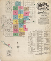
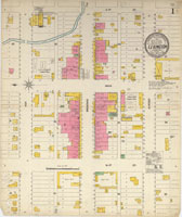 Fire insurance maps were created as a product to help insurance companies assess potential risks involved in underwriting policies. A survey was taken every two to three years for each town. Small communities may fit on one sheet, while larger cities are mapped over many pages. These examples were created by the Sanborn company, which is still in the business of geospatial mapping today. More than one thousand maps from the Clarkson Fire Insurance Maps Collection are available on The Gateway to Oklahoma History.
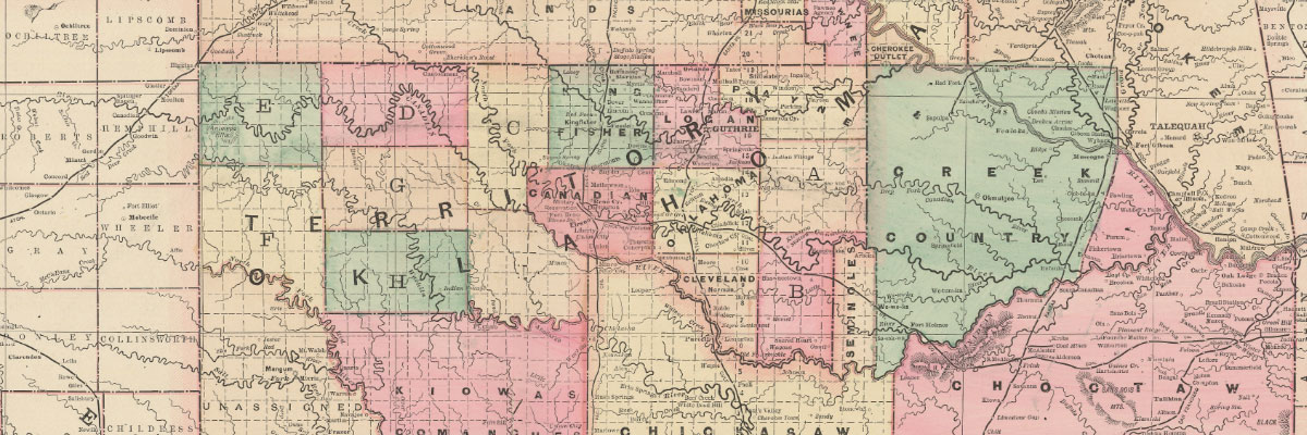
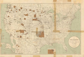 Maps from government reports include those submitted with Reports to the Commissioner of Indian Affairs. This example shows a map created from the information taken in the 11th United States Census of 1890 under the direction of T. J. Morgan, the commissioner of Indian Affairs.
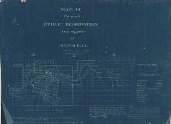 This map is a survey of the town of Sulphur and the surrounding areas, showing the proposed land for a public reservation now known as the Chickasaw National Recreation Area and maintained by the National Park Service. This map was created for the Commission to the Five Civilized Tribes in 1902.
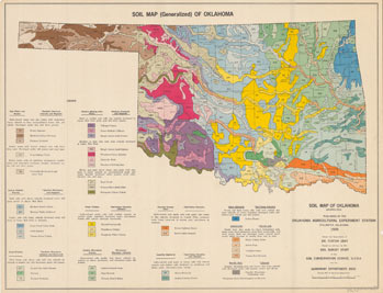 Maps containing geographic and topographical information are also included. This map shows the soil variations throughout the state of Oklahoma. It was created by the Agronomy Department of Oklahoma State University, Stillwater, in 1959.
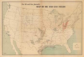 The mapping natural resources has a long history in Oklahoma; the Oil & Gas Journal is a publication out of Houston, Texas, devoted to the petroleum industry. This map was created as a supplement to the June 5, 1941, issue and features oil and gas fields across the United States.
Donations
The OHS accepts original maps that are hand-drawn, printed, or published. Copies of maps from Oklahoma state agencies or United States federal agencies are discouraged, as they are available elsewhere.
Useful Links
- Oklahoma Corporation Commission Aerial Photo Viewer: oklahoma.gov/occ/divisions/oil-gas/database-search-imaged-documents/occ-aerial-photo-viewer.html
- Oklahoma Department of Libraries offers maps on the Oklahoma Digital Prairie: digitalprairie.ok.gov/
- Oklahoma Department of Transportation: https://www.odot.org/maps/state/archive-a.htm
- Oklahoma Geological Survey: www.ou.edu/ogs/maps
- Oklahoma State University, Oklahoma Digital Maps Collections: www.library.okstate.edu/collections/digital-collections/oklahoma-digital-maps-collection