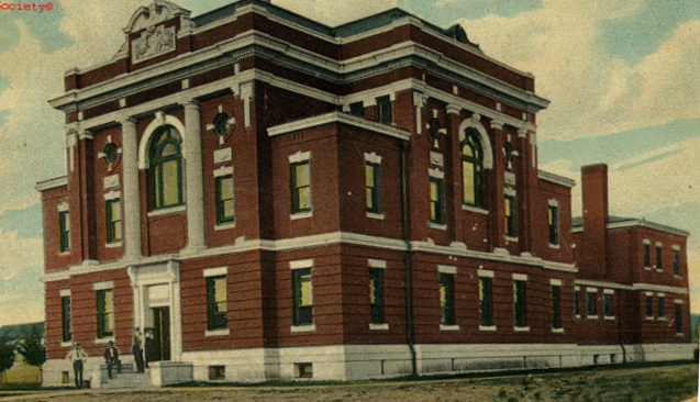
Caddo County Courthouse, Anadarko, Oklahoma, 1910
(20747.11, Oklahoma Historical Society Photograph Collection, OHS).
CADDO COUNTY.
Located in west-central Oklahoma, Caddo County is bordered on the north by Blaine and Canadian counties, on the east by Grady County, on the south by Comanche County, and on the west by Kiowa, Washita, and Custer counties. Most of Caddo County is situated in the Gypsum Hills and Red Bed Plains physiographic regions with the exception of the far southwestern corner, which lies in the Wichita Mountains region. Comprised of 1,290.31 square miles of land and water, the county is drained by the Washita River and various creeks such as Sugar and Pond. The Canadian River passes through the northeastern corner of Caddo County. Streams have cut deep canyons such as Red Rock Canyon near Hinton and Devil's Canyon near Lookeba. Outcrops south of Hydro are known as the Twin Mounds, Ghost Mound, Dead Woman Mound, and Rock Mary. In 2010 the incorporated towns included Anadarko (the county seat), Apache, Binger, Bridgeport, Carnegie, Cement, Cyril, Eakly, Fort Cobb, Gracemont, Hinton, Hydro, and Lookeba.
At the turn of the twenty-first century Caddo County had 451 reported archaeological sites, and 180 of them had been identified to time period. One hundred fifteen of those sites relate to the Plains Village era (A.D. 1000 to 1500). The Domebo Canyon Site, where a Columbian mammoth had been killed approximately 11,000 years ago, is the most significant. In addition, the Caddo County Medicine Creek Archaeological District (NR 95000235) and the Stevens Rock Shelter (NR 95000237) were listed in the National Register of Historic Places in 1995.
In 1803 the United States acquired from France the area known as the Louisiana Purchase, which included present Oklahoma. In 1818 the Quapaw ceded to the United States the land between the Canadian and Red rivers. During the 1820s and 1830s the Choctaw and Chickasaw removed from the southeastern portion of the United States to this area that became part of Indian Territory. Through an agreement with the Choctaw and Chickasaw in June 1855 their land west of the 98th Meridian was leased to the United States to provide reservations for Plains tribes. Known as the Leased District, the Choctaw and Chickasaw ceded the area to the United States under the Reconstruction Treaty of 1866, following the Civil War. In 1859 the superintendent of Indian Affairs for Indian Territory founded the Wichita Agency, which was established four miles east of the present town of Fort Cobb. Before the town was established, a fort by that name existed from 1859 to 1869. In 1867 the Kiowa, Comanche, and Apache were located in the southern part of present Caddo County, and in 1868 the Wichita and Caddo were situated north of the Washita River.
Between the 1830s and 1850s expeditions passed through the area. In 1834 the Dodge-Leavenworth Expedition traveled through present Caddo County, crossing the Washita River on its march back to Fort Gibson. Nine years later Nathan Boone led a reconnaissance that went northwest from Fort Gibson through northern Oklahoma to the 98th and 99th Meridians before turning south and following the Canadian River back to the fort. In 1849 gold seekers going to California used the southern branch of the California Road, which passed through Indian Territory. Emigrant parties left Fort Smith and Van Buren, Arkansas, and traveled the Californian Road, which basically ran parallel to the Canadian River. Rock Mary, one of the landmarks along that road, is situated in present Caddo County. In 1853 the Whipple Expedition commenced from Fort Smith and crossed Indian Territory by following a route south of the Canadian River.
Caddo County was organized on August 6, 1901, when the area was opened by lottery to non-Indian settlers. According to historian George Shirk, the county is named for the Caddo tribe, and the word stems from kaadi, meaning "chief." Caddo County lost area to Grady County at 1907 statehood and in 1911. Initially, county government was administered under a tent on the courthouse square in Anadarko. Late in 1901 a one-story, wood-frame building was erected. A second story was added in 1902. That year construction started on a three-story, brick courthouse, which served the county until Barbour and Short Company built a two-story structure in 1958.
Agricultural pursuits have dominated Caddo County's economic base. At 1907 statehood 80 percent of the county was farmland, with 360,000 acres under cultivation. The fertile river and creek bottomland provided rich nutrients for the principal crops of cotton, corn, wheat, alfalfa, broomcorn, and sorghum. In 1920 the State Board of Agriculture reported 4,214 farms, of which 49 percent were operated by owners and 51 percent operated by renters. In 1930 the county had livestock numbering 24,331 cattle, 7,147 horses, 5,820 mules, 4,033 swine, and 2,591 sheep and goats. In the early 1930s cotton gins operated in Anadarko, Bridgeport, Carnegie, Gracemont, and Hydro. Elevators and mills in Anadarko and Bridgeport served farmers. By 1960 Caddo County ranked first in Oklahoma for the production of peanuts and raising hogs and poultry. By 1963 livestock numbered 90,500 chickens, 88,000 cattle, 4,500 milk cows, 9,500 hogs, and 5,200 sheep. That year farmers had planted 96,000 acres in wheat, 43,900 acres in cotton, 39,400 acres in sorghums, 31,700 acres in peanuts, 23,000 acres in barley, and 18,000 acres in oats. At the turn of the twenty-first century Caddo County had 1,496 farms consisting of 726,629 acres.
In addition to agriculture, the petroleum industry has supplemented the economy. At Cement oil fields were discovered in 1911, and by 1924 that field had one hundred producing wells. In the 1930s the Magnolia Oil Corporation was the largest company in the Cement area. The Anderson-Pritchard Refinery Company in Cyril stored the oil output from the Cement field. In the early 1930s Anadarko had six oil service businesses. Brief economic boosts due to oil production came to Gracemont in the 1960s, to Carnegie and Lookeba in the 1970s, and to Hydro in the 1980s.
After the Great Depression ended, Pres. Franklin D. Roosevelt's New Deal programs put the unemployed back to work. Among the projects in Caddo County were a Civilian Conservation Corps camp near Binger and the construction of the Anadarko National Guard Armory. The armory (NR 94000479) was added to the National Register of Historic Places in 1994.
The Riverside Indian School and mission schools were the earliest educational facilities in present Caddo County. John Jasper Methvin, a Methodist missionary, opened the Methvin Institute near Anadarko in 1890. Father Isidore Ricklin established St. Patrick's Mission in 1892. The Baptists and Presbyterians also organized mission schools. Following the land lottery in 1901 non-Indian children attended subscription schools until taxes could be assessed and collected to support public schools. At the turn of the twenty-first century Caddo County had eleven school districts: Anadarko, Binger-Oney, Boone-Apache, Carnegie, Cement, Cyril, Fort Cobb-Broxton, Gracemont, Hinton, Hydro-Eakly, and Lookeba-Sickles.
The earliest transportation routes in Caddo County included the California Road and military roads such as the route from Camp Supply to Fort Sill. At the turn of the twentieth century the Chicago, Rock Island and Pacific (CRI&P) Railway had two lines in Caddo County. One line traversed the county in a north-south direction and passed through Bridgeport, Hinton, Lookeba, Binger, Gracemont, Anadarko, and Apache. The line between Hinton and Anadarko was abandoned in 1939. The other CRI&P line passed through the county from east to west connecting Chickasha (Grady County), Anadarko, Fort Cobb, and Carnegie with southwestern Oklahoma. Between 1901 and 1903 the Oklahoma City and Western Railroad (later the St. Louis and San Francisco Railway) built a line from Chickasha to the Red River and through Cement and Cyril in southeastern Caddo County. Modern motorists use U.S. Highways 62, 277, and 281 and State Highways 8, 9, 19, 37, 58, 146, and 152.
Caddo County had 30,241 residents at 1907 statehood. Numbers increased to 35,685 in 1910 and declined slightly to 34,207 in 1920. Unlike most Oklahoma counties that lost population in 1930 due to the Great Depression, Caddo County reached its peak population of 50,799. Through the next three decades the numbers dwindled from 41,567 in 1940 to 28,621 in 1960. Due to the temporary oil boom between the 1970s and 1980s the population increased to 30,905 in 1980. At the turn of the twenty-first century the county had 30,150 inhabitants. In 2010 the census identified 29,600, of whom 63.1 percent were white, 24.5 percent American Indian, 2.8 percent African American, and 0.2 percent Asian. Hispanic ethnicity was identified as 10.1 percent. The April 2020 population of 26,934 were 55.1 percent white, 23.3 percent American Indian, 4.2 percent African American, 0.6 percent Asian, and 16.0 percent Hispanic.
Caddo County offers many amenities. Outdoor enthusiasts can enjoy Red Rock Canyon State Park, Fort Cobb State Park, Fort Cobb Lake, Lake Chickasha, and Lake Ellsworth. The Southern Plains Indian Museum, Anadarko Philomathic Pioneer Museum, Indian City USA, National Hall of Fame for Famous American Indians, and the Delaware Tribe Museum offer exhibits relating to American Indians and regional history. The annual American Indian Exposition is held in August in Anadarko. In addition to the National Guard Armory and the two archaeological sites, Caddo County had eight other listings in the National Register of Historic Places. They were the Amphlett Brothers Drug and Jewelry Store (NR 82003669), Anadarko Downtown Historic District (NR 82005385), Apache State Bank (NR 72001060), Black Beaver's Grave (NR 73002256), Fort Cobb Site (NR 73001556), Provine Service Station (NR 97000803), Randlett Park (NR 03000878), and Rock Mary (NR 70000528). Internationally known Kiowa artist Stephen Mopope painted murals in the Anadarko post office.
See Also
Learn More
"Caddo County," Vertical File, Research Division, Oklahoma Historical Society, Oklahoma City.
Profiles of America, Vol. 2 (2d ed.; Millerton, N.Y.: Grey House Publishing, 2003).
Related Resources
Amphlett Brother's Drug and Jewelry Store, National Register of Historic PlacesAnadarko Armory, National Register of Historic Places
Anadarko Downtown Historic District, National Register of Historic Places
Apache State Bank, National Register of Historic Places
Black Beaver's Grave, National Register of Historic Places
Bridgeport Bridge, National Register of Historic Places
Fort Cobb Site, National Register of Historic Places
Provine Service Station, National Register of Historic Places
Randlett Park, National Register of Historic Places
Rock Island Passenger Station, National Register of Historic Places
Rock Mary, National Register of Historic Places
Caddo County newspapers, The Gateway to Oklahoma History
Citation
The following (as per The Chicago Manual of Style, 17th edition) is the preferred citation for articles:
Linda D. Wilson, “Caddo County,” The Encyclopedia of Oklahoma History and Culture, https://www.okhistory.org/publications/enc/entry?entry=CA005.
Published January 15, 2010
Last updated February 8, 2024
© Oklahoma Historical Society