The Encyclopedia of Oklahoma History and Culture
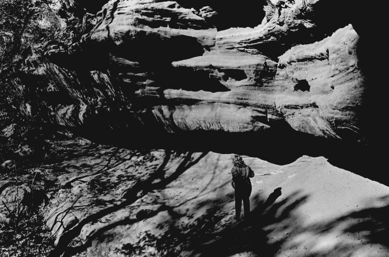
Horsethief Canyon near Perkins, Oklahoma, 1985
(2012.201.B1017.0117, Oklahoma Publishing Company Photography Collection, OHS).
HORSETHIEF CANYON.
Stories and legends about Horsethief Canyon add to Oklahoma's outlaw lore. The canyon is located in Logan County eight miles west of Perkins on the south side of the Cimarron River on private property. Tributary waters cut a broad, V-shaped opening through bluffs, creating a deep canyon that extends four hundred feet in a southeasterly direction. The upper extremity forms a two-hundred-foot-high shale proscenium arch, or natural amphitheater. Shale and clay constitute the lower floor. Over time, water eroded the rocks and created caves in which a person could stand. Names and dates from 1875 are carved on the stones.
The canyon lay on the Iowa Reservation, established in 1883. The area north of the Cimarron River became part of the Unassigned Lands, opened for settlement in the Land Run of 1889. Cedar trees growing on the canyon's bluffs provided wood to homesteaders, who crossed the river and cut timber illegally on the reservation until the 1891 run opened those lands to non-Indian settlers. Cedar continued to be cut and sold during the 1920s. In 1900 the Eastern Oklahoma Railway (later the Atchison, Topeka and Santa Fe Railway) built a line along the river one mile east of the canyon, where the town of Goodnight was established.
Early canyon visitors found a dugout on the western wall, rail fencing, and feed boxes made of split logs. Speculation grew that the canyon had provided a haven for notorious 1890s desperadoes such as the Dalton and Doolin gangs. No evidence exists, and most historians discredit the notion because the canyon's location is well known and because the rocky terrain and dense brush could trap criminals. Nevertheless, tales persisted, one such being the story of a Goodnight railroad agent who supposedly encountered Emmett Dalton, who asked for directions to the canyon in 1905. However, at that time Dalton was incarcerated in the Kansas State Penitentiary and was not released until 1907. The dugout probably belonged to line riders, cowboys who drove cattle north from Texas along the Chisholm Trail to Kansas railroad lines. They used the canyon as a line camp while cattle fattened in Cowboy Flat, a grassland thirteen miles to the west. The canyon provided shelter and views in three directions for scouting lost cattle. Other canyon "residents" included horse thieves, cattle rustlers, and vagrants.
As more homesteaders moved into the area, they demanded that the criminals be removed from the canyon. It soon became the meeting place for the Goodnight chapter of the Anti-Horse Thief Association (AHTA). From Missouri, the AHTA had spread into Oklahoma Territory, investigating thefts during the 1890s. Legend contends that an oak tree on a nearby trail was known as "the courtroom." Accused thieves received midnight trials and hangings administered by horseback juries. Again, no hard evidence exists.
On Easter Sunday in 1907 Goodnight residents went to the canyon for their first annual gathering, an event organized by the AHTA. Association president Roy Hays served as master of ceremonies, and Maj. Gordon "Pawnee Bill" Lillie gave a speech. Guests included Frank "Pistol Pete" Eaton, Rolla Goodnight, and others. By the 1920s such gatherings ceased until the Old Settlers' Association of Payne and Adjoining Counties, founded in 1922 (succeeded in 1927 by the Old Settlers' Sons-Daughters Association of Oklahoma), began its annual encampment on a nearby farm. More recently, the canyon has provided a recreational area for camping, picnicking, and horseback riding for Boy Scouts and Oklahoma State University students. Since 1974, when a student slipped and fell to his death, access has been restricted. At the turn of the twenty-first century Horsethief Canyon remained closed to the public.
Learn More
LeRoy H. Fischer and Thomas D. Isern, "Horsethief Canyon: Landmark on the Cimarron River," The Chronicles of Oklahoma 56 (Spring 1978).
"Horsethief Canyon," Vertical File, Research Division, Oklahoma Historical Society, Oklahoma City.
David Sasser and Mahlon Erickson, Perkins, O.T., Queen City of the Cimarron: A Pictorial History 1889–1920 (Perkins, Okla.: Evans Publishing, 1989).
Tulsa (Oklahoma) Tribune, 19 December 1979.
Citation
The following (as per The Chicago Manual of Style, 17th edition) is the preferred citation for articles:
Tally D. Fugate, “Horsethief Canyon,” The Encyclopedia of Oklahoma History and Culture, https://www.okhistory.org/publications/enc/entry?entry=HO034.
Published January 15, 2010
© Oklahoma Historical Society