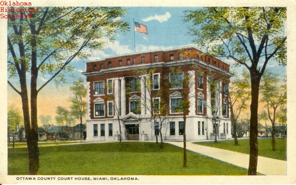
Ottawa County Courthouse
(19502.4, Oklahoma Historical Society Photograph Collection, OHS).
OTTAWA COUNTY.
Located in Oklahoma's northeastern corner, Ottawa County contains 484.73 square miles of land and water. Created at 1907 statehood the county is bordered by Kansas on the north, Missouri on the east, Delaware County on the south, and Craig County on the west. The name honors the Ottawa tribe.
The environmental setting displays two separate characteristics, the Ozark Plateau and the Osage Plains. The Ozark Plateau of the eastern part of the county gives way to the plains west of the Neosho River. The plains region here has also been classified as the Neosho Lowlands. The Neosho (Grand) and Spring rivers once merged in the county, but they now drain into the Lake O' the Cherokees, known as Grand Lake, impounded in 1940.
Most of the archaeological work relating to the Paleo-Indian period in Ottawa County has involved surface collection. William H. Holmes conducted two early, professional archaeological examinations here. In 1894 he investigated a chert quarry near Peoria, and in 1901 he surveyed a marsh known as Sulphur Springs near Afton, finding spear and arrow points, tools, and knives associated with mammoth and mastodon teeth. At the beginning of the twentieth century there were eight Archaic sites (6000 B.C. to A.D. 1), sixteen Woodland sites (A.D. 1 to 1000), and six Plains Village sites (A.D. 1000 to 1500).
After the Osage ceded their claim to the area, in 1828 the Western Cherokees acquired the region by ceding their Arkansas lands to the United States. Beginning in 1831 the federal government began to reacquire part of the land lying in present Ottawa County in order to relocate smaller tribes. The first such treaty between the Seneca living on the Sandusky River in Ohio and the federal government was concluded on February 28, 1831. A few months later the United States made an agreement with another Seneca band and the Shawnee of Ohio. Both of these treaties contained a clause promising a sawmill and blacksmith shop. In 1833 a treaty with Quapaw assigned them 150 sections of land near the Seneca. In 1867 the federal government purchased land from the Seneca/Shawnee and the Quapaw to relocate several tribes then residing in Kansas. These included the Peoria, Kaskaskias, Weas, Piankeshaws, Miami, Ottawa, and Wyandotte. After the Modoc War (1872–73) 153 Moduc were placed on the Quapaw Reservation.
From 1838 to 1871 the Neosho Agency administered these tribes' affairs, operating from several different locations over time. From 1851 through 1861 it occupied the Crawford Seminary, founded in 1843 near the present site of Peoria by the Methodist Episcopal Church as a school for Quapaw children east of Spring River. In 1848 the school had moved several miles north to a healthier environment, and it closed in 1852. Moved to Fort Scott, Kansas, during the Civil War, the Neosho Agency reopened in 1865 under Special Indian Agent George Mitchell in present Ottawa County and in July 1871 became the Quapaw Agency, serving only the tribes located in northeastern Indian Territory (beginning in 1849 several Indian nations then located in Kansas had been placed under the Neosho Agency, and the official Neosho agent lived there after the Civil War).
In 1869 the Society of Friends (Quakers) established a mission for the Wyandotte. It evolved into a boarding school for Seneca, Wyandotte, and Shawnee children, with classes initiated in 1872. Over the years the school was known by several names, including the Wyandotte Mission, Seneca Indian School, Seneca, Shawnee, and Wyandotte Industrial Boarding School, and Seneca Boarding School. In 1870 a school opened for the Ottawa, in 1871 a school for the Peoria was established north of the reservations in Baxter Springs, Kansas, and in 1871 a boarding school for the Quapaw and Modoc was founded. From 1894 until 1927 St. Mary's of the Quapaw, a Catholic facility, served that tribe. By the late 1890s most of the Quapaw Agency's charges had taken allotments.
Although lead and zinc mining occurred in the Missouri portion of the Tri-State Lead and Zinc District (southwestern Missouri, southeastern Kansas, and northeastern Oklahoma) as early as the 1850s, mining began in present Ottawa County near Peoria in 1891. Soon numerous mining camps emerged, including Picher, Lincolnville, Hattonville (later Commerce), Century, and Cardin. The industry also led to instant growth in preexisting towns, such as Miami and Quapaw. The Quapaw tribe initially held the rights to most of the land that produced the valuable ore. By the 1910s companies began to buy, rather than lease the land, and as a result, a few large corporations monopolized the lead and zinc fields. These included the Commerce Mining and Royalty Company, the Eagle-Picher Company, the Childers Mining Company, the LaClede Lead and Zinc Company, and the American Lead and Zinc Company. Several smelters also operated, heat-refining the ore into a marketable product.
In 1926, at the region's height of production, Ottawa County stood as the largest source of lead and zinc in the world. By the 1960s most of the mines had closed, leaving mine shafts, sinkholes, chat piles, and other dangers for the next generation. By 2000 the Tar Creek Superfund Site, a federally funded clean-up project, centered on Picher and encompassed most of the former lead and zinc production centers. Limestone, timber, and tripoli have also been extracted in Ottawa County. In 1912 tripoli, primarily used as an abrasive, was found near Peoria and continued to be mined into the twenty-first century, with 29,277 tons produced in 2002.
Transportation routes had emerged in the area by the early 1800s. The Texas Road and later two branches of the Shawnee Trail, which followed the Grand River from Fort Gibson, traversed present Ottawa County, connecting Texas to Kansas. In 1871 the Atlantic and Pacific Railroad, acquired in 1876 by the St. Louis and San Francisco Railway, laid tracks through the area southwesterly to Vinita. In 1901 the Kansas City, Fort Scott and Memphis Railway, leased to the St. Louis and San Francisco Railway that same year, built from the Kansas border to Afton. In 1906–07 the Southwest Missouri Railroad built an interurban line from Baxter Springs, Kansas, to Picher to haul lead and zinc. In 1908–09 the Oklahoma, Kansas and Missouri Inter-Urban Railway constructed a line from Miami to Commerce to also service the mining industry, completing another branch in 1916 from Commerce to Century. In 1919 the Northeast Oklahoma Railroad purchased the Oklahoma, Kansas and Missouri and in 1939 bought the Southwest Missouri Railroad. In 1912–13 the Missouri, Oklahoma and Gulf Railroad, eventually sold to the Kansas, Oklahoma and Gulf Railway, laid rails from the Kansas-Oklahoma line south through Ottawa County to Wagoner.
Historically, corn has been the key agricultural product. In 1907 Ottawa County farmers planted 55,483 acres of it, as well as 8,276 acres of wheat, and 5,800 acres of oats. In 1934 they planted 19,823 acres of corn, 19,873 acres of oats, and 12,040 acres of wheat. By 1960 wheat had taken the lead, with 22,000 acres planted, followed by 9,600 acres of corn, and 6,500 acres of oats. That year farmers planted 13,400 acres of sorghums. In 2002 wheat continued to be the leading cash crop, with seventy-seven farms planting 23,032 acres, but soybeans grew in importance, with 21,786 acres planted by seventy farms. Corn had diminished in consequence, and only 3,642 acres were planted.
Ranching has also supplemented the county's economy. In 1907 residents owned 9,145 swine, 7,715 cattle, and 3,589 horses. By 1935 ranchers had increased the cattle to 19,957, and there were 10,984 swine and 3,974 horses. By 1960 the cattle industry continued to grow with 31,000 head, but the hog business declined to 6,200. In 2002 the U.S. Department of Agriculture inventoried 53,833 cattle and 5,969 hogs and pigs in Ottawa County.
In the first half of the twentieth century many of the county's businesses catered to the lead and zinc industry. These included machine shops, drilling companies, iron and metal supply companies, welding outfits, and a number of retail entities serving the miners. The chat, or rock fragmented waste, from the lead and zinc mines could be used as aggregate for road construction and concrete production, and a trucking industry developed to haul it. In 2002 the Flint Rock Products company utilized 588,429 tons of chat. In 1945 a B. F. Goodrich tire manufacturing plant opened northwest of Miami, providing jobs and boosting the county's sagging economy as lead and zinc production declined. On August 23, 1985, known in the region as "Black Friday," Goodrich announced the plant's closing.
Educational, medical, and recreational facilities developed to serve families in the mining region. In 1919 Oklahoma created the Miami School of Mines, which evolved into Northeastern Oklahoma Junior College (1924) and then Northeastern Oklahoma Agricultural and Mechanical College (1943). Miami also acquired an Integris medical complex and the Northeast Area Vo-Tech Center. In 1940 the Grand River Dam Authority completed construction on the Pensacola Dam, creating the Lake O' the Cherokees or popularly Grand Lake. Lying mostly in Delaware County, the lake extends into Ottawa County, attracting recreational dollars and development.
In 1907 the county's population stood at 12,827, and it increased to 15,713 in 1910. As the lead and zinc industry flourished, the number climbed, reaching 41,108 in 1920 and gradually declined with mining industry. There were 38,542 residents in 1930, 35,849 in 1940, and 28,301 in 1960. In 1970 the population registered 29,800 and ascended to 32,870 in 1980. Various transportation arteries were created to serve residents and industry. The Will Rogers Turnpike (Interstate 44) cuts diagonally through the county, entering Missouri at Oklahoma's northeastern corner. U.S. Highways 59, 60, and 69 traverse Ottawa County in a general north-south direction. State Highways 10, 10C, 25, 69A, 125, and 137 also serve travelers. Historic U.S. Highway Route 66 also ran through the county, and several related sites have been listed in the National Register of Historic Places, including Miami's Original Nine-Foot Section of Route 66 Roadbed (NR 94001610), Afton's Cities Service Station (NR 95000039), Horse Creek Bridge (NR 95000040), Miami's Marathon Oil Company Service Station (NR 95000041), Miami's Riviera Courts Motel (NR 04000524), and the Narcissa D-X Gas Station (NR 03001240) near Miami.
Two successful athletes hailed from Ottawa County, baseball hall-of-famer Mickey Mantle of Commerce and Heisman trophy-winning football star Steve Owens of Miami. Also with county ties are artists Joe Beeler and Charles Banks Wilson and composer and educator Louis W. Ballard. In 1916 Harry S. Truman, future United States president, invested in an unsuccessful Ottawa County lead and zinc mine. National Register of Historic Places properties include Miami's George L. Coleman, Sr., House (NR 83002113), Coleman Theater (NR 83002114), and the Ottawa County Courthouse (NR 04000122). In the Miami vicinity lies the Modoc Mission Church and Cemetery (NR 80003293), the Peoria Indian School (NR 83002116), and the Peoria Tribal Cemetery (NR 83002117). The John Patrick McNaughton Barn (NR 91001903) is in the Quapaw area, and the Tri-State Zinc and Lead Ore Producers Association Office (NR 03000097) is in Picher. The latter site contains the Picher Mining Field Museum.
In 2000 the county's population stood at 33,194. In 2010, 31,848 residents were 69.0 percent white, 18.9 percent American Indian, 0.8 percent African American, and 0.1 percent Asian. Hispanic ethnicity was identified as 4.7 percent. In 2010 Ottawa County's incorporated towns included Afton, Commerce, Fairland, North Miami, Peoria, Quapaw, and Wyandotte, with Miami as the county seat. In April 2020 the population of 30,291 were 62.7 percent white, 21.1 percent American Indian, 1.3 percent African American, 0.9 percent Asian, and 6.4 percent Hispanic.
Learn More
Ivy Coffey, "Ottawa County Reconstructs Economy on Diversification," Daily Oklahoman (Oklahoma City), 27 May 1962.
Carolyn Thomas Foreman, "Education Among the Quapaws, 1829–1875," The Chronicles of Oklahoma 25 (Spring 1947).
Arrell M. Gibson, Wilderness Bonanza: The Tri-State District of Missouri, Kansas, and Oklahoma (Norman: University of Oklahoma Press, 1972).
Frank H. Harris, "Neosho Agency, 1838–1871," The Chronicles of Oklahoma 43 (Spring 1965).
Steven Mack, Donald O. Henry, and Cathy Mayo, Archaeological Survey of Spring and Neosho Rivers, Ottawa County, Oklahoma, Contributions in Archaeology, Number 19 (Tulsa, Okla.: University of Tulsa, 1993).
Velma Nieberding, The History of Ottawa County (Miami, Okla.: Walsworth Publishing Co., 1983).
Velma Nieberding, "St. Mary's of the Quapaws, 1894–1927," The Chronicles of Oklahoma 31 (Spring 1953).
Muriel H. Wright, A Guide to the Indian Tribes of Oklahoma (Norman: University of Oklahoma Press, 1951).
Related Resources
Citation
The following (as per The Chicago Manual of Style, 17th edition) is the preferred citation for articles:
Larry O'Dell, “Ottawa County,” The Encyclopedia of Oklahoma History and Culture, https://www.okhistory.org/publications/enc/entry?entry=OT003.
Published January 15, 2010
Last updated February 9, 2024
© Oklahoma Historical Society