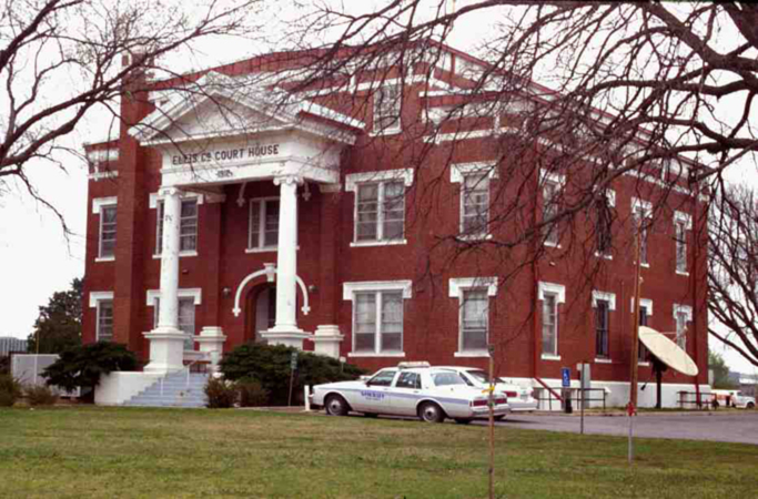
Ellis County Courthouse
(State Historic Preservation Office, OHS).
ELLIS COUNTY.
Named for Albert H. Ellis, a vice president of the 1906 Constitutional Convention, Ellis County lies in the state's westernmost tier of counties, along 100th Meridian, the Texas state line. The southern border is the meandering Canadian River. To the north lies Harper County and to the east, Woodward and Dewey counties. Ellis County encompasses a total land and water area of 1,231.8 square miles, most lying within the Great Plains physiographic region. Originally characterized by level, treeless, grassy prairies, much is now devoted to agriculture and grazing. Water features include generally southward-flowing tributaries of the Canadian River and northward-flowing tributaries of the North Canadian. The major stream is Wolf Creek, emptying into the North Canadian in Woodward County. Little Robe, Commission, and Hackberry creeks empty into the main Canadian. In the southwestern corner of the county is the 4,800-acre Ellis County Wildlife Management Area, with Lake Lloyd Vincent, and to the south, along the Canadian River, is the 17,000-acre Packsaddle Wildlife Management Area. Both encourage grasslands-bottomlands flora and fauna.
Native peoples used the area for subsistence for thousands of years. Surface surveys have found Paleo-Indian Clovis, Folsom, and Plano points. Late prehistoric sites revealed hunting, gathering, and horticulture by peoples of the Plains Villager Antelope Creek Phase, dating from 1200 to 1750. Historically, western Oklahoma was a corridor for the movement of Comanche, Kiowa, Apache, Cheyenne, and Arapaho people. A significant intertribal battle occurred in mid-June 1838 when allied Cheyenne and Arapaho attacked camps of confederated Kiowa, Comanche, and Plains Apache on Wolf Creek, about twenty miles above present Fort Supply (in present Ellis County).
In August 1820 an expedition led by Maj. Stephen H. Long passed through Ellis County, exploring the length of the Canadian River eastward to Fort Smith. In May 1858 a force of Texas Rangers and Indians under Capt. John S. "Rip" Ford crossed into the Indian Territory in pursuit of affiliated Indian bands accused of raiding in Texas. The Rangers attacked a Comanche village at the mouth of Little Robe Creek, in present Ellis County. Known as the Battle of the Antelope Hills or of Little Robe Creek, the encounter is notable because the Texans' illegal incursion into the Indian Territory resulted in the killing of Comanche leader Iron Jacket.
Settlement by non-Indians transpired in the late 1800s as the region developed as a transportation corridor. From the mid-1870s to the 1890s the Fort Supply (Indian Territory) to Fort Elliott (Texas) military road crossed the area, passing near present Fargo and present Gage, southward toward present Arnett, and southwestward into the Texas Panhandle. Serving troops and supply wagons, the route also had civilian stage stops, most notably at the crossing of Wolf Creek near Fargo and near Gage. In the 1880s the Western (cattle) Trail from Texas to Kansas intersected the military road a few miles northeast of Fargo. In 1886–87 the Southern Kansas Railway, later owned by the Atchison, Topeka and Santa Fe Railway system, constructed a line southwest from Kiowa, Kansas, through the future county, and along the tracks emerged Fargo, Gage, and Shattuck. A large settlement of Germans from Russia around Shattuck in 1901–02 gave Ellis County's history an ethnic aspect. By 1910 Ellis County's population of 15,375 included 526 ethnic Germans born in Russia and several thousand American-born family members.
Ellis County's organization in 1907 involved dissolving an existing county and rearranging another. The northern part of present Ellis County had formed the southwestern corner of the Cherokee Outlet from 1835. This area had been included in Woodward County after the Outlet opening in September 1893. The southern part of present Ellis County, between the Cherokee Outlet and the Canadian River, had originally been part of the Creek lands but from 1856 to 1866 was Seminole land. After the Seminole ceded it to the U.S. government, the area was part of the Cheyenne-Arapaho Reservation. Those lands were opened by run in April 1892. Afterward, this part had been organized into Day County, which also included northern Roger Mills County. Day County's seat of government was established first at Ioland and then at Grand. At 1907 statehood Day County was eliminated, Roger Mills County was extended northward to the Canadian River, and Woodward County was subdivided into several counties. It gave up its southwestern corner, which was combined with the remainder of Day County as Ellis County.
Ellis County's residents had definite ideas about the placement of their county offices. Although a logical site might be along the railroad, in Fargo, Shattuck, or Gage, many believed that a courthouse located so far north would be inconvenient. Adding to the slate, the town of Arnett, formerly in Day County, now lay within Ellis's boundaries. In June 1908 an election between Gage, Shattuck, and Arnett resulted in a runoff between the latter two towns. In the next election Arnett was chosen by a vote of 1,897 to 1,482. Arnett's citizens had quickly erected a frame building to serve as a courthouse. It was replaced in 1912 by a brick building on the town square.
Ellis County's economy has always derived from farming and ranching. Wheat, cotton, and broomcorn were important. In 1907, for instance, the rail depot at Shattuck shipped more broomcorn than any other shipping point in the nation. In 1920 the Santa Fe built a line from Shattuck to Spearman, in the Texas Panhandle, facilitating connections to markets in Colorado. In the early 1900s Ellis County had thirty-seven known rural communities and towns. Most towns had agribusinesses as their base, along with the customary retail establishments and services for residents and farmers coming to the rail stations. In the early years of the twentieth century farms were numerous. In 1910 there were 2,791, of which 2,531 ranged from a quarter-section (160 acres) to 1,000 acres. Thereafter, farms grew fewer but larger. In 1920 there were only 1,858, of which 1,150 were 160 to 1,000 acres and 49 were larger than 1,000. By 1950 the 1,123 farms included 427 larger than 500 acres. The trend continued until in 2000, 622 farms totaled 669,922 acres.
After the Civil War the Dominion Cattle Company, part of the Cherokee Strip Livestock Association, had leased cattle-grazing land in the southwest corner of the Cherokee Outlet. Grazing leases ended with the land run, but ranching and cattle feeding remained important. From the 1970s dairying proved profitable as well, and by 1980 county farmers owned 3,100 dairy cows. In the 1970s oil and gas production brought new jobs and money and rescued the county's population from decline. The official 1970 census count of 5,129 rose to 5,596 in 1980, but the subsequent drop in oil price curtailed production, and in 1990 the population stood at 4,497. In 2000 nonagricultural activities employed 28 percent of workers in the health industry and social services and 24.5 percent in retail operations.
Ellis County parents deemed education vital for children's futures, and they established at least 114 district schools in rural areas. A few of these included Ioland School, held in a log house built in 1894, Little Wolf School, near Gage, built in 1901 and destroyed by a 1947 tornado, Little Turkey School, and Pinkston school, established in 1926. Many consolidated with schools of the larger towns in the 1930s and 1940s. Old Beum School, built in 1902, opened in late 1903, and replaced by a new building in 1911, closed in 1934. It became the Western Art Center in the 1950s when Dord Fitz retired from an academic career in Kentucky and returned to establish art clubs in Oklahoma and Texas.
The disappearance of the rural schools reflects highway development in the 1920s and 1930s and, at the same time, population shift to urban areas. State Highway 46 and U.S. Highway 283 cross the county north-south, and State Highway 15 and U.S. 60 cross it east-west. Good roads facilitated commuting to jobs in larger towns, often in other counties. In 2010 the incorporated towns included Arnett (the county seat), Gage, Shattuck, and Fargo. Unincorporated communities included Catesby, Peek, and Harmon.
Ellis County's history was marked by one of the nation's most significant weather events. On April 9, 1947, a major F5 tornado, the sixth-most-deadly ever recorded in the United States, came through Ellis County. The storm system began near White Deer, Texas, and moved northeast for 221 miles. Ellis County's towns escaped damage, but outlying communities and farms suffered $1.2 million in damage. Six county residents died.
Population figures reflect the decline repeated in many counties. In 1910 the U.S. Census recorded 15,375 residents and in 1920, 11,673. Subsequent decades recorded 84,66 in 1940, 5,457 in 1960, 5,596 in 1980, and 4,497 in 1990, and 4.075 in 2000. Of the 2010 population of 4,151, 94.4 percent were white, 1.6 percent American Indian, 0.3 percent African American, and 0.2 percent Asian. Hispanic ethnicity was identified as 6.0 percent. In April 2020 the population of 3,747 were 84.9 percent white, 3.2 percent American Indian, 0.7 percent African American, 0.6 percent Asian, and 8.6 percent Hispanic.
See Also
Bibliography
Doug Hale, The Germans from Russia in Oklahoma (Norman: University of Oklahoma Press, 1980).
Our Ellis County Heritage, 1885–1974, Vol. 1 (N.p.: Ellis County Historical Society, 1974).
Plat Book of Ellis County, Oklahoma (Ashland, Kans.: Western Publishing Co., 1910).
Alvin O. Turner, "Order and Disorder: The Opening of the Cherokee Outlet," The Chronicles of Oklahoma 71 (Summer 1993).
Citation
The following (as per The Chicago Manual of Style, 17th edition) is the preferred citation for articles:
Dianna Everett, “Ellis County,” The Encyclopedia of Oklahoma History and Culture, https://www.okhistory.org/publications/enc/entry?entry=EL008.
Published January 15, 2010
Last updated
February 9, 2024
© Oklahoma Historical Society