The Encyclopedia of Oklahoma History and Culture
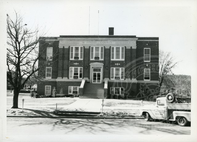
McIntosh County Courthouse
(2012.088.49, Lewis A. Danner Collection, OHS).
McINTOSH COUNTY.
Located in eastern Oklahoma, McIntosh County is surrounded by Okmulgee County on the north and west, Okfuskee and Hughes counties on the west, Muskogee County on the north and east, and Haskell and Pittsburg counties on the south. Named for the influential Creek family of McIntoshes, the county encompasses 712.48 square miles of land and water. Because of the convergence of three rivers, the Deep Fork, North Canadian, and Canadian, the area has a long history of human occupation. In 1964 the U.S. Army Corps of Engineers completed Eufaula Dam, creating Lake Eufaula. As Oklahoma's largest-surface area lake, it dominates McIntosh County's landscape. At 1907 statehood, when the county was established, its population stood at 17,975. The county annexed part of Hughes County in 1915 but lost land to Okmulgee County in 1918. In 2010 the county's six incorporated towns were Checotah, Eufaula (the county seat), Hanna, Hitchita, Rentiesville, and Stidham.
The county contains more than ninety-two square miles of water area, more than any other Oklahoma county, and with just under 13 percent of its total land under water, McIntosh County is second only to Marshall County's 13.08 percent. The creation of Lake Eufaula submerged a large amount of bottomland that had provided fertile fields. Much of the remaining surface land comprises sandstone hills, often covered in timber.
A majority of the county's archaeological sites date to the Archaic Period (6000 B.C. to A.D. 1), although in 2003 there were six sites predating that period. The Handprint Site contains petroglyphs, which were probably produced by precontact American Indians. Because of the rivers, early explorers and traders often trekked through the present county, including Jean Baptiste Bénard de La Harpe, André Fabry de la Bruyere, Stephen Long, Josiah Gregg, and Nathan Boone. The Texas Road cut through McIntosh County, establishing a route for the U.S. Army and early travelers to Texas.
The present county was part of the Eufaula District of the Creek Nation. In 1825 the Lower Creeks, many of whom were mixed-blood citizens led by William McIntosh, agreed to a treaty exchanging the tribe's land in Georgia for territory in present Oklahoma. Most of McIntosh County belonged to the Creek, except for the southeastern corner, which was held by the Cherokee. After the Creek people's harsh experiences on the Trail of Tears, they repeatedly clashed with the Osage in the new area. In 1836 Creeks established North Fork Town, an important tribal center on the Texas Road two miles east of present Eufaula. From 1853 until 1886 the U.S. Post Office Department operated a post office designated as Micco at North Fork Town. In 1848 the Methodist Church established the Asbury Manual Training School for Creek children; it closed briefly during the Civil War. Several years after the building burned in 1889, the students transferred to the new Eufaula Boarding School for Girls at Eufaula.
At the beginning of the Civil War Confederate representative Albert Pike signed treaties with the Chickasaw, Choctaw, and Creek nations at North Fork Town. For a short time Confederate Col. Douglas Cooper located his headquarters near Fisher's Store, which had been established around 1847 northeast of present Eufaula. The Battle of Honey Springs occurred near Rentiesville on July 17, 1863, and was the largest Civil War engagement in present Oklahoma. The Union victory allowed the Federal army to control Indian Territory north of the Arkansas River.
In 1871–72 the Missouri, Kansas and Texas Railway built tracks through the area, establishing Checotah and Eufaula. The line followed the Texas Road, as did the later Jefferson Highway, which became U.S. Highway 69. In 1903 the Fort Smith and Western Railroad Company constructed a railway through the southwestern corner of the county, running through Hanna. Railroad service ended in 1939. In 1904–05 the Missouri, Oklahoma and Gulf Railway laid tracks in McIntosh County's northwestern portion, and the town of Hitchita developed. U.S Highway 266 crosses the county's northern portion from east and west, meeting U.S. Highway 69 in Checotah. Interstate 40 also runs east and west and intersects U.S. 69 south of Checotah. State Highway 9, another east-west road, crosses U.S. 69 at Eufaula. The Indian Nation Turnpike and State Highways 52 and 72 join U.S. 69 as north-south highways.
Farming and ranching has historically driven the economy. By 1900 corn played an integral part in agriculture, but cotton gradually dominated. In 1938 county farmers planted 41,820 acres of cotton, compared to 56,900 acres of corn, and in 1955 they covered 13,500 acres with cotton and 11,500 with corn. Oats, sorghum, and wheat were also harvested. As cotton production increased, so did the number of tenant farmers. In 1910 there were 2,136 tenants on 164,174 acres, and, this increased in 1930 to 2,764 tenants on 235,749 acres. By 1950 tenancy throughout Oklahoma had decreased, and McIntosh County reflected the trend, with 916 on 126,110 acres. In the mid-1970s planters had almost completely stopped growing cotton, and with Lake Eufaula inundating cropland, all agriculture slowed. In 2000 there were 2,000 acres of wheat, 1,500 acres of soybeans, and 700 acres of corn, with sorghum, hay, and oats also raised. Cattle ranching remained vital throughout the twentieth century. In 1930 there were 13,300 head of cattle in the county, climbing to 24,800 in 1945, and 55,000 in 2000.
The county developed some of its mineral resources, including oil and gas production, limestone, sand, and gravel. Although Oklahoma's most productive coal counties surround McIntosh County, because of high ash and sulfur content little of its coal was mined in the early twentieth century. Between 1978 and 1990 companies strip-mined 3.2 million tons of a low-sulfur Secor coal that was discovered in McIntosh and Wagoner counties. A boon to the economy came with the 1964 completion of Lake Eufaula for flood control, water supply, and hydroelectric power. After that time tourism increased, bringing in outside dollars, and created companion industries such as boat manufacturing and retail sales.
Pulitzer Prize winner Jim Lucas and World War II hero Henry Carr hailed from Checotah. African American historian John Hope Franklin lived in Rentiesville. Poet, author, and journalist Alexander Posey, born in McIntosh County, operated one of Oklahoma's oldest newspapers, the Indian Journal, at Eufaula. Eufaula natives include U.S. Rep. John Conover "Jack" Nichols, noted football players Lucious II, Dewey, and Lee Roy Selmon, artist Jerome Tiger, and U.S. Rep. J. C. Watts. Creek leader George W. Grayson was also from the region, and Grant Johnson served as a deputy U.S. marshal in the Eufaula area. Artist Acee Blue Eagle was born in Hanna, and actor William Sampson is buried there. Outlaw Belle Starr made the region her refuge. The county was also home to many of the members of the McIntosh family, including Daniel, Chilly, and W. E. Dode McIntosh.
A number of county properties are listed in the National Register of Historic Places, including the Honey Springs Battlefield (NR 70000848), Slippery Moss Shelter (NR 78003085), Johnson Lake Shelters (NR 78003086), and the First Soil Conservation District Dedication Site (NR 82003689) near Eufaula. There are six National Register sites in Checotah and five in Eufaula. Vernon, one of the county's two remaining All-Black towns (Rentiesville is the other), has the Rock Front (also known as the Vernon Post Office, NR 84003152) listed in the National Register of Historic Places.
In 1910 the county population stood at 20,961, and it climbed to a high of 26,404 in 1920. After falling to 24,924 in 1930, 24,097 in 1940, and 17,029 in 1950, by 1960 the population reached a low of 12,371. After that growth was consistent, the 1970 census showing 7,529 and the 1980 census, 8,772. From 16,779 in 1990, it rose to 19,456 in 2000. In2010 the census counted 20,252, with 70.3 percent white, 18.5 percent American Indian, 3.2 percent African American, and 0.3 percent Asian. Hispanic ethnicity was identified at 1.9 percent. In April 2020 the population of 18,944 were 66.4 percent white, 19.4 percent American Indian, 3.1 percent African American, 0.6 percent Asian, and 3.6 percent Hispanic.
See Also
Bibliography
Angie Debo, The Road to Disappearance: A History of the Creek Indians (Norman: University of Oklahoma Press, 1941).
Yvonne Gamblin, Checotah Historical Highlights, 1890–1990 ([Marcelene, Mo.]: Heritage House, 1990).
"McIntosh County," Vertical File, Research Division, Oklahoma Historical Society, Oklahoma City.
V. V. Masterson, The Katy Railroad and the Last Frontier (Norman: University of Oklahoma Press, 1952).
John Bartlett Meserve, "The MacIntoshes," The Chronicles of Oklahoma 10 (September 1932).
Brian F. Rader, The Political Outsiders: Blacks and Indians in a Rural Oklahoma County (San Francisco, Calif.: R and E Research Associates, 1978).
C. W. "Dub" West, ed., McIntosh County Memories: People, Places, Events (N.p.: McIntosh County Historical Society, 1993).
Muriel H. Wright and LeRoy H. Fischer, "Civil War Sites in Oklahoma," The Chronicles of Oklahoma 44 (Summer 1966).
Citation
The following (as per The Chicago Manual of Style, 17th edition) is the preferred citation for articles:
Larry O'Dell, “McIntosh County,” The Encyclopedia of Oklahoma History and Culture, https://www.okhistory.org/publications/enc/entry?entry=MC028.
Published January 15, 2010
Last updated
February 9, 2024
© Oklahoma Historical Society