
Hillerman Map Project
Explore Using the Map
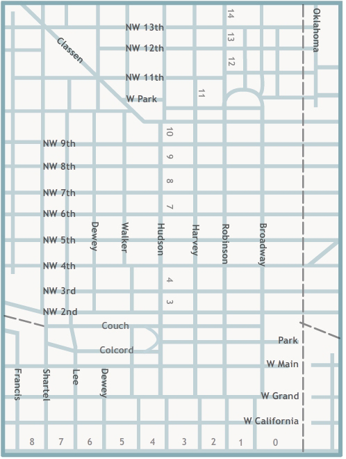
Click points or regions on the map to view photographs. You may also use our list of photographs by building or area name.
- •
- Ford Assembling Plant
- •
- Municipal Auditorium
- •
- Bird’s Eye View of Civic Center and Courthouse
- •
- Old County Courthouse
- •
- Montgomery Ward Building
- •
- Hotel Black
- •
- Motor Hotel
- •
- Plaza Court
- •
- Gene Jones Motor Company
- •
- Magnolia Petroleum Company
- •
- Rockwall Apartments
- •
- Masonic Temple (Home State Life Building)
- •
- Kirkpatrick Hotel
- •
- Elks Lodge (Key Building, ONG Building)
- •
- Federal Building
- •
- US Post Office
- •
- Federal Reserve Bank
- •
- Cotton-Exchange Building
- •
- Oklahoma County Courthouse
- •
- YWCA
- •
- Hightower Building
- •
- Mercantile Building (Levy Building)
- •
- Majestic Building
- •
- First National Building
- •
- Wright Building
- •
- Skirvin Tower
- •
- Rock Island Railroad Depot
- •
- Skirvin Hotel
- •
- Insurance Building
- •
- Public Warehouse Company
- •
- Patterson and Hoffman Wholesale Cigars and Pipes
- •
- Milner Hotel
- •
- Hotel Kingkade
- •
- Herskowitz Building
- •
- Santa Fe Railroad Station
- •
- Wells Roberts Hotel
- •
- Sooner Theatre
- •
- Colcord Building
- •
- Baltimore Building
- •
- Midwest Theatre
- •
- Kress
- •
- Lerner
- •
- Katz Drug Store
- •
- The American National Building
- •
- Empire Building
- •
- Criterion Theatre
- •
- Biltmore Hotel
- •
- Oklahoma Club Building
- •
- Farmer's National Bank Building
- •
- Commerce Exchange Building
- •
- Huckins Hotel, Huckins Garage
- •
- Campbell Building
- •
- Hales Building
- •
- Fidelity Bank
- •
- Britling Cafeteria
- •
- Manly Office Supply Company
- •
- Perrine Building, Cravens Building
- •
- Baum Building
- •
- Security National Building
- •
- Ramsey Tower, City National Building
- •
- Petroleum Building
- •
- Franklin Building
- •
- Braniff Building
- •
- Kerr-McGee Building
- •
- Capitol Federal Savings and Loan
- •
- Telephone, Pioneer, Southwestern Bell
- •
- Street View
- •
- Street View
- •
- Street View
- •
- Street View
- •
- Street View
- •
- Street View
- •
- Street View
- •
- Street View
- •
- Street View
- •
- Parade on Broadway
- •
- Street View
- •
- Street View
- •
- Aerial View
- •
- Bird’s-Eye View
- •
- Bird’s-Eye View
- •
- Bird’s-Eye View
Explore Using the List of Photographs
Use the links below view historic photographs of Oklahoma City.
Links by Building Name
- Baltimore Building
- Baum Building
- Biltmore Hotel
- Braniff Building
- Britling Cafeteria
- Campbell Building
- Capitol Federal Savings and Loan
- Colcord Building
- Commerce Exchange Building
- Cotton-Exchange Building
- Criterion Theatre
- Elks Lodge (Key Building, ONG Building)
- Empire Building
- Farmer's National Bank Building
- Federal Building
- Federal Reserve Bank
- Fidelity Bank
- First National Building
- Ford Assembling Plant
- Franklin Building
- Gene Jones Motor Co.
- Hales Building
- Herskowitz Building
- Hightower Building
- Hotel Black
- Hotel Kingkade
- Huckins Hotel, Huckins Garage
- Insurance Building
- Katz Drug
- Kerr-McGee Building
- Kirkpatrick Hotel
- Kress
- Lerner
- Magnolia Petroleum Company
- Majestic Building
- Manly Office Supply Company
- Masonic Temple (Home State Life Building)
- Mercantile Building (Levy Building)
- Midwest Theatre
- Milner Hotel
- Montgomery Ward Building
- Motor Hotel
- Municipal Auditorium
- Oklahoma Club Building
- Oklahoma County Courthouse
- Old County Courthouse
- Parade on Broadway
- Patterson and Hoffman Wholesale Cigars and Pipes
- Perrine Building, Cravens Building
- Petroleum Building
- Plaza Court
- Public Warehouse Company
- Ramsey Tower, City National Building
- Rock Island Railroad Depot
- Rockwell Apartments
- Santa Fe Railroad Station
- Security National Building
- Skirvin Hotel
- Skirvin Tower
- Sooner Theatre
- Telephone Building and Pioneer Building, Southwestern Bell
- American National Building
- US Post Office
- Wells Roberts Hotel
- Wright Building
- YWCA
Links to Aerial and Bird’s-Eye Views
- Aerial view of Oklahoma City northeast
- Bird’s-eye view of Broadway Circle
- Bird’s-eye view of Civic Center and Courthouse
- Bird’s-eye view looking southeast
- Bird’s-eye view looking southeast
Links to Street Views
- Looking east down First Street, or Park Avenue
- Looking east on Main Street
- Looking northeast on Main Street
- Looking northeast on Main Street
- Looking north on Robinson from Grand Avenue
- Looking north on Broadway Avenue
- Looking southeast on the 200 block of West Main
- Looking west on Grant Avenue
- Looking west on Northwest First Street (Park) from Broadway Avenue
- View of the 200 block of Northwest First Street, or Park Avenue
- View of Northwest First Street, or Park Avenue
The Z. P. Meyers/Barney Hillerman Photographic Collection
The Z. P. Meyers/Barney Hillerman Photographic Collection includes thousands of images, many of which depict businesses in Oklahoma City. Many photographs in the collection are from the Meyers Photo Shop, which employed Barney Hillerman and other photographers. This map highlights significant buildings in the downtown Oklahoma City area, as well as street and aerial views. The map features images dating from the late 1920s to the 1960s.
This project was made possible by a grant from the Pauline Dwyer Macklanburg and Robert A. Macklanburg Jr. Foundation.
Discover more images from the Z. P. Meyers/Barney Hillerman Photographic Collection on The Gateway to Oklahoma History.
