
Archaeology in Oklahoma
Important Sites in Oklahoma
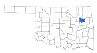
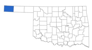
Bryson-Paddock

Bryson-Paddock is an archaeological site associated with the Wichita people, an American Indian tribe. It is located in north-central Oklahoma along the Arkansas River near the Kansas-Oklahoma border. This is an important site because the Wichita were able to use the flint and chert to make tools. The site was also protected by surrounding open prairie. Bryson-Paddock is where the French and Wichita traded goods such as hides and guns. Before the archaeologists excavated the site they surveyed the thirty acres (which is equal to thirty-nine football fields) and looked for evidence of artifacts and features.
After surveying, they excavated the features they found. and recorded their context. Some examples of the features are the postholes that the Wichita dug for the fences that held livestock. They also found hearths, which are holes that are dug into the ground for fires. They found several middens and many artifacts. Some of the artifacts in the matrices included bison bones, stone hide scrapers, French gun parts, glass beads, and fabric. After excavation, the archaeologists went back to the lab and placed the artifacts into classifications (groups) typically using seriation (dates) to better understand the evidence that was discovered.
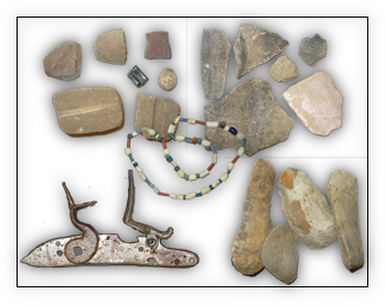
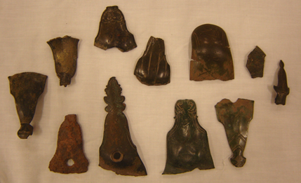
Items from the Bryson-Paddock site (OHS Collections).
Items from the Bryson-Paddock site (image courtesy of the University of Oklahoma).
Doaksville
Doaksville is an archaeological site located northwest of the modern town of Fort Towson. Doaksville was abandoned around the same time as Fort Towson and named after the man that owned the first trading post in the town, Josiah S. Doak. This town was a trading post in the 1820s and was the capital of the Choctaw Nation. Doaksville is where the food allotment for the Choctaw Nation was sent and where the tribe conducted their business and tribal courts. Doaksville was also a center of major transportation in the Indian Territory. When Fort Towson was abandoned, the economic markets in Doaksville declined, which eventually led to people leaving the town.
Before archaeologists excavated, they surveyed the one-acre site, which is a little more than one football field, and looked for evidence of artifacts and features. After they surveyed, they excavated the features found and recorded their context. Some of the features they found included foundations, a brick hearth, and a wood cellar. There were over thirty buildings that comprised the town when it was occupied. Some of the artifacts they found in their matrices were burnt ceramic shards, a limestone chimney, and nails. Unfortunately, many of the artifacts and features were changed due to looting and vandalism.
After excavation, the archaeologists went back to the lab and placed the artifacts into classifications (groups), typically using seriation (dates) so they could better understand the evidence. The purpose of excavating this site was to gather information about life in Doaksville.
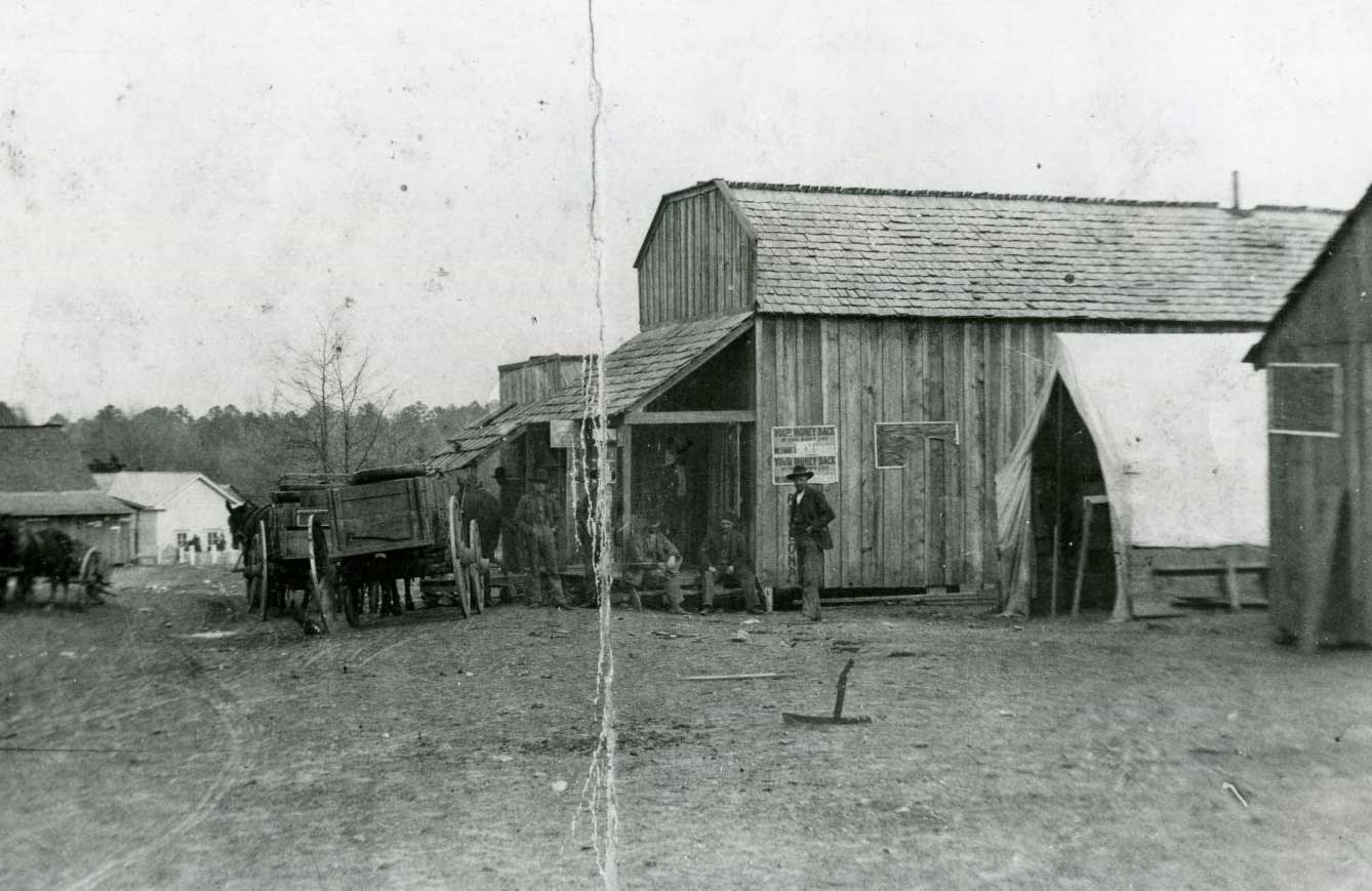
Doaksville in the late 1890s (11381.A, Francis Inman Collection, OHS).
Fernandina
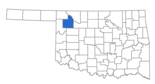
Fernandina, also known as Ferdinandina or Deer Creek Site, is a thirty-acre archaeological site that is located in north central Oklahoma near the Kansas border. The site is the size of thirty-nine football fields. The name Ferdinandina was found on a map published in the 1860s and was proposed to be one of the first white settlements in Indian Territory. Located near the Bryson-Paddock site, the Wichita Indians inhabited both the Fernandina and the Bryson-Paddock site in the mid-eighteenth century. Fernandina is thought to be where the French traded with the Wichita Indians and the Louisiana Colony received the majority of its meat.
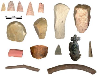
Items from Fernandina site (OHS Collections).
Fort Gibson
Fort Gibson is an archaeological site in Fort Gibson, Oklahoma, built in 1824. Fort Gibson was the ending point for many American Indians that suffered the Trail of Tears. Fort Gibson ensured the American Indians lived in the area without fear of attack by resident tribes and non-Natives. The fort was an important stopping point for people during the Mexican-American War and the California gold rush as well. The soldiers at this fort created roads and explored boundaries. Fort Gibson was abandoned in 1857 and then reoccupied during the Civil War.
Before archaeologists excavated, they surveyed the site and looked for evidence of artifacts and features. After they surveyed, they excavated the features they found and recorded context. Some examples of the features found are hospitals, barracks where the soldiers lived, a bakery, and a powder magazine. Some of the artifacts found in their matrices were buttons, muskets flints, a hunting knife, wash basins and pitchers, and champagne and wine bottles. After excavation, the archaeologists went back to the lab and placed the artifacts into classifications (groups) using seriation (dates) so they could better understand the evidence.
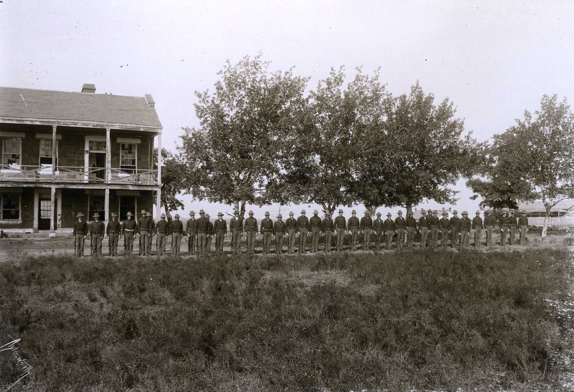
US soldiers at Fort Gibson (15802, Aylesworth Album Collection, OHS).
Fort Supply
Fort Supply is an archaeological site located in Woodward County, Oklahoma. Fort Supply was originally a camp where soldiers went to fight American Indians in the southern plains. Lieutenant Colonel George A. Custer was stationed at this post and destroyed several Cheyenne villages while he was there.
Later at the fort, Cheyenne people collected rations from the government. When Indian Territory was opened to non-Indians during the land runs, Fort Supply monitored the situation, helping to build roads and protect travelers as they passed through the country. When the post was no longer needed, it became Oklahoma's first state-operated mental hospital.
Before archaeologists excavated, they surveyed the site and looked for evidence of artifacts and features. They also made cuts as they excavated so they could examine the stratigraphy. After they surveyed, they excavated the features they found and recorded their context. Some of the features they found include five buildings, barracks, and employee and officer quarters including two rare picket-style log buildings. Some of the artifacts found in the matrices include buttons, shell, shards, bottles, and iron pots.
Camp Supply, later known as Fort Supply (11017, Harper's Weekly & Frank Leslie's Illustrated Collection, OHS).
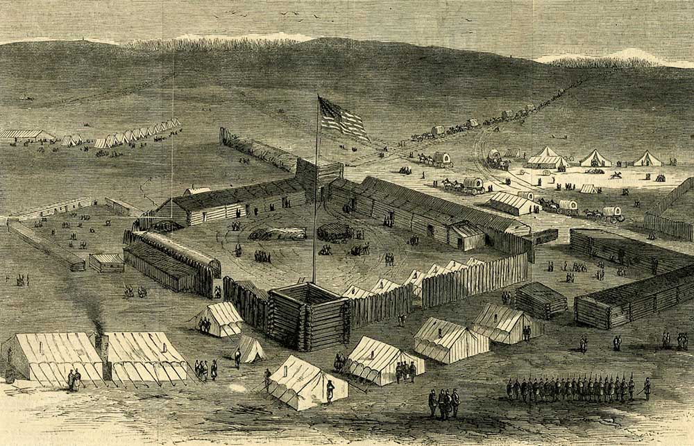
Fort Towson
Fort Towson is an archaeological site in Fort Towson, Oklahoma. It is in the southern part of the state near where the Red River and the Kiamichi River meet. The fort is named after Nathan Towson, a war hero of the War of 1812. It was built in 1824 and used to keep peace with Mexico. Later, after being burned down, Fort Towson was rebuilt to protect the Choctaw Indians. When the Choctaw moved into Indian Territory the fort kept non-Indian settlers out of the area. In addition, it was used to train soldiers to fight in the war with Mexico. During the Civil War, Fort Towson was the headquarters of the Indian Territory Confederate forces.
The state archaeologist and the team that works at Fort Towson surveyed the site so they would know how big it was and then started to excavate and record the context of the features and artifacts. They found many features at this site including barracks (where the soldiers lived), a hospital, a schoolhouse, storerooms, and guardhouses. They also found many artifacts in the matrices at this site, including animal bone fragments, bricks, shards of earthenware, and window glass. After excavation the archaeologists went back to the lab and placed the artifacts into classifications. The excavation served to positively locate buildings from historic maps, allow for reconstruction of buildings to enhance visitor experience, and create exhibits from artifact recovery to interpret the cultural setting.
Fort Towson (19154, Oklahoma Historical Society Photograph Collection, OHS).
Honey Springs Battlefield
The Battle of Honey Springs was the largest Civil War battle in Oklahoma. It is located on the Texas Road and is about three thousand acres, or three thousand football fields. The springs were a stopping point for people traveling through Indian Territory to Texas, as well as a supply depot for the Confederates. At this site, the Union forces stopped the Confederates from intercepting a supply train on its way to Fort Gibson. The battle was one of the first mass Confederate battles against the Union in Indian Territory and enabled the Union to attack other forts. This battle is also one of the first in which African Americans were praised for their contribution.
Archaeologists have not excavated at this site, but they have surveyed the site and looked for evidence of artifacts and features. Limited excavations of the site have occurred to collect and examine artifacts and features located here.
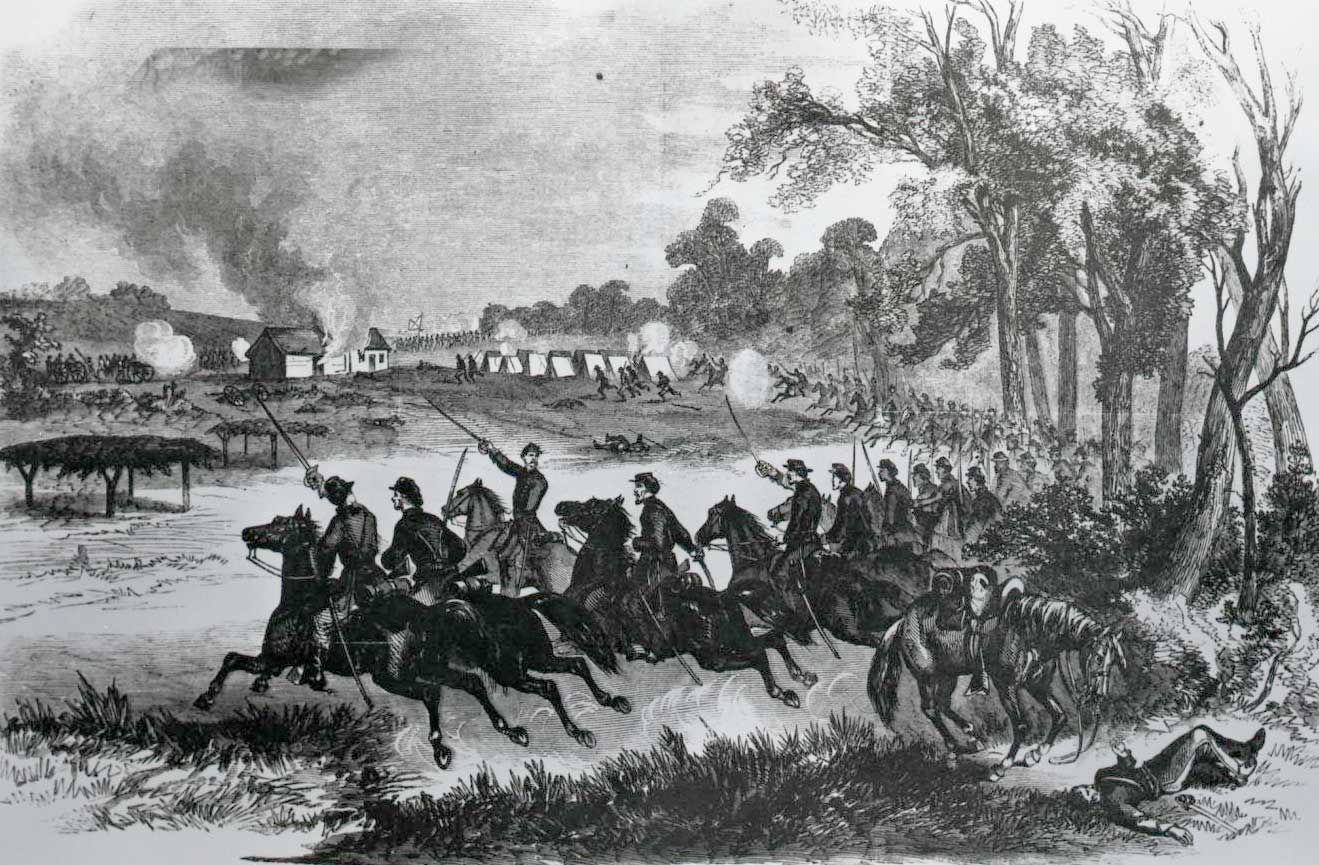
The Battle of Honey Springs (20655.63.364, Harper's Weekly & Frank Leslie's Illustrated Collection, OHS).
Kenton Caves
Located in Cimarron County, the Kenton Caves were discovered in 1928 by an amateur archaeologist. There are seven different caves or shelter sites within the entire site. Because of the dry climate many artifacts from thousands of years ago survived and were collected and studied. Some of those artifacts include bone and wooden beads, hide and yucca-fiber sandals, shells, squash rinds, beans, baskets, stone arrowpoints and spearpoints, and a wooden atlatl (spear throwing tool).
Before archaeologists excavated, they surveyed the site and looked for evidence of artifacts and features. They also made cuts as they excavated so they could examine the stratigraphy. After they surveyed, they excavated the features they found and recorded their context.
Learn more about the Kenton Cave Sites here
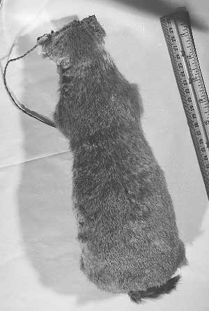
Prairie-dog skin bag stuffed with seed corn (image courtesy of Oklahoma Archeological Survey).
Spiro Mounds
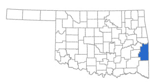
The Spiro Mounds are located on a 150-acre prehistoric American Indian archaeological site located near the town of Spiro, Oklahoma. The site is the size of 195 football fields. There are eight mounds located at the site. The mounds are a part of the Mississippian culture and were made by the ancestors of Caddoan-speaking peoples. The mounds are burial sites that include many artifacts and human remains. The Spiro Mounds are a part of a time period in archaeology known as the Mississippian. The Spiro Mounds are important because they are located along the Arkansas River and the people of Spiro influenced many of the people with which they traded. The people of Spiro sent representatives as far away as present-day Florida, the Gulf of Mexico, and the west coast.
The Spiro Mounds are notable because before archaeologists could excavate, looters destroyed several of the mounds looking for interesting and profitable artifacts. Once a law passed making it illegal to loot the Spiro Mounds, the state hired archaeologists to do cultural resource management work to preserve the site. The archaeologists surveyed the site and looked for evidence of artifacts and features. After the survey, they excavated the features and recorded their context. Some of the features they found were the eight mounds and the remains of the surrounding village. Some of the artifacts in the matrices were shells, sherds, whole pots, copper artifacts, and masks. Today, archeologists still work to identify features from the Spiro Mounds. They also have used ground-penetrating radar (GPR) to locate housing areas.
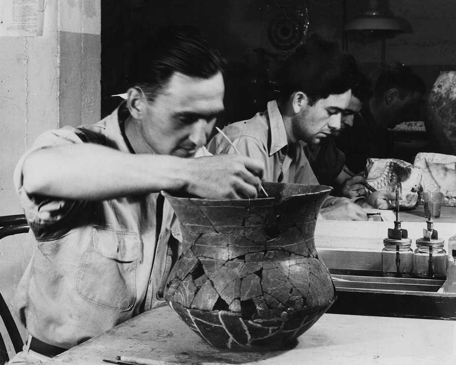
Lab work on the Spiro Mounds artifacts (19394.6, Oklahoma Historical Society Photograph Collection, OHS).
Visit the Spiro Mounds Archaeology Center
Steamboat Heroine
The steamboat Heroine is an archaeological site near the Red River on the Oklahoma southern border. The Heroine traveled from Cincinnati, Ohio, to the Kiamichi River to deliver supplies in 1838. It contained a large amount of cargo that was going to the soldiers at Fort Towson. The steamboat was one of the first five boats to go up river after the Red River had been cleared of the "great raft" by Henry Miller Shreve. The steamboat was stranded many times along the way by low water and had to sit and wait for rainstorms to raise the water level. When it was twenty minutes away from landing at Fort Towson, the Heroine struck a submerged snag in the river and sank. All of the people on board survived, but the ship sank into the sands of the Red River. This is an important site because there is little underwater archaeology done in Oklahoma, and it is the only shipwreck in the state, found in the late 1990s.
Before archaeologists excavated, they surveyed the underwater site and looked for evidence of artifacts and features. After surveying, they excavated the site and found several artifacts. Some of the artifacts found in their matrices were barrels of salted pork, soap, empty wooden barrels, ceramic saucers, and clothing. Unlike other sites, there were no features because they were able to remove all of the artifacts they found. More examples of the artifacts found include a hand truck, a block for leading the tiller rope, hasp from the companion hatch at the stern, mechanical pieces related to the engine, and items from the stern compartment.
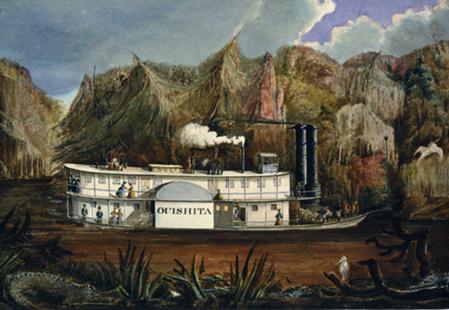
Steamboat Heroine by Peter Rindlisbacher (OHS Collections).