
Home | About OHS | Historical Marker Program
Location: in Greenhill Cemetery in Muskogee (DAR)
Sponsored by: Daughters of the American Revolution
Topics: Government, Civil Rights, Early Statehood 1907–1941
Alice Robertson, a member of the Daughters of the American Revolution, was Oklahoma's first female member of Congress, elected in 1920 from the Second Congressional District for one term. See Greenhill Cemetery.
Location: at front entrance of Bacone College in Muskogee (DAR)
Sponsored by: Daughters of the American Revolution
Topics: American Indians, Education, Religion/Philosophy, Territorial Period 1861–1907
Almon C. Bacone founded Bacone College for American Indians in Tahlequah, Cherokee Nation, in 1880. The school was moved to Muskogee in the Creek Nation in 1885. It is affiliated with the American Baptist Church and is the oldest college continually in operation in Oklahoma.
Location: at the Fort Gibson Historic Site
Note: This marker was removed due to historical inaccuracies.
Topics: Military, Territorial Period 1861–1907, Transportation, Social/Cultural
This brick oven was constructed with the new bakery erected at Fort Gibson about 1863 to supply the garrison with fresh bread.
This marker was removed due to historical inaccuracies.
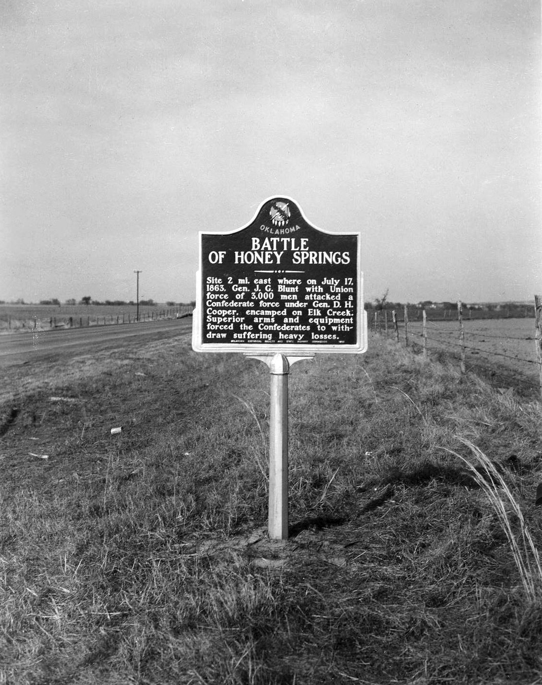
Location: on US-69 northeast of Oktaha
Sponsored by: Oklahoma Historical Society and the Oklahoma Department of Transportation
Material: Aluminum
Note: Marker is missing
Topics: Military, Government, Transportation, Indian and Frontier Trade, Territorial Period 1861–1907
This battlefield east of the marker, beginning near the south edge of Oktaha, extends south over the countryside more than two and a half miles to Honey Springs on Elk Creek, located south of the Muskogee County line in McIntosh County. Beautiful, clear flowing Honey Springs can be seen about one and a half miles east and north of Rentiesville, McIntosh County. On a rise of ground several hundred feet north of the springs was a Confederate commissary depot where large stores of flour, pork, and other supplies in a big warehouse were destroyed by the Confederate troops to keep them from falling into the hands of the enemy.
Location: on East Poplar Street in Fort Gibson
Material: Aluminum
Topics: American Indians, Social/Cultural, Westward Expansion 1803–1861, Territorial Period 1861–1907, Government
Before the Civil War, the Cherokees designated the cemetery as a national cemetery. The Cherokee Nation maintained the cemetery until 1906 when it was transferred to the town of Fort Gibson. Cherokee Principal Chief William P. Ross and other tribal leaders are buried here.
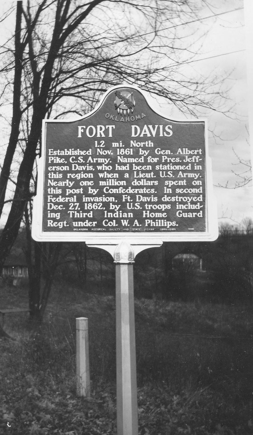
Location: on OK-16, one mile north of Bacone College
Topics: Military, Government, Territorial Period 1861–1907
Brigadier General Albert Pike established this frontier post in November of 1861 to house Confederate forces. It was named for Confederate President Jefferson Davis who had served in present-day Oklahoma in his army career. Union forces completely destroyed the heavily fortified post two days after Christmas in 1862.
Location: on OK-80 in Fort Gibson
Topics: Military, Westward Expansion 1803–1861, Territorial Period 1861–1907, Settlement Patterns
Fort Gibson has a long and colorful history. The first post was erected by Colonel Matthew Arbuckle in 1824 and named for the head of the army's commissary department. At the time, it was the westernmost fort built by the military to guard the western frontier.
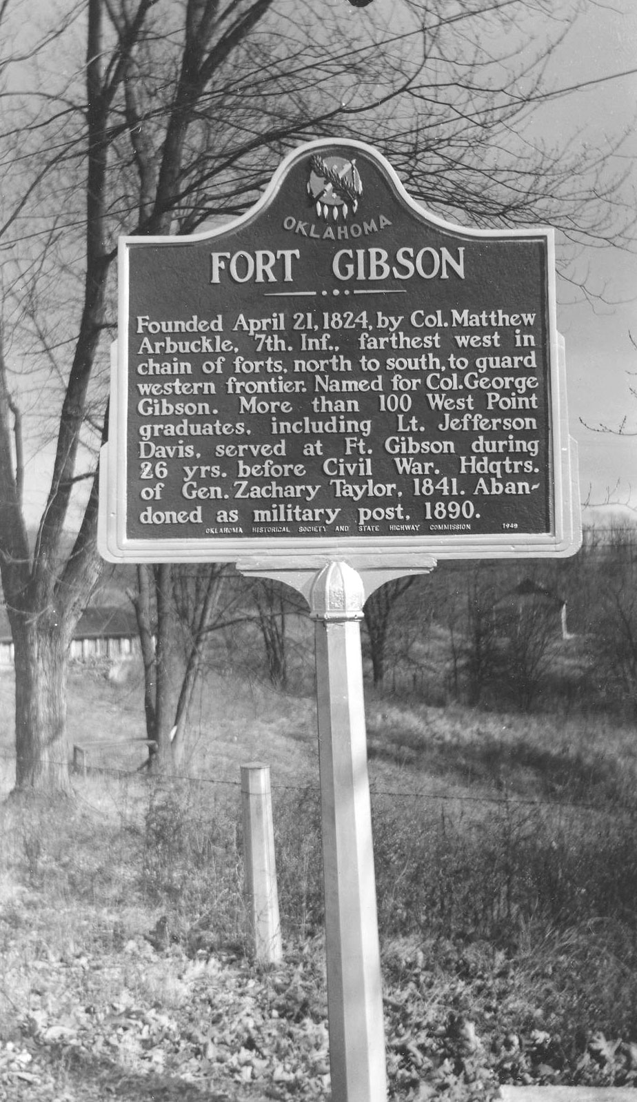
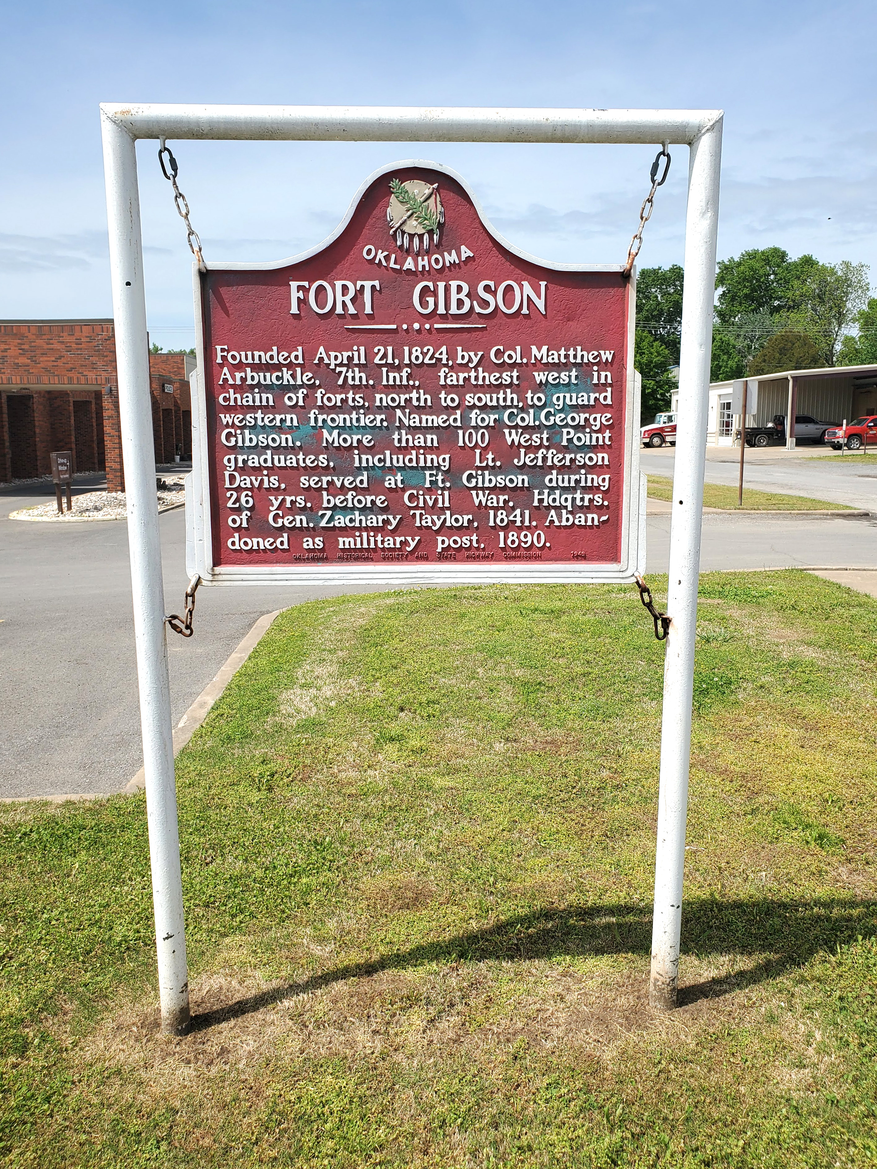
Location: on BUS-62 in front of Town Hall in Fort Gibson
Coordinates: 35.797141, -95.251534
Sponsored by: Oklahoma Historical Society and the Oklahoma Department of Transportation
Material: Aluminum
Topics: Military, Government, Territorial Period 1861–1907, Settlement Patterns, American Indians
Founded on April 21, 1824, by Col. Matthew Arbuckle. In the twenty-six years before the Civil War, more than one hundred West Point graduates served at Fort Gibson. In 1841, the post was headquarters of Brigadier General (later President) Zachary Taylor. The post was abandoned in 1890.
Location: on US-69, three miles north of the Arkansas River north of Muskogee
Topics: Religion/Philosophy
The church was formerly known as Ebenezer Church.
Location: at intersection of York and North Streets in Musgokee
Topics: Social/Cultural, Territorial Period 1861–1907, Government
Greenhill Cemetery began in 1894 and moved to its present location in 1904 when town leaders contributed 250 acres to be used as the town's official burial site. The cemetery is the final resting place for Oklahoma's first governor, Charles Haskell; Oklahoma's first congresswoman, Alice Robertson; and Alexander Posey, newspaperman and poet laureate of the Creek Indians.
Location: at intersection of Elm and Jackson Streets in Fort Gibson
Note: Marker reported missing
Topics: American Indians, Government
John Martin, a Cherokee Indian who was the first chief justice of the first supreme court established in the Cherokee Nation, is buried here.
Location: on US-64 south of Haskell city limits
Material: Aluminum
Topics: Government, Empire Period 1541–1803, American Indians
First peace council and alliance between a European government and Oklahoma Indian tribes occurred here in 1719 when French explorer Bernard de la Harpe explored the area.
Location: in Fort Gibson (DAR)
Sponsored by: Daughters of the American Revolution
Topics: Military, American Indians, Government, Westward Expansion 1803–1861, Empire Period 1541–1803
A former governor of North Carolina and an Indian agency, Montford Stokes died at Fort Gibson in 1842, the only Revolutionary War soldier buried in Oklahoma.
Location: at the Fort Gibson Historic Site
Topics: Military, Westward Expansion 1803–1861
Erected to provide storage space for the gunpowder and ammunition used by the troops stationed at the post, this building was constructed about 1842.
Location: in community of Red Bird
Topics: Ethnic Diversity, Urban Development, Territorial Period 1861–1907, Early Statehood 1907–1941, Goveernment, Mass COmmunication
Red Bird is one of thirteen All-Black towns, out of more than fifty that once existed, remaining in Oklahoma. While Tullahassee is reportedly the oldest, most were established between 1889 and 1907 as African Americans sought security and control of their own destiny in a segregated world. Most of the towns began to decline in the 1920s and 1930s as rural African Americans faced economic hardships and began to move to urban areas. Red Bird was established with a post office in June 1902.
Location: at south city limits of Muskogee
Material: Aluminum
Topics: Industry/Business, Petroleum, Natural Resources, Territorial Period 1861–1907
Muskogee Oil Refining Company, organized in March 1905, built a "finishing plant" near this site in November 1904. It soon was producing lamp kerosene, lubricating oil and industrial fuel—the beginning of oil refining in Oklahoma, a leading industry today.
Location: in community of Summit
Topics: Government, Mass Communication, Transportation, Territorial Period 1861–1907, Environmental/Cultural Ecology
Summit, the highest point on the Missouri, Kansas and Texas Railroad between the Arkansas River and the North Canadian River, was established with a post office in 1896.
Location: in town of Taft; see Red Bird
Topics: Government, Urban Development, Ethnic Diversity, Social/Cultural, Education, Recreational/Service, Territorial Period 1861–1907
Taft was initially named Twine after an early-day resident, editor, and activist W. H. Twine. The name was changed to Taft in 1904 to honor William Howard Taft, secretary of war and later president of the United States. Taft was home to several state-operated facilities for the state's African American population, including the Industrial Institute for the Deaf, Blind, and Orphans of the Colored Race, State Training School for Negro Girls, and State Hospital for the Negro Insane.
Location: on grounds of Fort Gibson Historic Site
Coordinates: 35.803693, -95.256968
Sponsored by: Southwestern Bell Telephone Company
Material: Aluminum
Topics: Mass Communication, American Indians, Territorial Period 1861–1907
The first commercial long-distance telephone line in Oklahoma was placed in service here in 1886. It connected Fort Gibson with Tahlequah and Muskogee. The line was built by a company formed by a group of Cherokees that included L. B. Bell, J.S. Stapler, J.B. Stapler, C.W. Turner, John S. Scott, and E.D. Hicks.
Location: on OK-16 near Verdigris River Bridge (DAR)
Sponsored by: Daughters of the American Revolution
Topics: Transportation, Indian and Frontier Trade, American Indians
This marker commemorates the Old Texas Road, the oldest road in Oklahoma; Three Forks, the oldest trading post in Oklahoma; and the site of the first Creek and Osage Indian agencies on the banks of the Verdigris River.
Location: at 1419 North Okmulgee in Muskogee
Topics: Family/Household, Government, Military, Social/Cultural
Residence was built by John R. Thomas, a federal judge and former congressman from Illinois. He was known as the father of the United States Navy for his congressional work to increase the size of the American navy. His daughter, Carolyn Thomas, married his law partner, Grant Foreman, and they lived out their lives in the home. The Foremans were outstanding authorities on the history of Oklahoma and the Five Civilized Tribes.
Location: in community of Tullahassee; see Red Bird
Material: Granite
Topics: American Indians, Education, Religion/Philosophy, Westward Expansion 1803–1861, Ethnic Diversity, Territorial Period 1861–1907
Tullahassee, a Creek word meaning "old town," now occupies the site of Tullahassee Mission, established in the Creek Nation in 1850 by Reverend Robert M. Loughridge under the auspices of the Presbyterian Board of Foreign Missions. After the mission burned and was abandoned, Creek freedmen moved to the area, receiving a post office in 1899.
Location: on Honor Heights (Agency) Hill next to Veterans Administration hospital in Muskogee
Material: Aluminum
Topics: Recreational/Service, Social/Cultural, Government, Territorial Period 1861–1907, American Indians
Now housing the Five Civilized Tribes Museum, this original Union Agency building was constructed in 1875 by the federal government to oversee the affairs of the Five Civilized Tribes. Cornerstone was laid by members of the Masonic Lodge, believed to be the first Masonic cornerstone laying in Oklahoma.
Location: on US-64 at west end of the Arkansas River Bridge
Material: Originally aluminum, now granite
Topics: American Indians, Indian and Frontier Trade, Westward Expansion 1803–1861, Water, Transportation, Territorial Period 1861–1907
Western Cherokee Chief Walter Webber established a trading post here in 1829. The falls on the Arkansas were reportedly six feet high in 1806, sufficient to block travel for river steamers. The village of Webbers Falls was burned by federal troops in the Civil War in April 1863.
Location: 2910 East Highway 71, Porum
Sponsored by: Dr. Ron Hood
Material: Aluminum
Topics: Law and Order
Formerly a strong southerly bend in the Canadian River was located here. The course of the river was permanently changed after the construction of the Lake Eufaula Dam in 1964. It is thought that the bend is named for Cole Younger who served in the Civil War as a member of Quantrill’s Raiders and operated in this area 1862-64. After the war, Cole Younger and his brothers would join Frank and Jesse James to form the James-Younger Gang. Although visited by many other famous Outlaws of the time, Younger’s Bend is best known as the home of Sam and Belle Starr 1880-1889. Both lived here until the separate events of their untimely deaths. It remains the quiet final resting place of Belle Starr. “On the Canadian River …far from society, I hoped to pass the remainder of my life in peace.” Belle Starr
Lincoln County
Logan County
Love County
Major County
Marshall County
Mayes County
McClain County
McCurtain County
McIntosh County
Murray County
Muskogee County
Noble County
Okfuskee County
Oklahoma County
Okmulgee County
Osage County
Ottawa County
Pawnee County
Payne County
Pittsburg County
Pontotoc County
Pottawatomie County
Pushmataha County
Roger Mills County
Rogers County
Seminole County
Sequoyah County
Stephens County
Texas County
Tillman County
Tulsa County
Wagoner County
Washington County
Washita County
Woods County
Woodward County
Historical Marker Program
Search Results
Your search returned 25 results.
Alice Robertson
Muskogee CountyLocation: in Greenhill Cemetery in Muskogee (DAR)
Sponsored by: Daughters of the American Revolution
Topics: Government, Civil Rights, Early Statehood 1907–1941
Alice Robertson, a member of the Daughters of the American Revolution, was Oklahoma's first female member of Congress, elected in 1920 from the Second Congressional District for one term. See Greenhill Cemetery.
Bacone College
Muskogee CountyLocation: at front entrance of Bacone College in Muskogee (DAR)
Sponsored by: Daughters of the American Revolution
Topics: American Indians, Education, Religion/Philosophy, Territorial Period 1861–1907
Almon C. Bacone founded Bacone College for American Indians in Tahlequah, Cherokee Nation, in 1880. The school was moved to Muskogee in the Creek Nation in 1885. It is affiliated with the American Baptist Church and is the oldest college continually in operation in Oklahoma.
Bake Oven
Muskogee CountyLocation: at the Fort Gibson Historic Site
Note: This marker was removed due to historical inaccuracies.
Topics: Military, Territorial Period 1861–1907, Transportation, Social/Cultural
This brick oven was constructed with the new bakery erected at Fort Gibson about 1863 to supply the garrison with fresh bread.
This marker was removed due to historical inaccuracies.
Battle of Honey Springs
Location: on US-69 northeast of Oktaha
Sponsored by: Oklahoma Historical Society and the Oklahoma Department of Transportation
Material: Aluminum
Note: Marker is missing
Topics: Military, Government, Transportation, Indian and Frontier Trade, Territorial Period 1861–1907
This battlefield east of the marker, beginning near the south edge of Oktaha, extends south over the countryside more than two and a half miles to Honey Springs on Elk Creek, located south of the Muskogee County line in McIntosh County. Beautiful, clear flowing Honey Springs can be seen about one and a half miles east and north of Rentiesville, McIntosh County. On a rise of ground several hundred feet north of the springs was a Confederate commissary depot where large stores of flour, pork, and other supplies in a big warehouse were destroyed by the Confederate troops to keep them from falling into the hands of the enemy.
Cherokee National Cemetery
Muskogee CountyLocation: on East Poplar Street in Fort Gibson
Material: Aluminum
Topics: American Indians, Social/Cultural, Westward Expansion 1803–1861, Territorial Period 1861–1907, Government
Before the Civil War, the Cherokees designated the cemetery as a national cemetery. The Cherokee Nation maintained the cemetery until 1906 when it was transferred to the town of Fort Gibson. Cherokee Principal Chief William P. Ross and other tribal leaders are buried here.
Fort Davis
Location: on OK-16, one mile north of Bacone College
Topics: Military, Government, Territorial Period 1861–1907
Brigadier General Albert Pike established this frontier post in November of 1861 to house Confederate forces. It was named for Confederate President Jefferson Davis who had served in present-day Oklahoma in his army career. Union forces completely destroyed the heavily fortified post two days after Christmas in 1862.
Fort Gibson
Muskogee CountyLocation: on OK-80 in Fort Gibson
Topics: Military, Westward Expansion 1803–1861, Territorial Period 1861–1907, Settlement Patterns
Fort Gibson has a long and colorful history. The first post was erected by Colonel Matthew Arbuckle in 1824 and named for the head of the army's commissary department. At the time, it was the westernmost fort built by the military to guard the western frontier.
Fort Gibson
Location: on BUS-62 in front of Town Hall in Fort Gibson
Coordinates: 35.797141, -95.251534
Sponsored by: Oklahoma Historical Society and the Oklahoma Department of Transportation
Material: Aluminum
Topics: Military, Government, Territorial Period 1861–1907, Settlement Patterns, American Indians
Founded on April 21, 1824, by Col. Matthew Arbuckle. In the twenty-six years before the Civil War, more than one hundred West Point graduates served at Fort Gibson. In 1841, the post was headquarters of Brigadier General (later President) Zachary Taylor. The post was abandoned in 1890.
Fountain Church
Muskogee CountyLocation: on US-69, three miles north of the Arkansas River north of Muskogee
Topics: Religion/Philosophy
The church was formerly known as Ebenezer Church.
Greenhill Cemetery
Muskogee CountyLocation: at intersection of York and North Streets in Musgokee
Topics: Social/Cultural, Territorial Period 1861–1907, Government
Greenhill Cemetery began in 1894 and moved to its present location in 1904 when town leaders contributed 250 acres to be used as the town's official burial site. The cemetery is the final resting place for Oklahoma's first governor, Charles Haskell; Oklahoma's first congresswoman, Alice Robertson; and Alexander Posey, newspaperman and poet laureate of the Creek Indians.
John Martin
Muskogee CountyLocation: at intersection of Elm and Jackson Streets in Fort Gibson
Note: Marker reported missing
Topics: American Indians, Government
John Martin, a Cherokee Indian who was the first chief justice of the first supreme court established in the Cherokee Nation, is buried here.
La Harpe's Council
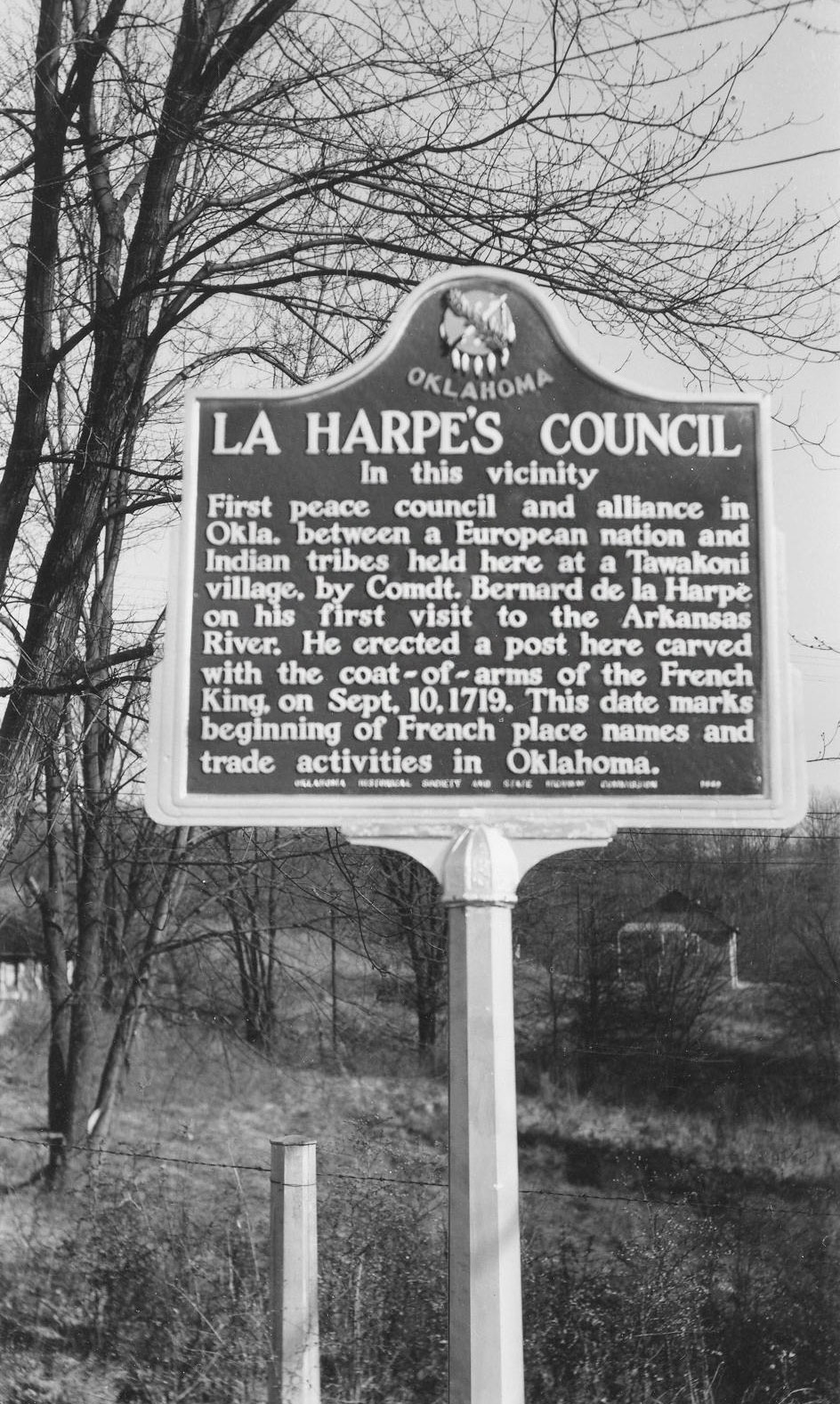
Location: on US-64 south of Haskell city limits
Material: Aluminum
Topics: Government, Empire Period 1541–1803, American Indians
First peace council and alliance between a European government and Oklahoma Indian tribes occurred here in 1719 when French explorer Bernard de la Harpe explored the area.
Montford Stokes
Muskogee CountyLocation: in Fort Gibson (DAR)
Sponsored by: Daughters of the American Revolution
Topics: Military, American Indians, Government, Westward Expansion 1803–1861, Empire Period 1541–1803
A former governor of North Carolina and an Indian agency, Montford Stokes died at Fort Gibson in 1842, the only Revolutionary War soldier buried in Oklahoma.
Powder Magazine
Muskogee CountyLocation: at the Fort Gibson Historic Site
Topics: Military, Westward Expansion 1803–1861
Erected to provide storage space for the gunpowder and ammunition used by the troops stationed at the post, this building was constructed about 1842.
Red Bird
Muskogee CountyLocation: in community of Red Bird
Topics: Ethnic Diversity, Urban Development, Territorial Period 1861–1907, Early Statehood 1907–1941, Goveernment, Mass COmmunication
Red Bird is one of thirteen All-Black towns, out of more than fifty that once existed, remaining in Oklahoma. While Tullahassee is reportedly the oldest, most were established between 1889 and 1907 as African Americans sought security and control of their own destiny in a segregated world. Most of the towns began to decline in the 1920s and 1930s as rural African Americans faced economic hardships and began to move to urban areas. Red Bird was established with a post office in June 1902.
State's Earliest Oil Refinery
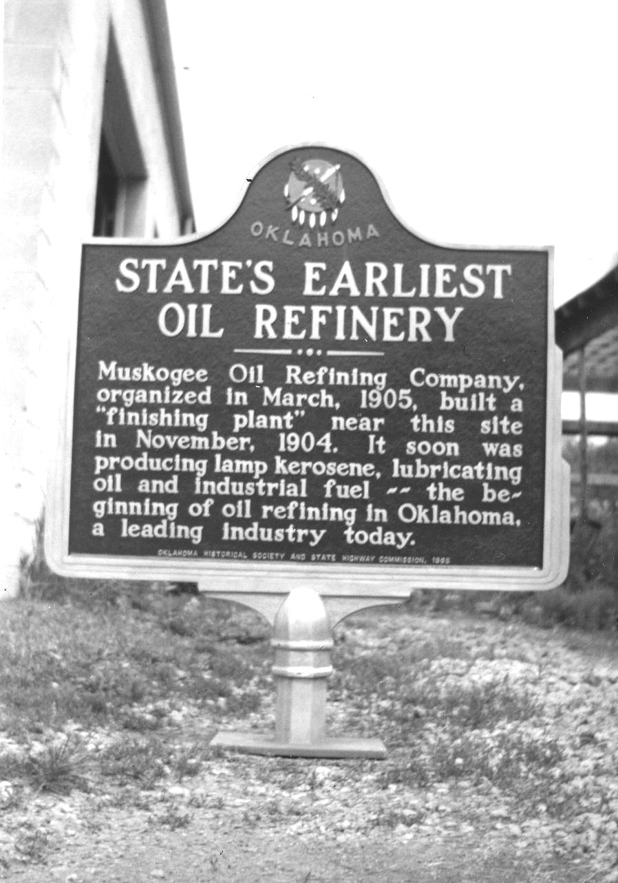
Location: at south city limits of Muskogee
Material: Aluminum
Topics: Industry/Business, Petroleum, Natural Resources, Territorial Period 1861–1907
Muskogee Oil Refining Company, organized in March 1905, built a "finishing plant" near this site in November 1904. It soon was producing lamp kerosene, lubricating oil and industrial fuel—the beginning of oil refining in Oklahoma, a leading industry today.
Summit
Muskogee CountyLocation: in community of Summit
Topics: Government, Mass Communication, Transportation, Territorial Period 1861–1907, Environmental/Cultural Ecology
Summit, the highest point on the Missouri, Kansas and Texas Railroad between the Arkansas River and the North Canadian River, was established with a post office in 1896.
Taft
Muskogee CountyLocation: in town of Taft; see Red Bird
Topics: Government, Urban Development, Ethnic Diversity, Social/Cultural, Education, Recreational/Service, Territorial Period 1861–1907
Taft was initially named Twine after an early-day resident, editor, and activist W. H. Twine. The name was changed to Taft in 1904 to honor William Howard Taft, secretary of war and later president of the United States. Taft was home to several state-operated facilities for the state's African American population, including the Industrial Institute for the Deaf, Blind, and Orphans of the Colored Race, State Training School for Negro Girls, and State Hospital for the Negro Insane.
Telephones in 1886
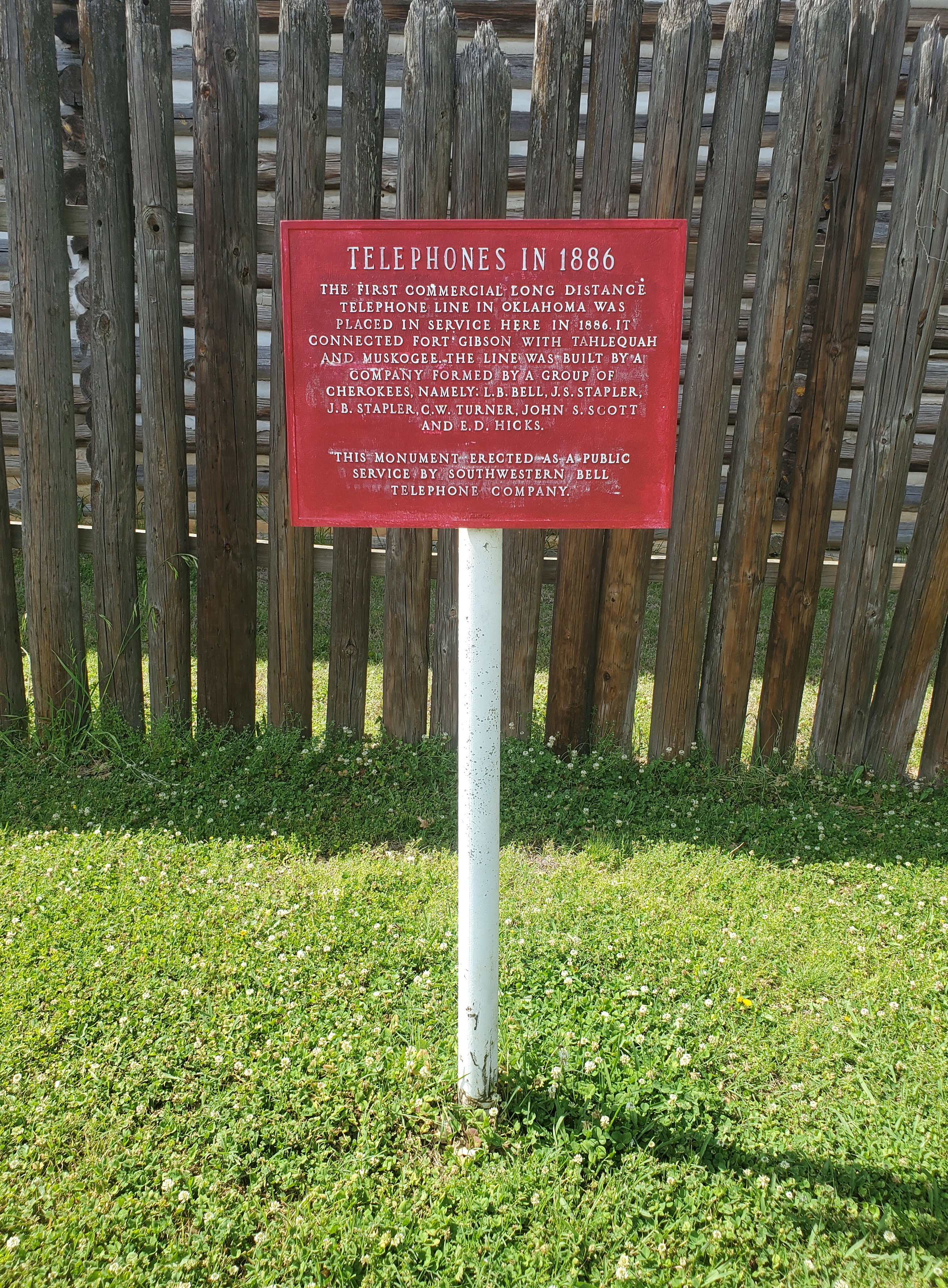
Location: on grounds of Fort Gibson Historic Site
Coordinates: 35.803693, -95.256968
Sponsored by: Southwestern Bell Telephone Company
Material: Aluminum
Topics: Mass Communication, American Indians, Territorial Period 1861–1907
The first commercial long-distance telephone line in Oklahoma was placed in service here in 1886. It connected Fort Gibson with Tahlequah and Muskogee. The line was built by a company formed by a group of Cherokees that included L. B. Bell, J.S. Stapler, J.B. Stapler, C.W. Turner, John S. Scott, and E.D. Hicks.
Texas Road
Muskogee CountyLocation: on OK-16 near Verdigris River Bridge (DAR)
Sponsored by: Daughters of the American Revolution
Topics: Transportation, Indian and Frontier Trade, American Indians
This marker commemorates the Old Texas Road, the oldest road in Oklahoma; Three Forks, the oldest trading post in Oklahoma; and the site of the first Creek and Osage Indian agencies on the banks of the Verdigris River.
Thomas-Foreman Home
Muskogee CountyLocation: at 1419 North Okmulgee in Muskogee
Topics: Family/Household, Government, Military, Social/Cultural
Residence was built by John R. Thomas, a federal judge and former congressman from Illinois. He was known as the father of the United States Navy for his congressional work to increase the size of the American navy. His daughter, Carolyn Thomas, married his law partner, Grant Foreman, and they lived out their lives in the home. The Foremans were outstanding authorities on the history of Oklahoma and the Five Civilized Tribes.
Tullahassee
Muskogee CountyLocation: in community of Tullahassee; see Red Bird
Material: Granite
Topics: American Indians, Education, Religion/Philosophy, Westward Expansion 1803–1861, Ethnic Diversity, Territorial Period 1861–1907
Tullahassee, a Creek word meaning "old town," now occupies the site of Tullahassee Mission, established in the Creek Nation in 1850 by Reverend Robert M. Loughridge under the auspices of the Presbyterian Board of Foreign Missions. After the mission burned and was abandoned, Creek freedmen moved to the area, receiving a post office in 1899.
Union Agency
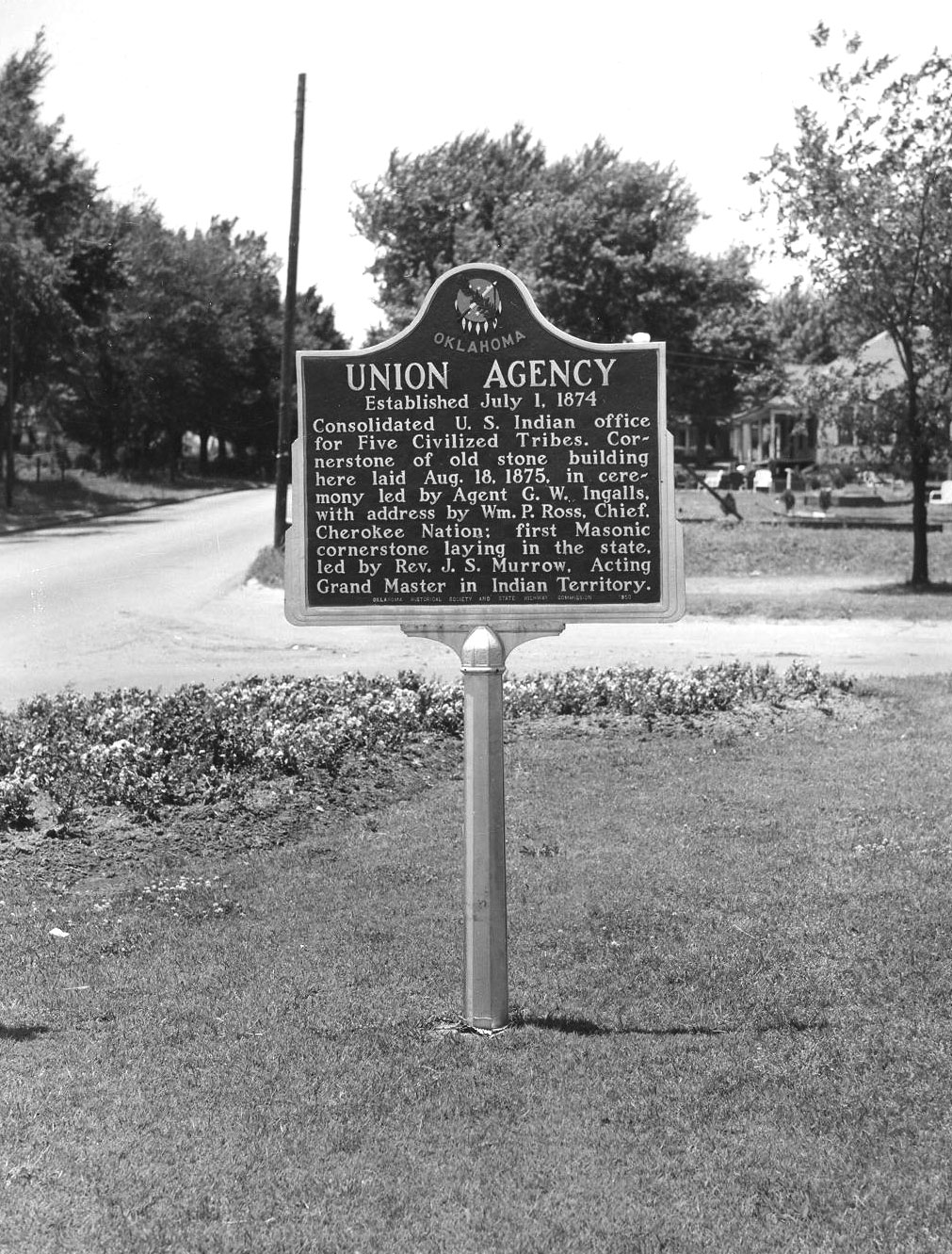
Location: on Honor Heights (Agency) Hill next to Veterans Administration hospital in Muskogee
Material: Aluminum
Topics: Recreational/Service, Social/Cultural, Government, Territorial Period 1861–1907, American Indians
Now housing the Five Civilized Tribes Museum, this original Union Agency building was constructed in 1875 by the federal government to oversee the affairs of the Five Civilized Tribes. Cornerstone was laid by members of the Masonic Lodge, believed to be the first Masonic cornerstone laying in Oklahoma.
Webbers Falls
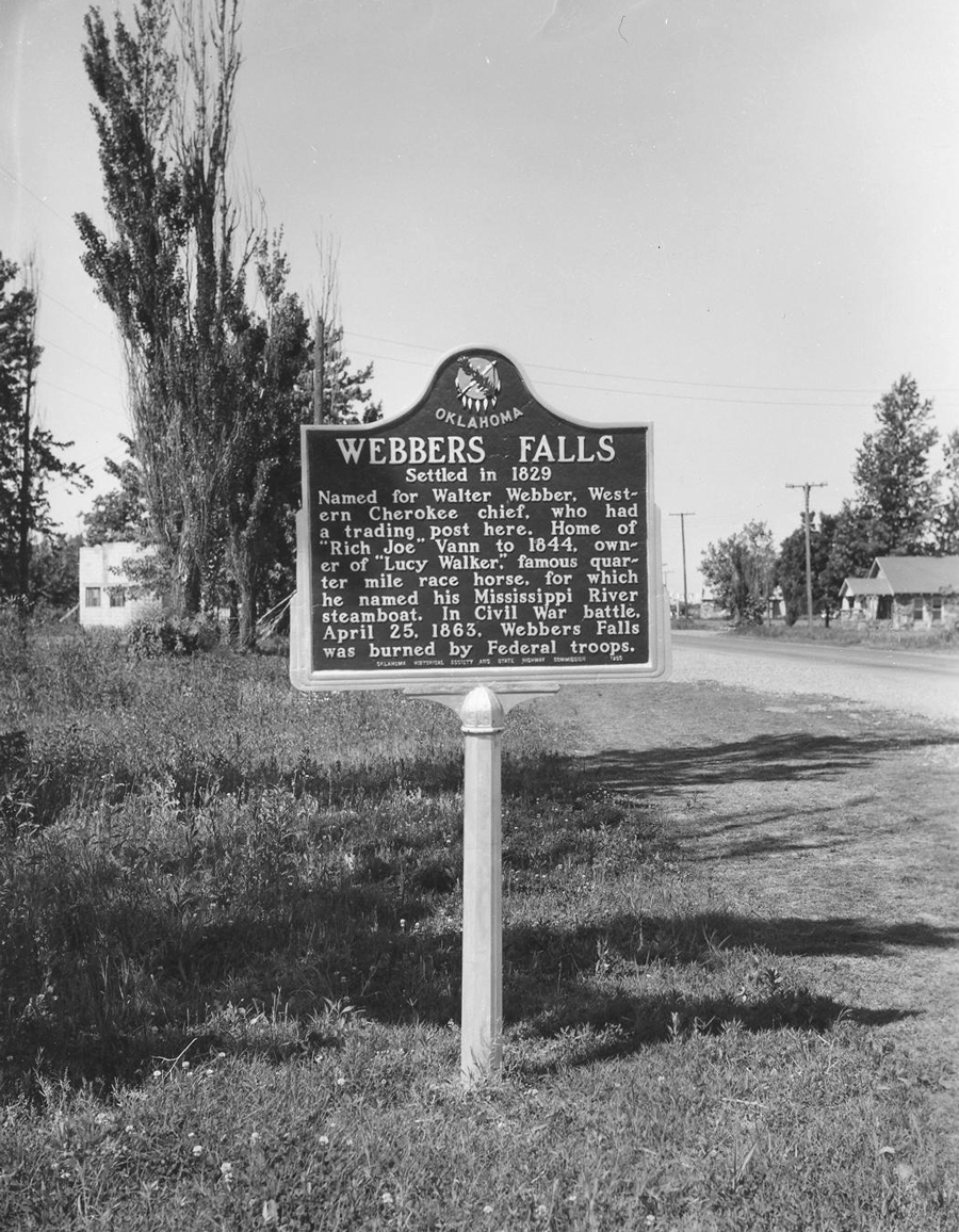
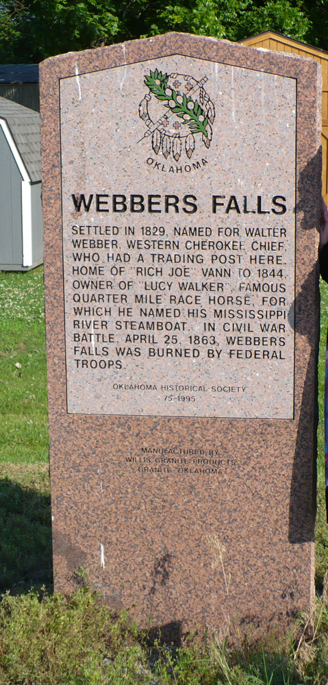
Location: on US-64 at west end of the Arkansas River Bridge
Material: Originally aluminum, now granite
Topics: American Indians, Indian and Frontier Trade, Westward Expansion 1803–1861, Water, Transportation, Territorial Period 1861–1907
Western Cherokee Chief Walter Webber established a trading post here in 1829. The falls on the Arkansas were reportedly six feet high in 1806, sufficient to block travel for river steamers. The village of Webbers Falls was burned by federal troops in the Civil War in April 1863.
Younger's Bend
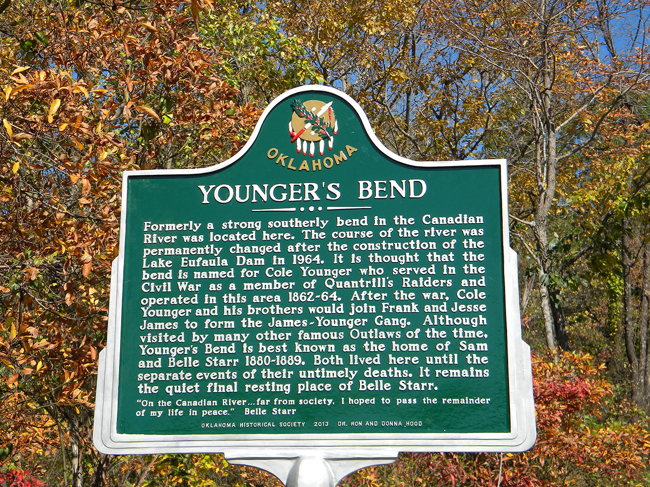
Location: 2910 East Highway 71, Porum
Sponsored by: Dr. Ron Hood
Material: Aluminum
Topics: Law and Order
Formerly a strong southerly bend in the Canadian River was located here. The course of the river was permanently changed after the construction of the Lake Eufaula Dam in 1964. It is thought that the bend is named for Cole Younger who served in the Civil War as a member of Quantrill’s Raiders and operated in this area 1862-64. After the war, Cole Younger and his brothers would join Frank and Jesse James to form the James-Younger Gang. Although visited by many other famous Outlaws of the time, Younger’s Bend is best known as the home of Sam and Belle Starr 1880-1889. Both lived here until the separate events of their untimely deaths. It remains the quiet final resting place of Belle Starr. “On the Canadian River …far from society, I hoped to pass the remainder of my life in peace.” Belle Starr
(Page 1 of 1)
Search for Markers
Search by keyword or browse by county to learn about more than 700 historical markers created to recognize key locations, events, and people in Oklahoma history.
Please note that some markers listed in this database may have been moved, damaged, or are no longer standing.
Browse by County
Adair County
Alfalfa County
Atoka County
Beaver County
Beckham County
Blaine County
Bryan County
Caddo County
Canadian County
Carter County
Cherokee County
Choctaw County
Cimarron County
Cleveland County
Comanche County
Cotton County
Craig County
Creek County
Custer County
Delaware County
Dewey County
Ellis County
Garfield County
Garvin County
Grady County
Grant County
Greer County
Harmon County
Harper County
Haskell County
Hughes County
Jackson County
Jefferson County
Johnston County
Kay County
Kingfisher County
Kiowa County
Latimer County
Le Flore CountyAlfalfa County
Atoka County
Beaver County
Beckham County
Blaine County
Bryan County
Caddo County
Canadian County
Carter County
Cherokee County
Choctaw County
Cimarron County
Cleveland County
Comanche County
Cotton County
Craig County
Creek County
Custer County
Delaware County
Dewey County
Ellis County
Garfield County
Garvin County
Grady County
Grant County
Greer County
Harmon County
Harper County
Haskell County
Hughes County
Jackson County
Jefferson County
Johnston County
Kay County
Kingfisher County
Kiowa County
Latimer County
Lincoln County
Logan County
Love County
Major County
Marshall County
Mayes County
McClain County
McCurtain County
McIntosh County
Murray County
Muskogee County
Noble County
Okfuskee County
Oklahoma County
Okmulgee County
Osage County
Ottawa County
Pawnee County
Payne County
Pittsburg County
Pontotoc County
Pottawatomie County
Pushmataha County
Roger Mills County
Rogers County
Seminole County
Sequoyah County
Stephens County
Texas County
Tillman County
Tulsa County
Wagoner County
Washington County
Washita County
Woods County
Woodward County
Contact Us
If you have questions, please contact:
Matthew Pearce
Oklahoma Historical Society
800 Nazih Zuhdi Drive
Oklahoma City, OK 73105
405-522-8659
matthew.pearce@history.ok.gov