
Historical Marker Program
Search Results
Your search returned 4 results.
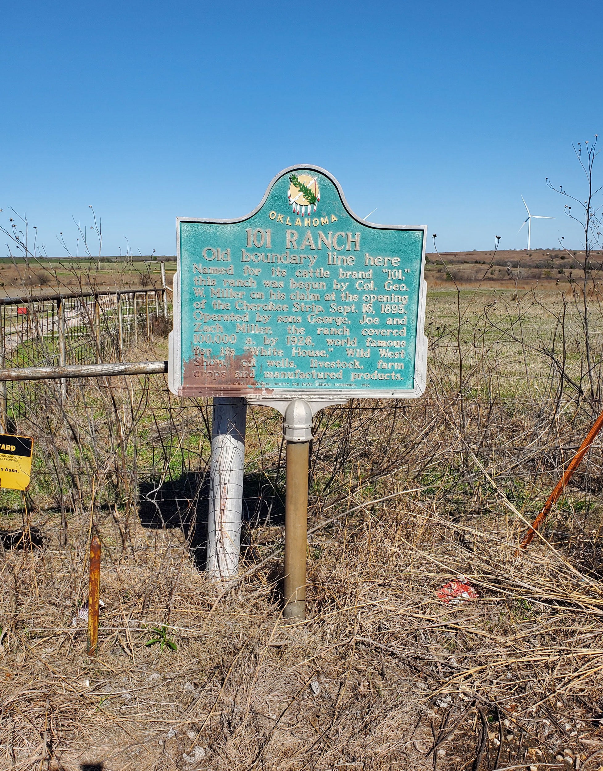
101 Ranch
Noble CountyLocation: on OK-156, north of Marland
Coordinates: 36.567150, -97.149150
Sponsored by: OHS/ODOT
Material: Aluminum
Topics: Ranching, American Indians, Arts, Territorial Period 1861–1907, Petroleum, Industry/Business, Agriculture
Believed to have derived its name from the 101,894 acres of the Ponca Reservation, this huge ranch was founded by George W. Miller and his sons in the early 1880s on land he leased, eventually purchased, or otherwise acquired from the Ponca Indians. The ranch became world-famous for its Wild West show, oil wells, livestock, and farm products.
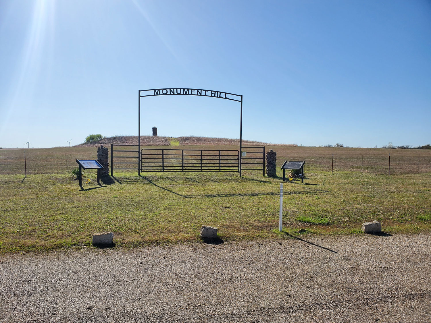
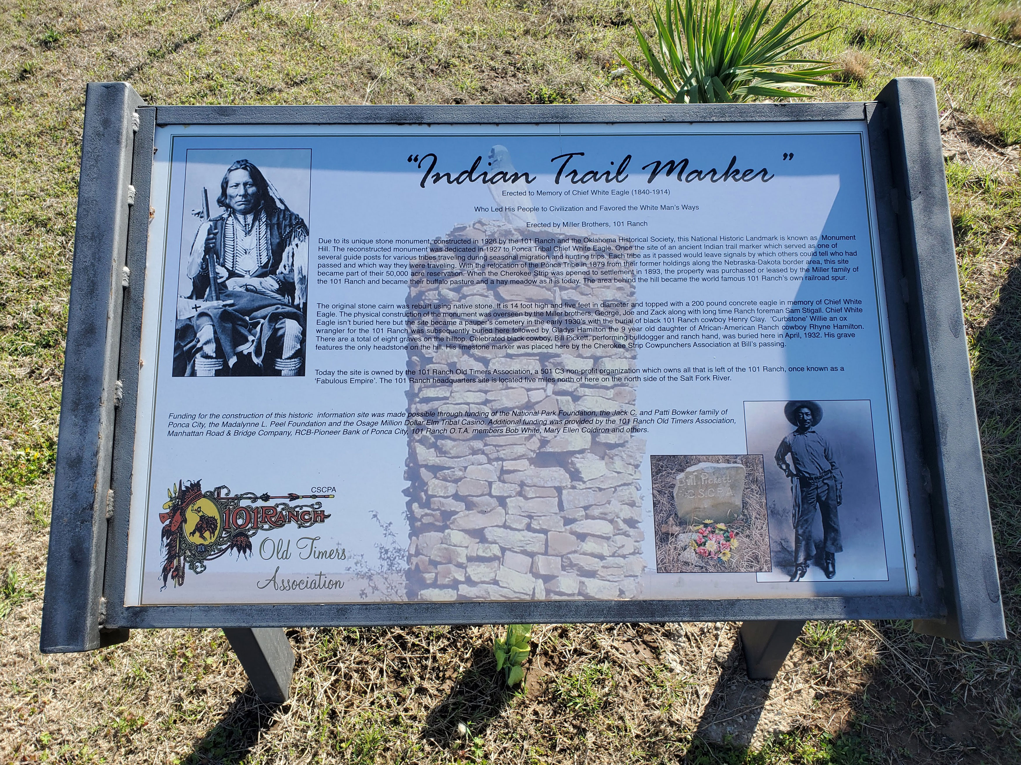
Monument Hill (Indian Trail Marker; Chief White Eagle Monument)
Noble CountyLocation: on OK-156, north of Marland
Coordinates: 36.569482, -97.144809
Sponsored by: 101 Ranch
Material: Stone
Topics: American Indians, Agriculture, Ranching, Territorial Period 1861–1907, Early Statehood 1907–1941
Dedicated in 1927 and constructed by the 101 Ranch, this stone monument is dedicated to Ponca Chief White Eagle. Once the site of an ancient trail marker that served as one of several guideposts for various tribes traveling through the area during seasonal migration and hunting trips. The stone cairn is fourteen feet tall, five feet in diameter, and capped by a 200-pound concrete white eagle. A small cemetery is on site and includes the grave of Black cowboy Bill Pickett.
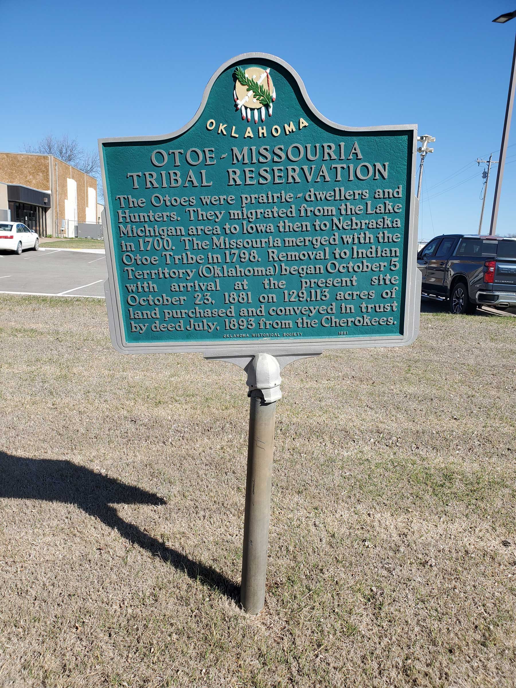
Otoe-Missouri Tribal Reservation
Noble CountyLocation: at Otoe-Missouria Complex off US-177
Coordinates: 36.491250, -97.074000
Sponsored by: Oklahoma Historical Society
Material: Aluminum
Topics: American Indians, Settlement Patterns, Territorial Period 1861–1907
The Otoes were prairie-dwellers and Hunters. They migrated from the Lake Michigan area to Iowa then to Nebraska in 1700. The Missouria merged with the Otoe Tribe in 1798. Removal to Indian Territory (Oklahoma) began October 5 with arrival at the present site October 23, 1881 on 129,113 acres of land purchased and conveyed in trust by deed July, 1893 from the Cherokees.
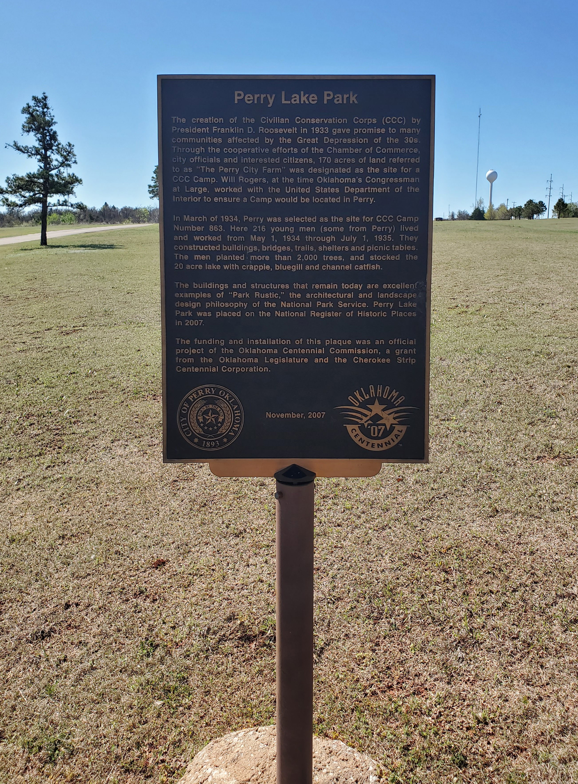
Perry Lake Park (CCC Lake Park)
Noble CountyLocation: in Perry Lake Park, approx. 300 ft from park entrance off OK-86
Coordinates: 36.266333, -97.280850
Sponsored by: Oklahoma Centennial Commission and Cherokee Strip Centennial Corporation
Material: Aluminum
Topics: Government, Social/Culture, Recreational/Service, Early Statehood 1907–1941
The creation of the Civilian Conservation Corps (CCC) by President Franklin D. Roosevelt in 1933 gave promise to many communities affected by the Great Depression of the 30s. Through the cooperative efforts of the Chamber of Commerce, city officials and interested citizens, 170 acres of land referred to as "The Perry City Farm" was designated as the site for a CCC Camp. Will Rogers, at the time Oklahoma's Congressman at Large, worked with the United States Department of the Interior to ensure a Camp would be located in Perry.
Search for Markers
Search by keyword or browse by county to learn about more than 600 historical markers created to recognize key locations, events, and people in Oklahoma history.
Please note that some markers listed in this database may have been moved, damaged, or are no longer standing.
Browse by County
Alfalfa County
Atoka County
Beaver County
Beckham County
Blaine County
Bryan County
Caddo County
Canadian County
Carter County
Cherokee County
Choctaw County
Cimarron County
Cleveland County
Comanche County
Cotton County
Craig County
Creek County
Custer County
Delaware County
Dewey County
Ellis County
Garfield County
Garvin County
Grady County
Grant County
Greer County
Harmon County
Harper County
Haskell County
Hughes County
Jackson County
Jefferson County
Johnston County
Kay County
Kingfisher County
Kiowa County
Le Flore County
Lincoln County
Logan County
Love County
Marshall County
Mayes County
McClain County
McCurtain County
McIntosh County
Murray County
Muskogee County
Noble County
Okfuskee County
Oklahoma County
Okmulgee County
Osage County
Ottawa County
Pawnee County
Payne County
Pittsburg County
Pontotoc County
Pottawatomie County
Pushmataha County
Roger Mills County
Rogers County
Seminole County
Sequoyah County
Stephens County
Texas County
Tillman County
Tulsa County
Wagoner County
Washington County
Washita County
Woods County
Woodward County
To find out more about the Oklahoma Historical Society Historical Marker Program or how to submit an application, please visit the Historical Marker Program page.
Missing or Damaged Markers
Please use our online form to report missing or damaged historical markers.
Report Missing or Damaged Markers
Contact Us
If you have questions, please contact:
Matthew Pearce
Oklahoma Historical Society
800 Nazih Zuhdi Drive
Oklahoma City, OK 73105
405-522-8659
matthew.pearce@history.ok.gov