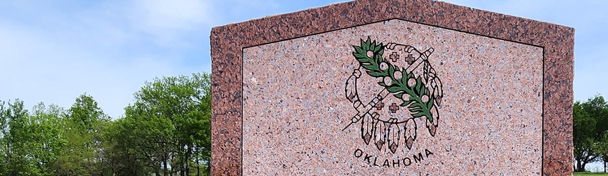
Historical Marker Program
Search Results
Your search returned 6 results.
In This Vicinity Coronado Passed
Beaver CountyLocation: at junction of US-270 and US-64 one mile east of Forgan
Coordinates: 36.906517, -100.513164
Material: Stone
Sponsor(s): National Society of Colonial Dames of America in Oklahoma
Topics: Empire Period, 1541-1803; Military
This marker commemorates the expedition of Francisco Vásquez de Coronado, which passed through Beaver County and the Oklahoma Panhandle in 1541.

View image
Jones-Plummer Trail
Beaver CountyLocation: at Beaver County Fairgrounds in Beaver
Coordinates: 36.807175, -100.520516
Material: Granite
Sponsor(s): Beaver County Historical Society and the Oklahoma Historical Society
Topics: Indian and Frontier Trade; Territorial Period, 1861-1907; Transportation
C. E. (Ed) Jones and Joe Plummer blazed this trail in the early 1870s after establishing trading posts on Wolf Creek in central Ochiltree County, Texas. Supplies for the post were hauled by wagon from Dodge City, Kansas. Buffalo hides were a major trade item for Jones and Plummer. In 1880, James Lane built a sod house near the trail crossing at Beaver River and established a station to accommodate teamsters and cowboys.

View image
No Man’s Land
Beaver CountyLocation: on OK-23, eight miles south of Elmwood
Coordinates: 36.501379, -100.522937
Material: Granite
Sponsor(s): Beaver County Historical Society and the Oklahoma Historical Society
Topics: Government; Settlement Patterns; Territorial Period, 1861–1907
The Oklahoma Panhandle, spanning 34.5 miles in width and 167 miles in length, was not attached to any US state or territory before 1890. Most maps identified it as Public Land or the Public Land Strip, but it became popularly known as No Man’s Land. The phrase referred to the fact that no one could legally own land within the Strip. Being outside any jurisdiction or any form of government, it became the home of outlaws, cowboys, and settlers. Beaver City was the largest town in the area. In 1890, Congress attached the Strip to the newly organized Oklahoma Territory, with Beaver City as the county seat. At statehood, the Panhandle was subdivided into three counties (Cimarron, Texas, and Beaver).

View image

View image
No Man’s Land
Beaver CountyLocation: on US-270/US-412/OK-3, six miles east of Slapout
Coordinates: 36.618696, -100.003836
Material: Granite
Sponsor(s): Beaver County Historical Society and the Oklahoma Historical Society
Topics: Government; Settlement Patterns; Territorial Period, 1861–1907
The Oklahoma Panhandle, spanning 34.5 miles in width and 167 miles in length, was not attached to any US state or territory before 1890. Most maps identified it as Public Land or the Public Land Strip, but it became popularly known as No Man’s Land. The phrase referred to the fact that no one could legally own land within the Strip. Being outside any jurisdiction or any form of government, it became the home of outlaws, cowboys, and settlers. Beaver City was the largest town in the area. In 1890, Congress attached the Strip to the newly organized Oklahoma Territory, with Beaver City as the county seat. At statehood, the Panhandle was subdivided into three counties (Cimarron, Texas, and Beaver).

View image

View image
No Man’s Land
Beaver CountyLocation: on US-64, three miles east of Gate
Coordinates: 36.838041, -100.003785
Material: Granite
Sponsor(s): Beaver County Historical Society and the Oklahoma Historical Society
Topics: Government; Settlement Patterns; Territorial Period, 1861–1907
The Oklahoma Panhandle, spanning 34.5 miles in width and 167 miles in length, was not attached to any US state or territory before 1890. Most maps identified it as Public Land or the Public Land Strip, but it became popularly known as No Man’s Land. The phrase referred to the fact that no one could legally own land within the Strip. Being outside any jurisdiction or any form of government, it became the home of outlaws, cowboys, and settlers. Beaver City was the largest town in the area. In 1890, Congress attached the Strip to the newly organized Oklahoma Territory, with Beaver City as the county seat. At statehood, the Panhandle was subdivided into three counties (Cimarron, Texas, and Beaver).

View image

View image
No Man’s Land
Beaver CountyLocation: on OK-23, six miles north of Forgan
Coordinates: 37.000759, -100.494401
Material: Granite
Sponsor(s): Beaver County Historical Society and the Oklahoma Historical Society
Topics: Government; Settlement Patterns; Territorial Period, 1861–1907
The Oklahoma Panhandle, spanning 34.5 miles in width and 167 miles in length, was not attached to any US state or territory before 1890. Most maps identified it as Public Land or the Public Land Strip, but it became popularly known as No Man’s Land. The phrase referred to the fact that no one could legally own land within the Strip. Being outside any jurisdiction or any form of government, it became the home of outlaws, cowboys, and settlers. Beaver City was the largest town in the area. In 1890, Congress attached the Strip to the newly organized Oklahoma Territory, with Beaver City as the county seat. At statehood, the Panhandle was subdivided into three counties (Cimarron, Texas, and Beaver).
(Page 1 of 1)
Marker Search
Use quotation marks to search for an exact phrase.
Browse by County
Adair County
Alfalfa County
Atoka County
Beaver County
Beckham County
Blaine County
Bryan County
Caddo County
Canadian County
Carter County
Cherokee County
Choctaw County
Cimarron County
Cleveland County
Comanche County
Cotton County
Craig County
Creek County
Custer County
Delaware County
Dewey County
Ellis County
Garfield County
Garvin County
Grady County
Grant County
Greer County
Harmon County
Harper County
Haskell County
Hughes County
Jackson County
Jefferson County
Johnston County
Kay County
Kingfisher County
Kiowa County
Latimer County
Le Flore County
Lincoln County
Logan County
Love County
Major County
Marshall County
Mayes County
McClain County
McCurtain County
McIntosh County
Murray County
Muskogee County
Noble County
Nowata County
Okfuskee County
Oklahoma County
Okmulgee County
Osage County
Ottawa County
Pawnee County
Payne County
Pittsburg County
Pontotoc County
Pottawatomie County
Pushmataha County
Roger Mills County
Rogers County
Seminole County
Sequoyah County
Stephens County
Texas County
Tillman County
Tulsa County
Wagoner County
Washington County
Washita County
Woods County
Woodward County
Alfalfa County
Atoka County
Beaver County
Beckham County
Blaine County
Bryan County
Caddo County
Canadian County
Carter County
Cherokee County
Choctaw County
Cimarron County
Cleveland County
Comanche County
Cotton County
Craig County
Creek County
Custer County
Delaware County
Dewey County
Ellis County
Garfield County
Garvin County
Grady County
Grant County
Greer County
Harmon County
Harper County
Haskell County
Hughes County
Jackson County
Jefferson County
Johnston County
Kay County
Kingfisher County
Kiowa County
Latimer County
Le Flore County
Lincoln County
Logan County
Love County
Major County
Marshall County
Mayes County
McClain County
McCurtain County
McIntosh County
Murray County
Muskogee County
Noble County
Nowata County
Okfuskee County
Oklahoma County
Okmulgee County
Osage County
Ottawa County
Pawnee County
Payne County
Pittsburg County
Pontotoc County
Pottawatomie County
Pushmataha County
Roger Mills County
Rogers County
Seminole County
Sequoyah County
Stephens County
Texas County
Tillman County
Tulsa County
Wagoner County
Washington County
Washita County
Woods County
Woodward County
To find out more about the Oklahoma Historical Society Historical Marker Program or how to submit an application, please visit the Historical Marker Program page.
Missing or Damaged Markers
Please use our online form to report missing or damaged historical markers.
Report Missing or Damaged Markers
Contact Us
If you have questions, please contact:
Matthew Pearce
Oklahoma Historical Society
800 Nazih Zuhdi Drive
Oklahoma City, OK 73105
405-522-8659
[email protected]
