Historical Marker Program
Search Results
Your search returned 12 results.
Birthplace of the University of Oklahoma
Cleveland CountyLocation: 206 West Main Street in Norman
Coordinates: 35.219846, -97.445395
Material: Other (Brick with bronze plaque)
Sponsor(s): Oklahoma Historical Society
Topics: Education; Social/Cultural; Territorial Period, 1861–1907
At this site, known as Rock Building, the first classes of the University of Oklahoma were held on September 15, 1892. Faculty consisted of David Ross Boyd, President; William N. Rice, Languages; Edwin C. DeBarr, Sciences; French S. E. Amos, English and History.
Note: This marker has been removed. Replacement marker is pending.

View image
The City of Norman and the Cleveland County Historical Museum
Cleveland CountyLocation: 508 North Peters Avenue in Norman
Coordinates: 35.225647, -97.444612
Material: Aluminum
Sponsor(s): Cleveland County Historical Society
Topics: Family/Household; Territorial Period, 1861–1907
Constructed in 1895, six years after the 1889 Land Run, this house, known as the Harry Lindsey Home, has been restored as a classic example of pre-statehood architecture.
Note: This marker has been replaced by the Moore-Lindsay Historic House Museum historical marker.
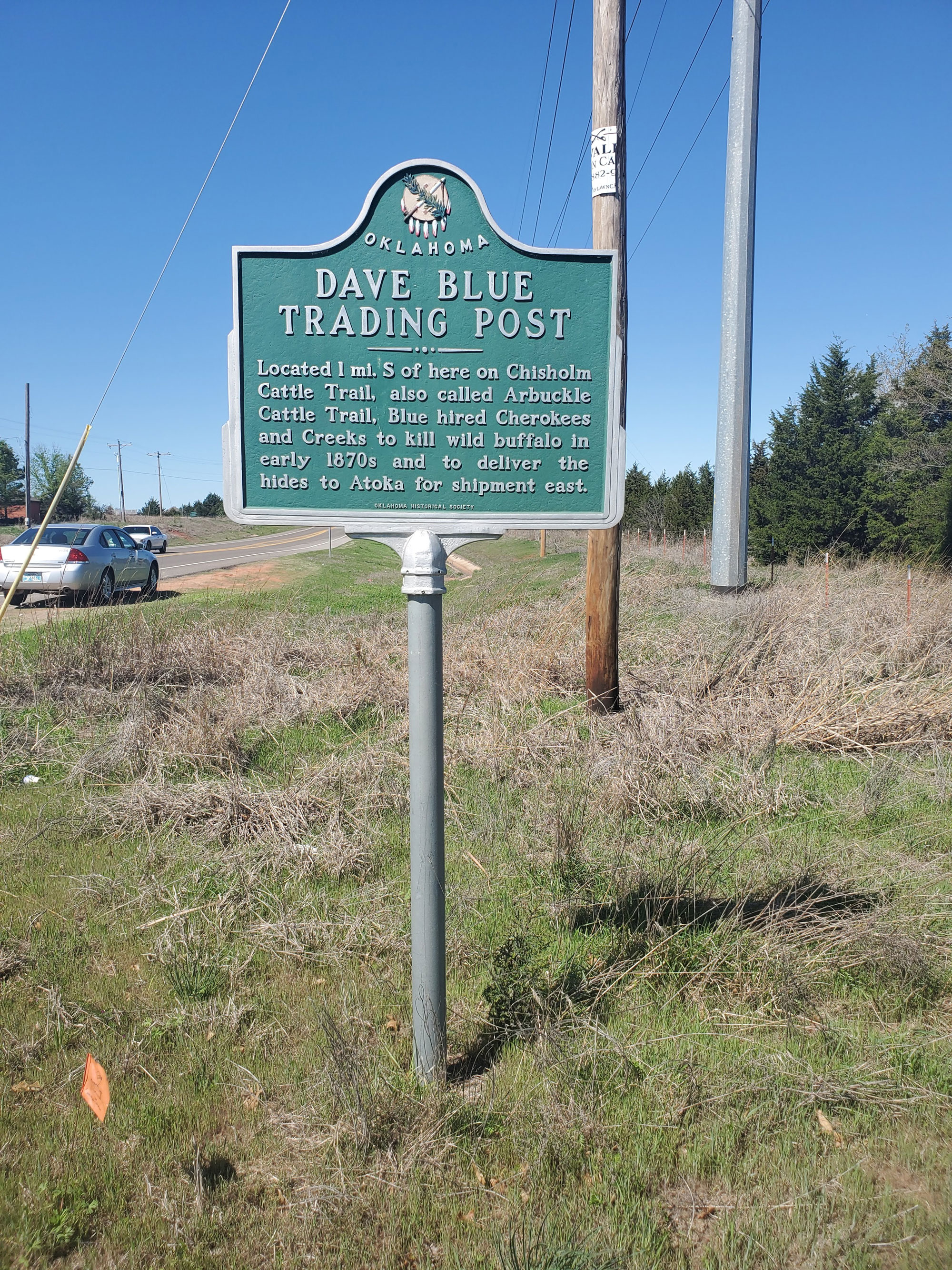
Dave Blue Trading Post
Cleveland CountyLocation: at intersection of 48th Avenue Southeast and East Imhoff Road (OK-9) in Norman
Coordinates: 35.189750, -97.370517
Material: Aluminum
Sponsor(s): Cleveland County Historical Society
Topics: American Indians; Indian and Frontier Trade; Territorial Period, 1861–1907
Dave Blue was a trader in the 1870s who hired Cherokee and Creeks to kill wild buffalo. Blue shipped the hides to Atoka for transportation to market in the eastern United States. Blue's trading post was built along the Arbuckle Cattle Trail.
View image
East Boundary of Run of 1889 and Indian Treaty Line
Cleveland CountyLocation: on OK-9, approximately ten miles east of Norman
Coordinates: 35.195019, -97.247560
Material: Aluminum
Sponsor(s): Cleveland County Historical Society
Topics: Land Openings; Territorial Period, 1861–1907
From this site a portion of Indian Territory was opened to thousands of settlers in 1889. One year later Congress provided for local and territorial government. This site also marks the west boundary of Shawnee and Pottawatomie lands that were opened to settlement on September 22, 1891. The Cleveland County line was then extended 6 1/2 miles east.
Note: This marker no longer exists. The opening “of Shawnee and Pottawatomie lands” referred to the Sac and Fox Opening, or the opening of the Iowa, Sac and Fox, Shawnee, and Potawatomi reservations to settlers on September 22, 1891.
The Jacobson House
Cleveland CountyLocation: 609 Chautauqua Avenue in Norman
Coordinates: 35.210691, -97.450055
Material: Aluminum
Sponsor(s): The Jacobson Foundation
Topics: American Indians; Arts; Early Statehood, 1907–1941; Industrial Period, 1941–1982
The home of Swedish-born artist Oscar B. Jacobson and Jeanne d’Ucel became a center for international celebrities, artists, and writers from 1918 to 1966. Jacobson, director of the University of Oklahoma School of Art from 1915 to 1945, revolutionized art education in Oklahoma. He is also credited with nurturing the “renaissance” of American Indian painting on the Southern Plains in the 1920s.

View image
March of the Dragoons
Cleveland CountyLocation: on US-77 in Noble just south of Maguire Road
Coordinates: 35.130033, -97.390217
Material: Aluminum
Sponsor(s): Cleveland County Historical Society
Topics: American Indians; Military; Westward Expansion, 1803–1861
Captain Nathan Boone, son of pioneer legend Daniel Boone, led 100 men and officers on an expedition to gather information about the Plains Indians. The 1843 expedition camped near this site.
Note: This marker no longer exists.
Moore-Lindsay Historic House Museum
Cleveland CountyLocation: 508 North Peters Avenue in Norman
Coordinates: 35.225649, -97.444612
Material: Aluminum
Sponsor(s): Cleveland County Historical Society
Topics: Early Statehood, 1907–1941; Family/Household; Territorial Period, 1861–1907
Banker and real estate investor William S. Moore and his wife Agnes built this house in December 1899. In November 1908, Moore sold the house to Harry Ginter Lindsay and his wife Daisy, the niece of Agnes Moore. The Lindsay’s owned a grain company and lumberyard near Main Street. This Queen Anne style architecture is representative of the Victorian era and currently serves as a museum that houses the Cleveland County Historical Society’s collections of early Norman history.
Note: This marker replaced The City of Norman and the Cleveland County Historical Museum historical marker.

View image
Norman’s Camp
Cleveland CountyLocation: on US-77, 1/2 mile north of intersection with OK-9
Coordinates: 35.190456, -97.422713
Material: Aluminum
Sponsor(s): Cleveland County Historial Society
Topics: Government; Territorial Period, 1861–1907; Transportation
This is the campsite of Abner Norman, a member of an 1873 survey party in Indian Territory. Members of his party burned "Norman's Camp" into a large elm at the site. The Norman Station was on the Santa Fe Railroad, and later the town of Norman took his name.
Note: This marker no longer exists.
Oklahoma’s Pioneer Oil City
Cleveland CountyTopics: American Indians; Land Openings; Petroleum; Territorial Period, 1861–1907
On July 2, 1904, the Lowery #1 came in just south of Cleveland, opening the Cleveland Sand and creating Oklahoma's first oil boom town. Here also was Jordan's Fort, built in 1886 by Colonel J. W. Jordan, Cherokee agent and deputy US marshal, to keep Boomers out of the Cherokee Outlet.
Run of ’89 South Boundary
Cleveland CountyLocation: on US-77 at east end of South Canadian River bridge in Lexington
Topics: Land Openings; Settlement Patterns; Territorial Period, 1861–1907
The South Canadian River was the south boundary line for the Unassigned Lands in central Oklahoma opened to settlement on April 22, 1889, in the first of five land runs in Oklahoma.

View image
University of Oklahoma
Cleveland CountyLocation: on US-77 in Norman
Coordinates: 35.194370, -97.423566
Material: Aluminum
Sponsor(s): Oklahoma Historical Society and the Oklahoma Department of Transportation
Topics: Education; Social/Cultural; Territorial Period, 1861–1907
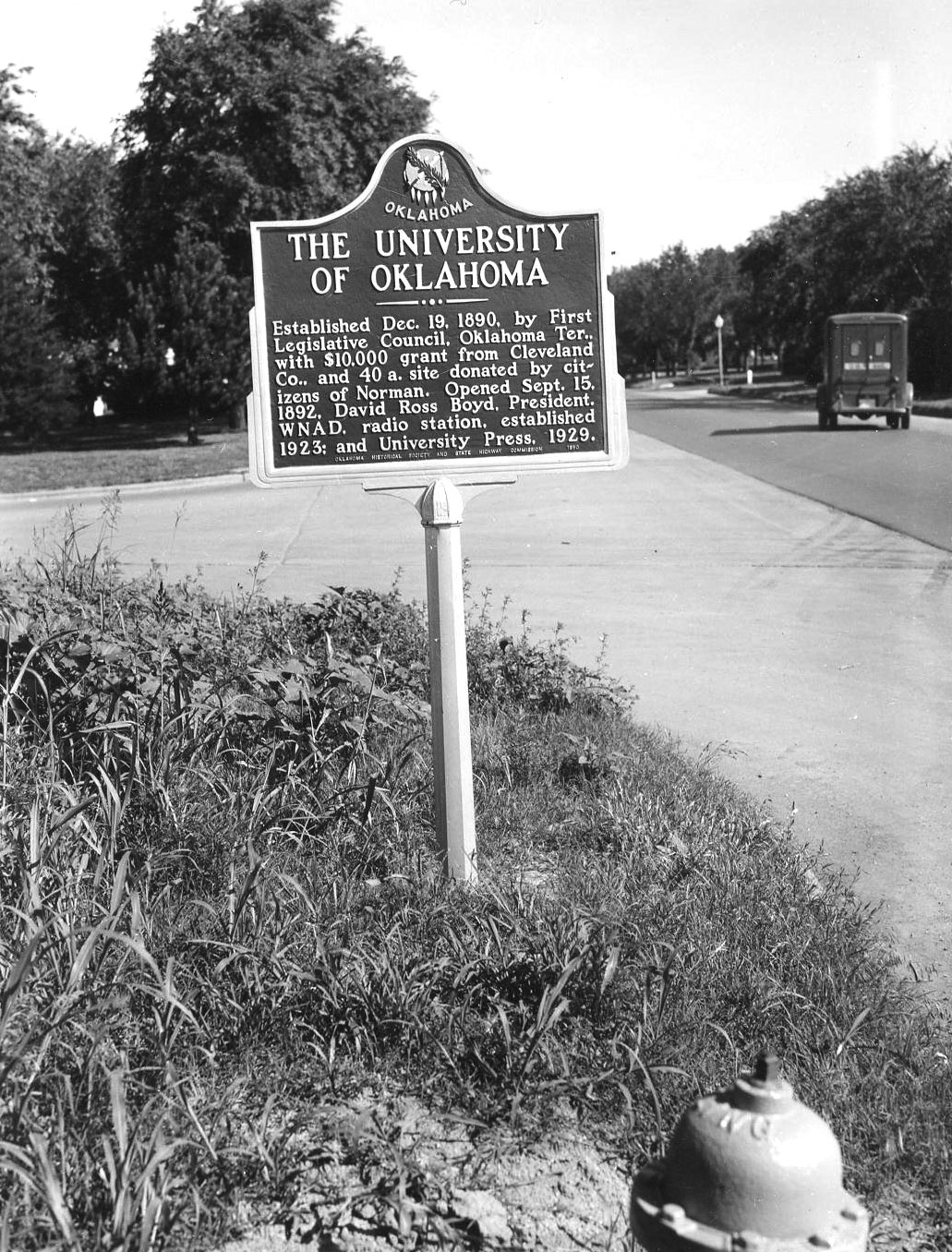
The University of Oklahoma was established by the first Territorial Legislature in 1890 and classes began in 1892. Cleveland County, Oklahoma Territory, contributed $10,000 and citizens of Norman donated forty acres for the campus. David Ross Boyd was the first president.
Note: This marker no longer exists.
View image
Washington Irving Campsite
Cleveland CountyLocation: on OK-9 in Little Axe Park ten miles east of Norman
Coordinates: 35.231711, -97.207471
Material: Other (Concrete with bronze plaque)
Sponsor(s): Daughters of the American Revolution
Topics: Arts; Settlement Patterns; Westward Expansion, 1803–1861
Noted American author Washington Irving and his party camped near Norman on his tour of the prairies in 1832, giving the outside world its first glimpse at the land that would become Oklahoma.
Note: This marker was reported damaged.
(Page 1 of 1)
Marker Search
Use quotation marks to search for an exact phrase.
Browse by County
Adair County
Alfalfa County
Atoka County
Beaver County
Beckham County
Blaine County
Bryan County
Caddo County
Canadian County
Carter County
Cherokee County
Choctaw County
Cimarron County
Cleveland County
Comanche County
Cotton County
Craig County
Creek County
Custer County
Delaware County
Dewey County
Ellis County
Garfield County
Garvin County
Grady County
Grant County
Greer County
Harmon County
Harper County
Haskell County
Hughes County
Jackson County
Jefferson County
Johnston County
Kay County
Kingfisher County
Kiowa County
Latimer County
Le Flore County
Lincoln County
Logan County
Love County
Major County
Marshall County
Mayes County
McClain County
McCurtain County
McIntosh County
Murray County
Muskogee County
Noble County
Nowata County
Okfuskee County
Oklahoma County
Okmulgee County
Osage County
Ottawa County
Pawnee County
Payne County
Pittsburg County
Pontotoc County
Pottawatomie County
Pushmataha County
Roger Mills County
Rogers County
Seminole County
Sequoyah County
Stephens County
Texas County
Tillman County
Tulsa County
Wagoner County
Washington County
Washita County
Woods County
Woodward County
Alfalfa County
Atoka County
Beaver County
Beckham County
Blaine County
Bryan County
Caddo County
Canadian County
Carter County
Cherokee County
Choctaw County
Cimarron County
Cleveland County
Comanche County
Cotton County
Craig County
Creek County
Custer County
Delaware County
Dewey County
Ellis County
Garfield County
Garvin County
Grady County
Grant County
Greer County
Harmon County
Harper County
Haskell County
Hughes County
Jackson County
Jefferson County
Johnston County
Kay County
Kingfisher County
Kiowa County
Latimer County
Le Flore County
Lincoln County
Logan County
Love County
Major County
Marshall County
Mayes County
McClain County
McCurtain County
McIntosh County
Murray County
Muskogee County
Noble County
Nowata County
Okfuskee County
Oklahoma County
Okmulgee County
Osage County
Ottawa County
Pawnee County
Payne County
Pittsburg County
Pontotoc County
Pottawatomie County
Pushmataha County
Roger Mills County
Rogers County
Seminole County
Sequoyah County
Stephens County
Texas County
Tillman County
Tulsa County
Wagoner County
Washington County
Washita County
Woods County
Woodward County
To find out more about the Oklahoma Historical Society Historical Marker Program or how to submit an application, please visit the Historical Marker Program page.
Missing or Damaged Markers
Please use our online form to report missing or damaged historical markers.
Report Missing or Damaged Markers
Contact Us
If you have questions, please contact:
Matthew Pearce
Oklahoma Historical Society
800 Nazih Zuhdi Drive
Oklahoma City, OK 73105
405-522-8659
[email protected]
