Historical Marker Program
Search Results
Your search returned 5 results.
Bond of Friendship
Pawnee CountyLocation: in the town of Skedee
Material: Granite
Bond of Friendship. Welcome to Skedee.
Cleveland
Pawnee CountyLocation: on US-64 at Triangle Oil and Historical Museum in Cleveland
Topics: Petroleum, Urban Development, Territorial Period 1861–1907, Industry/Business
The town of Cleveland became a boomtown in 1904 when oil was discovered nearby.
Cleveland-Pioneer Oil City
Pawnee CountyLocation: on US-64 and OK-99 in Cleveland
Topics: Urban Development, Petroleum, Territorial Period 1861–1907, American Indians, Natural Resources
Cleveland, established in 1894, was named for President Grover Cleveland. It became an early boomtown after oil was discovered in the immediate vicinity and in nearby Osage County in the early twentieth century.

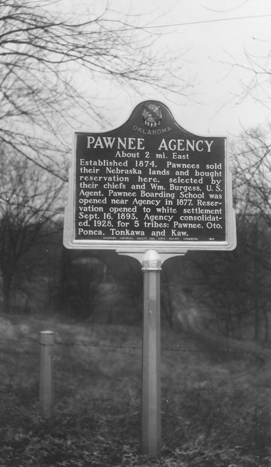
Pawnee Agency
Pawnee CountyLocation: on US-64 west of Pawnee
Material: Aluminum
Topics: American Indians, Government, Land Openings, Settlement Patterns, Territorial Period 1861–1907
Established in 1874, the agency supervised the Pawnee Indians who sold their lands in Nebraska and bought a reservation in present-day Pawnee County. The unallotted surplus lands of the Pawnee Reservation were opened to settlement in September 1893.
Skedee Monument
Pawnee CountyLocation: in town of Skedee
Topics: American Indians, Petroleum, Natural Resources, Social/Cultural, Folklife
Likenesses of Osage Chief Bacon Rind and Colonel E. E. Walters commemorate the cooperation of two different cultures. For many years, Walters served as the public auctioneer for oil lease rights on 160-acre tracts of the Osage Reservation, the revenue from which was distributed to the more than 2,000 Osage headrights. The auctions were held under the "million-dollar elm.
Search for Markers
Search by keyword or browse by county to learn about more than 700 historical markers created to recognize key locations, events, and people in Oklahoma history.
Please note that some markers listed in this database may have been moved, damaged, or are no longer standing.
Browse by County
Alfalfa County
Atoka County
Beaver County
Beckham County
Blaine County
Bryan County
Caddo County
Canadian County
Carter County
Cherokee County
Choctaw County
Cimarron County
Cleveland County
Comanche County
Cotton County
Craig County
Creek County
Custer County
Delaware County
Dewey County
Ellis County
Garfield County
Garvin County
Grady County
Grant County
Greer County
Harmon County
Harper County
Haskell County
Hughes County
Jackson County
Jefferson County
Johnston County
Kay County
Kingfisher County
Kiowa County
Le Flore County
Lincoln County
Logan County
Love County
Marshall County
Mayes County
McClain County
McCurtain County
McIntosh County
Murray County
Muskogee County
Noble County
Okfuskee County
Oklahoma County
Okmulgee County
Osage County
Ottawa County
Pawnee County
Payne County
Pittsburg County
Pontotoc County
Pottawatomie County
Pushmataha County
Roger Mills County
Rogers County
Seminole County
Sequoyah County
Stephens County
Texas County
Tillman County
Tulsa County
Wagoner County
Washington County
Washita County
Woods County
Woodward County
To find out more about the Oklahoma Historical Society Historical Marker Program or how to submit an application, please visit the Historical Marker Program page.
Missing or Damaged Markers
Please use our online form to report missing or damaged historical markers.
Report Missing or Damaged Markers
Contact Us
If you have questions, please contact:
Matthew Pearce
Oklahoma Historical Society
800 Nazih Zuhdi Drive
Oklahoma City, OK 73105
405-522-8659
matthew.pearce@history.ok.gov

