Historical Marker Program
Search Results
Your search returned 11 results.
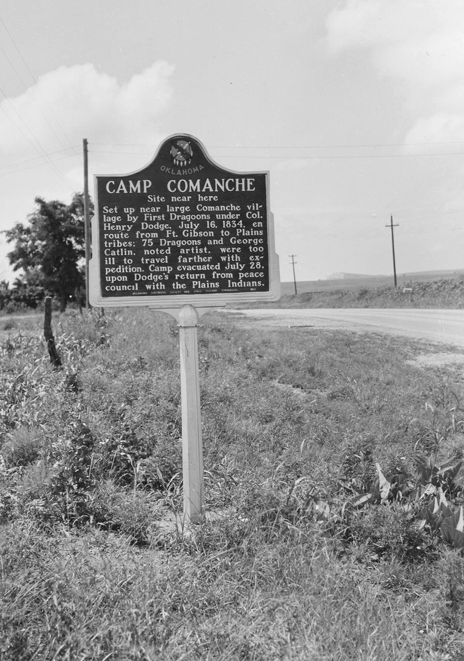
Camp Comanche
Comanche CountyLocation: on US Highway 62, two miles south of Caddo-Comanche County line
Coordinates: 34.825773, -98.387418
Material: Aluminum
Sponsor(s): Oklahoma Historical Society and the Oklahoma Department of Transportation
Topics: American Indians; Military; Westward Expansion, 1803–1861
Camp Comanche was set up near a large Comanche village by the First Dragoons under Colonel Henry Dodge on July 16, 1834, while en route from Fort Gibson to Plains tribes. Seventy-five Dragoons and noted artist George Catlin were too ill to travel farther with the expedition. The camp was evacuated on July 28, upon Dodge’s return from peace councils with the Plains Indians.
Note: This marker could not be located and is presumed to no longer exist.
View image
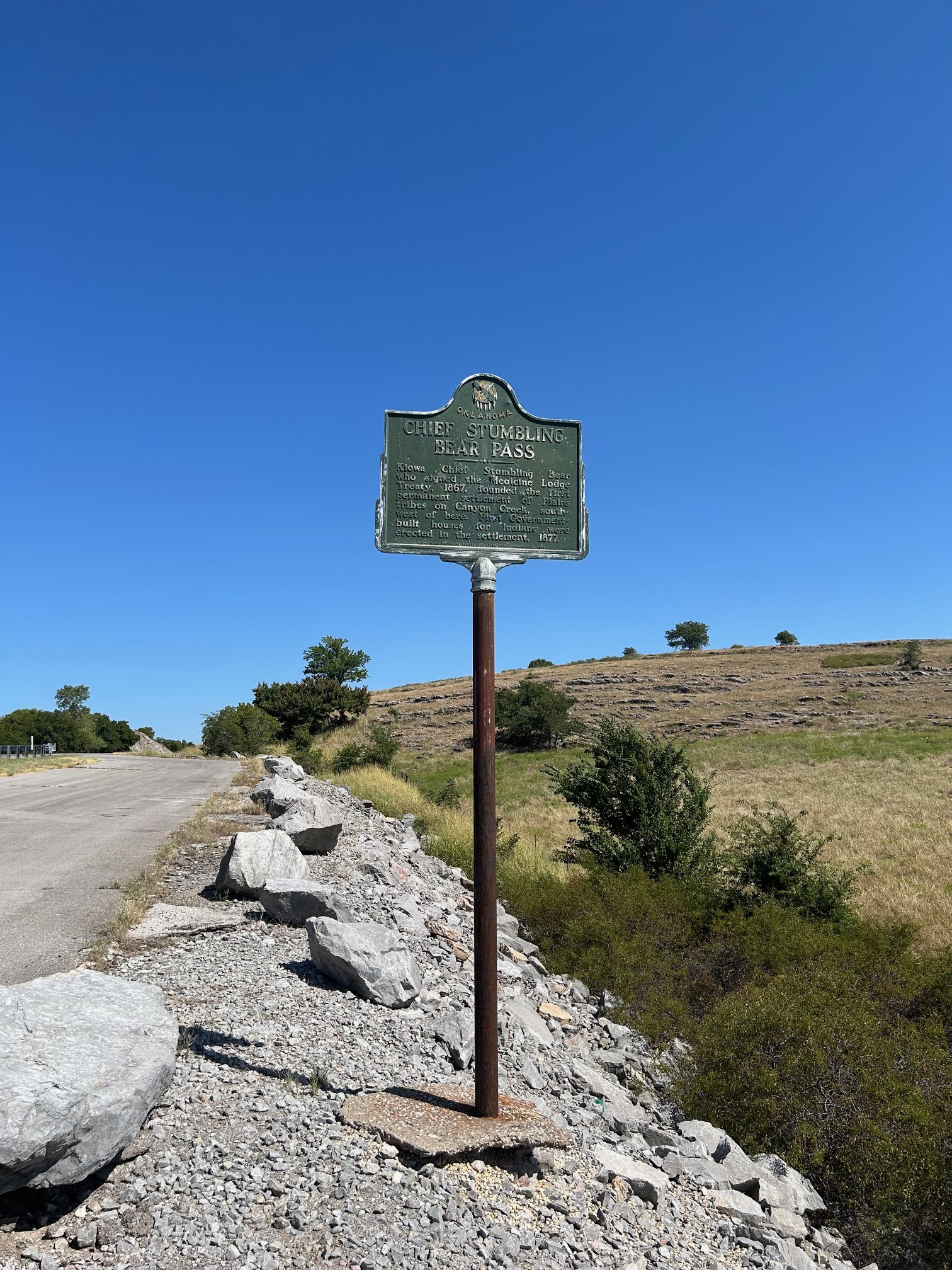
Chief Stumbling Bear Pass
Comanche CountyLocation: on OK-58 north of Fort Sill Military Reservation
Coordinates: 34.807365, -98.524543
Material: Aluminum
Sponsor(s): Oklahoma Historical Society and the Oklahoma Department of Transportation
Topics: American Indians; Government; Settlement Patterns; Territorial Period, 1861–1907
Stumbling Bear, a Kiowa, was the last signer of the Medicine Lodge Treaty in 1867. Stumbling Bear founded the first permanent settlement of Plains Indians in the area. In 1877 the federal government built houses for the Indians on Canyon Creek, north of the Wichita Mountains.
View image
Clarence E. Wilson
Comanche CountyLocation: at 6th and F Street, Lawton
Topics: Modern Period, 1982–present; Social/Cultural
Clarence Wilson, a Lawton native, is Lawton's only bombing victim. Clarence was a dedicated public servant and was a mentor for all youth.
Comanche Indian Mission
Comanche CountyLocation: beneath the Henry Post Airfield on the Fort Sill Military Reservation
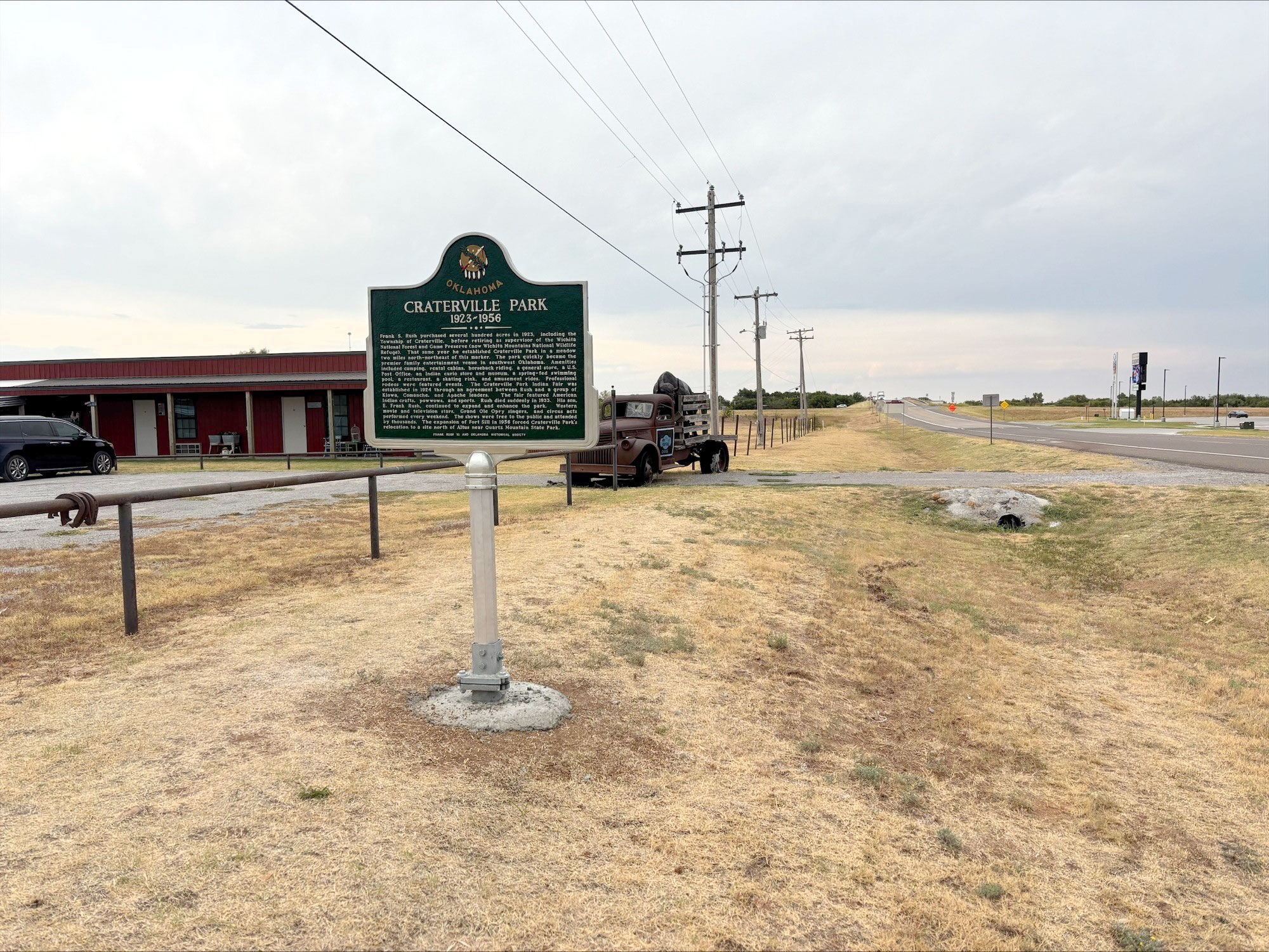
Craterville Park
Comanche CountyLocation: on OK-115 north of Cache
Coordinates: 34.643587, -98.632631
Material: Aluminum
Sponsor(s): Frank Rush III and the Oklahoma Historical Society
Topics: American Indians; Early Statehood, 1907–1941; Industrial Period, 1941–1982; Recreation/Service; Social/Culture
Frank S. Rush established Craterville Park in 1923. It became the premier family entertainment venue in southwest Oklahoma. The Craterville Park Indian Fair, established in 1924, featured American Indian crafts, powwows, and sports. The expansion of Fort Sill in 1956 forced Craterville Park’s relocation to a site north of Altus near Quartz Mountain State Park.
View image
Fort Sill
Comanche CountyLocation: on Sheridan Road, just inside Key Gate at Fort Sill
Topics: Government; Military; Territorial Period, 1861–1907
The US Army post was named in 1869 for Brigadier General Joshua W. Sill, killed in the Battle of Stone River, Tennessee, during the Civil War. The frontier post was previously referred to as "Camp on Medicine Bluff Creek" or "Camp Wichita.
Fort Sill Indian School
Comanche CountyLocation: on I-44 between Fort Sill and Lawton
Material: Aluminum
Topics: American Indians; Education; Religion/Philosophy; Territorial Period, 1861–1907
Quaker teacher Reverend Josiah Butler opened the school for Kiowa, Apache, and Comanche children in February of 1871.
I-See-O
Comanche CountyLocation: on wall of Old Post Chapel at Fort Sill
Sponsor(s): Daughters of the American Revolution
Topics: American Indians; Military
I-See-O was a famous Kiowa scout who attained the rank of sergeant in the US Army. Many consider him to be the last of the Indian scouts who faithfully served the army on the western frontier.
Old Post Chapel
Comanche CountyLocation: at site of old chapel at Fort Sill
Sponsor(s): Daughters of the American Revolution
Topics: Military; Religion/Philosophy; Territorial Period, 1861–1907
Built in 1870 by the 10th US Cavalry, Old Post Chapel served the religious needs of thousands of soldiers who passed through Fort Sill. Two markers preserve the history of the chapel which is the second-oldest house of worship still in use in Oklahoma.
Old Stone Corral
Comanche CountyLocation: at the Fort Sill Museum
Sponsor(s): Daughters of the American Revolution
Topics: American Indians; Ethnic Diversity; Military; Territorial Period, 1861–1907; Transportation
Known originally as the Quartermaster Corral, this structure, which replaced an earlier wooden corral, is located southeast of the original post quadrangle near Key Gate. The 10th Cavalry constructed the corral in 1870 to hold the horses, oxen, and mules used by the quartermaster for transport of men and supplies and for jobs such as road building. After 1875 the army used the corral for temporary incarceration of Plains Indians. In the 1880s, as boomers tried to enter and settle in the Indian Territory, the military rounded up and held the illegal settlers in the corral until the party was large enough to warrant military escort out of the area.
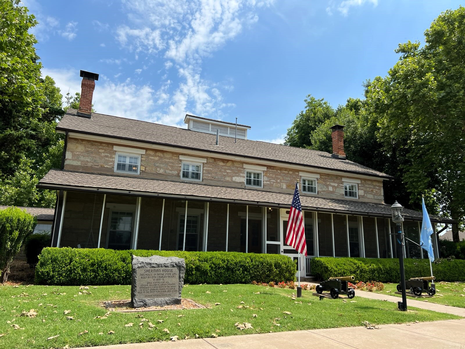
Sherman House
Comanche CountyLocation: on grounds of Fort Sill
Coordinates: 34.671783, -98.386217
Material: Granite
Sponsor(s): Oklahoma Historical Society
Topics: American Indians; Ethnic Diversity; Military; Territorial Period, 1861–1907
Constructed of native stone by members of the 10th Cavalry, this structure was home to General William Tecumseh Sherman when he conducted a tour of frontier army posts in the early 1870s. He narrowly escaped assassination by Kiowa warriors on the porch in May 1871.
View image
(Page 1 of 1)
Marker Search
Use quotation marks to search for an exact phrase.
Browse by County
Adair County
Alfalfa County
Atoka County
Beaver County
Beckham County
Blaine County
Bryan County
Caddo County
Canadian County
Carter County
Cherokee County
Choctaw County
Cimarron County
Cleveland County
Comanche County
Cotton County
Craig County
Creek County
Custer County
Delaware County
Dewey County
Ellis County
Garfield County
Garvin County
Grady County
Grant County
Greer County
Harmon County
Harper County
Haskell County
Hughes County
Jackson County
Jefferson County
Johnston County
Kay County
Kingfisher County
Kiowa County
Latimer County
Le Flore County
Lincoln County
Logan County
Love County
Major County
Marshall County
Mayes County
McClain County
McCurtain County
McIntosh County
Murray County
Muskogee County
Noble County
Nowata County
Okfuskee County
Oklahoma County
Okmulgee County
Osage County
Ottawa County
Pawnee County
Payne County
Pittsburg County
Pontotoc County
Pottawatomie County
Pushmataha County
Roger Mills County
Rogers County
Seminole County
Sequoyah County
Stephens County
Texas County
Tillman County
Tulsa County
Wagoner County
Washington County
Washita County
Woods County
Woodward County
Alfalfa County
Atoka County
Beaver County
Beckham County
Blaine County
Bryan County
Caddo County
Canadian County
Carter County
Cherokee County
Choctaw County
Cimarron County
Cleveland County
Comanche County
Cotton County
Craig County
Creek County
Custer County
Delaware County
Dewey County
Ellis County
Garfield County
Garvin County
Grady County
Grant County
Greer County
Harmon County
Harper County
Haskell County
Hughes County
Jackson County
Jefferson County
Johnston County
Kay County
Kingfisher County
Kiowa County
Latimer County
Le Flore County
Lincoln County
Logan County
Love County
Major County
Marshall County
Mayes County
McClain County
McCurtain County
McIntosh County
Murray County
Muskogee County
Noble County
Nowata County
Okfuskee County
Oklahoma County
Okmulgee County
Osage County
Ottawa County
Pawnee County
Payne County
Pittsburg County
Pontotoc County
Pottawatomie County
Pushmataha County
Roger Mills County
Rogers County
Seminole County
Sequoyah County
Stephens County
Texas County
Tillman County
Tulsa County
Wagoner County
Washington County
Washita County
Woods County
Woodward County
To find out more about the Oklahoma Historical Society Historical Marker Program or how to submit an application, please visit the Historical Marker Program page.
Missing or Damaged Markers
Please use our online form to report missing or damaged historical markers.
Report Missing or Damaged Markers
Contact Us
If you have questions, please contact:
Matthew Pearce
Oklahoma Historical Society
800 Nazih Zuhdi Drive
Oklahoma City, OK 73105
405-522-8659
[email protected]
