Historical Marker Program
Search Results
Your search returned 7 results.
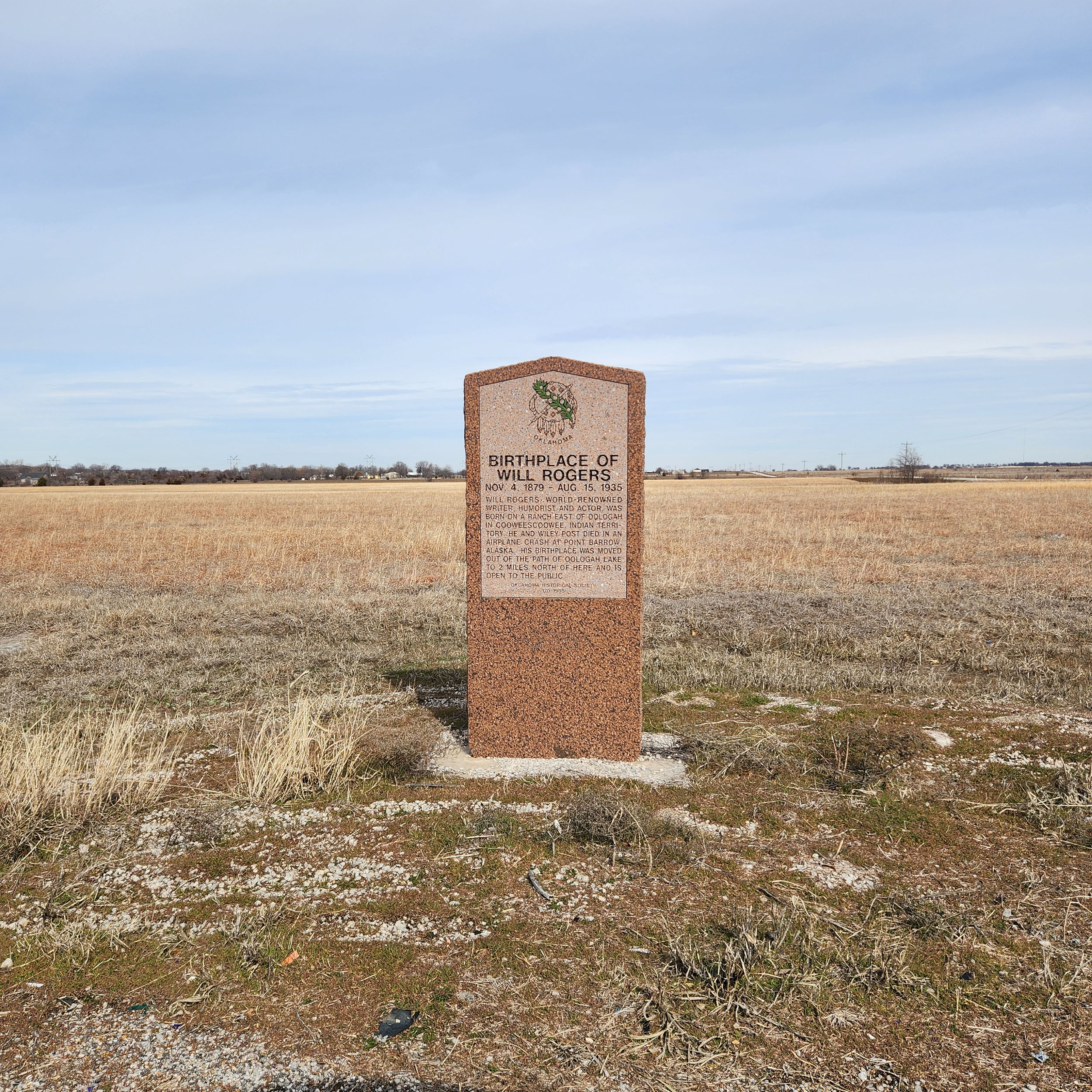
Birthplace of Will Rogers
Rogers CountyCoordinates: 36.437944, -95.687250
Topics: American Indians
November 4, 1879-August 15, 1935. Will Rogers, world-renowned writer, humorist, and actor, was born on a ranch east of Oologah in Cooweescoowee, Indian Territory. He and Wiley Post died in an airplane crash at Point Barrow, Alaska. His birthplace was moved out of the path of Oologah Lake to 2 miles north of here and is open to the public.

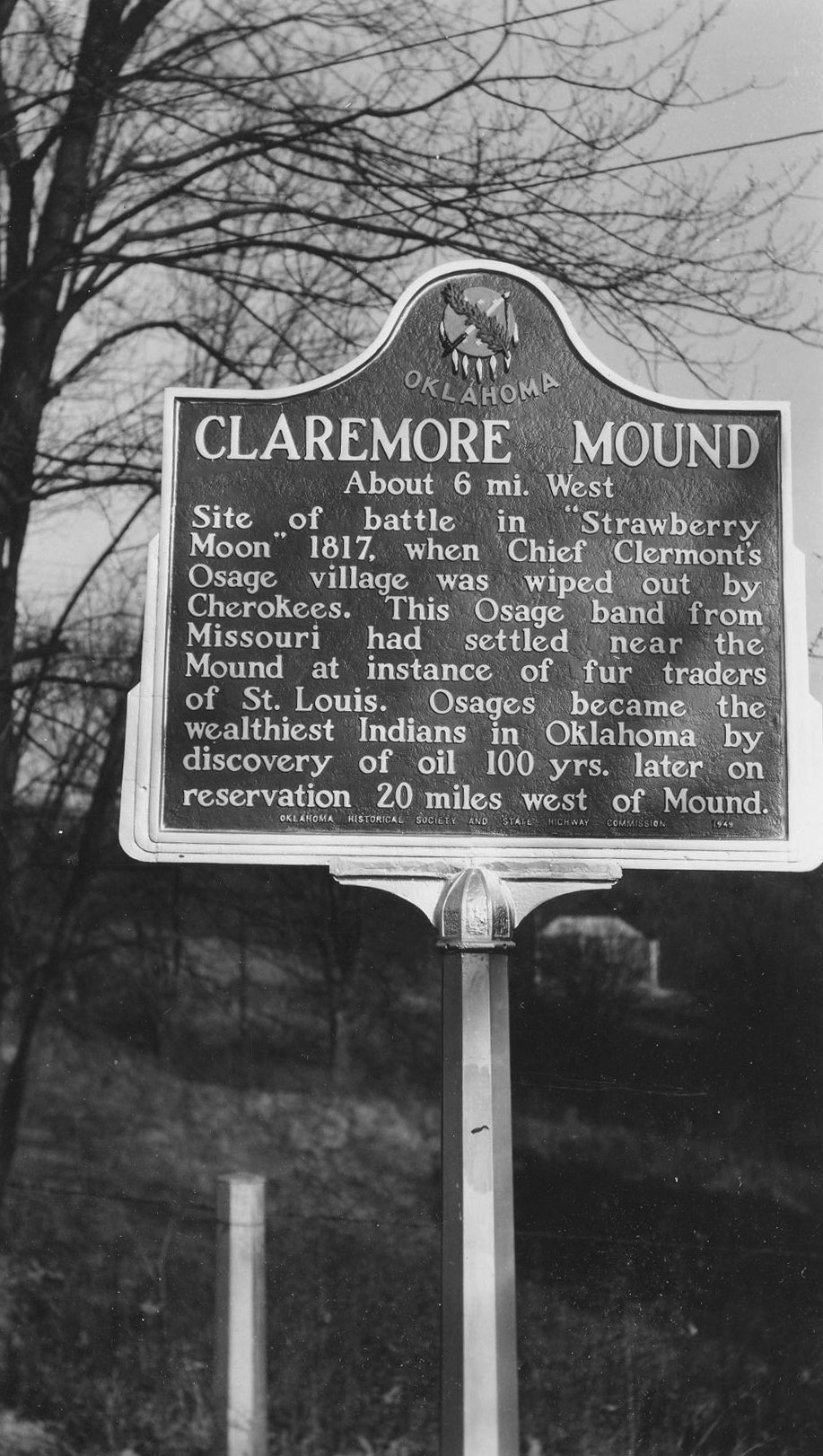
Claremore Mound
Rogers CountyLocation: on OK-88, one mile north of County Road 44
Material: Aluminum
Topics: American Indians, Petroleum, Natural Resources, Westward Expansion 1803–1861
Named for the great Osage chief, Clermont, the area was the site of an Osage village destroyed by the Cherokees in 1817. Oil was discovered a century later on the Osage Reservation nearby.

Claremore Mound
Rogers CountyLocation: on OK-88, one mile north of County Road
Coordinates: 36.382000, -95.632833
Material: Granite
Topics: American Indians, Petroleum, Natural Resources, Westward Expansion 1803–1861
on OK-88 west of County Road 411

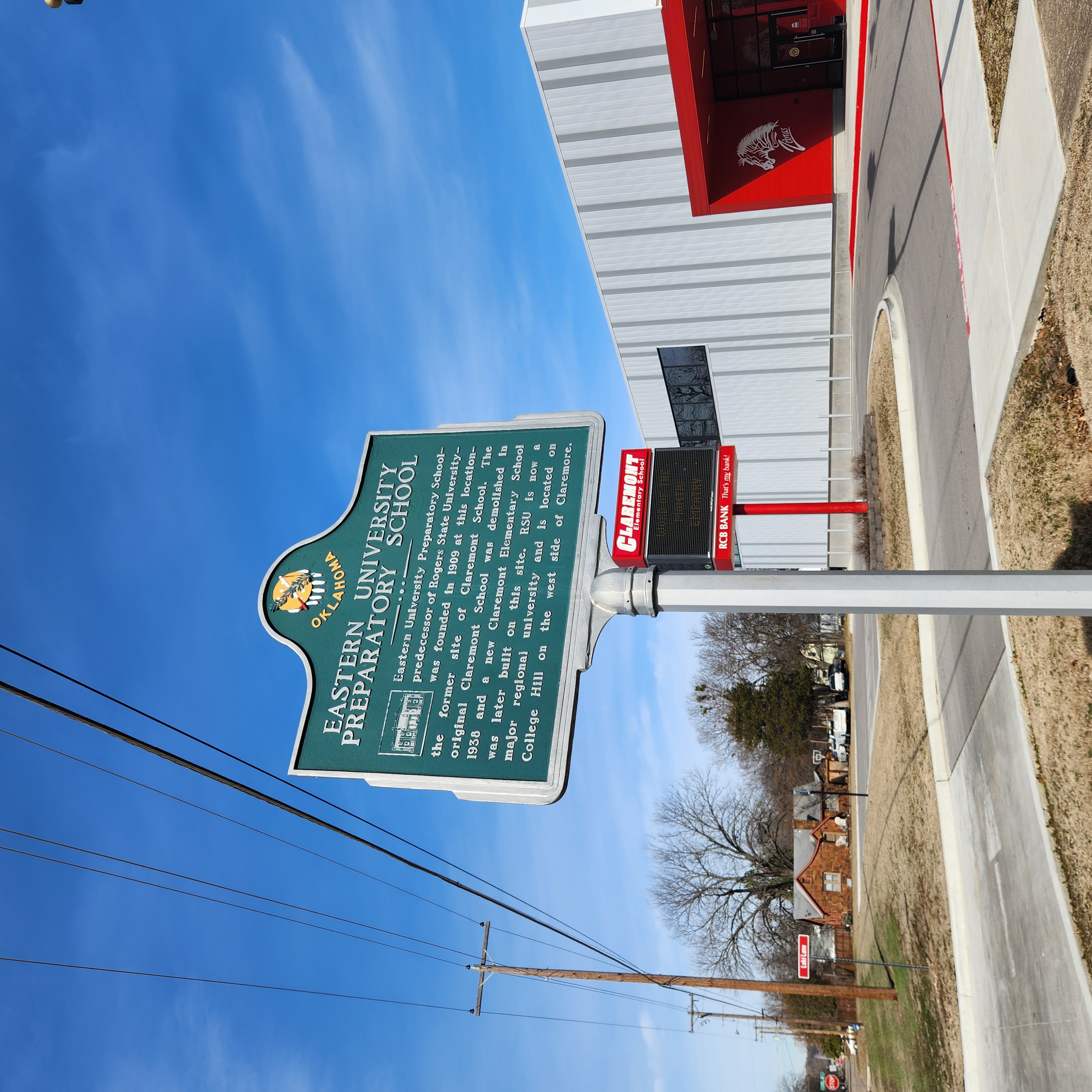
Eastern University Preparatory School
Rogers CountyLocation: at 7th Street and Choctaw Avenue in Claremore
Coordinates: 36.312650, -95.604966
Sponsored by: Rogers State University - Brent Ortolani
Material: Aluminum
Topics: Education, Early Statehood 1907–1941
Eastern University Preparatory School, the predecessor of Rogers State University (RSU), was founded in 1909 at this location, the former site of Claremore School. The original school was demolished and a new Claremont Elementary School was built on this site. RSU is now located on College Hill on the west side of Claremore.

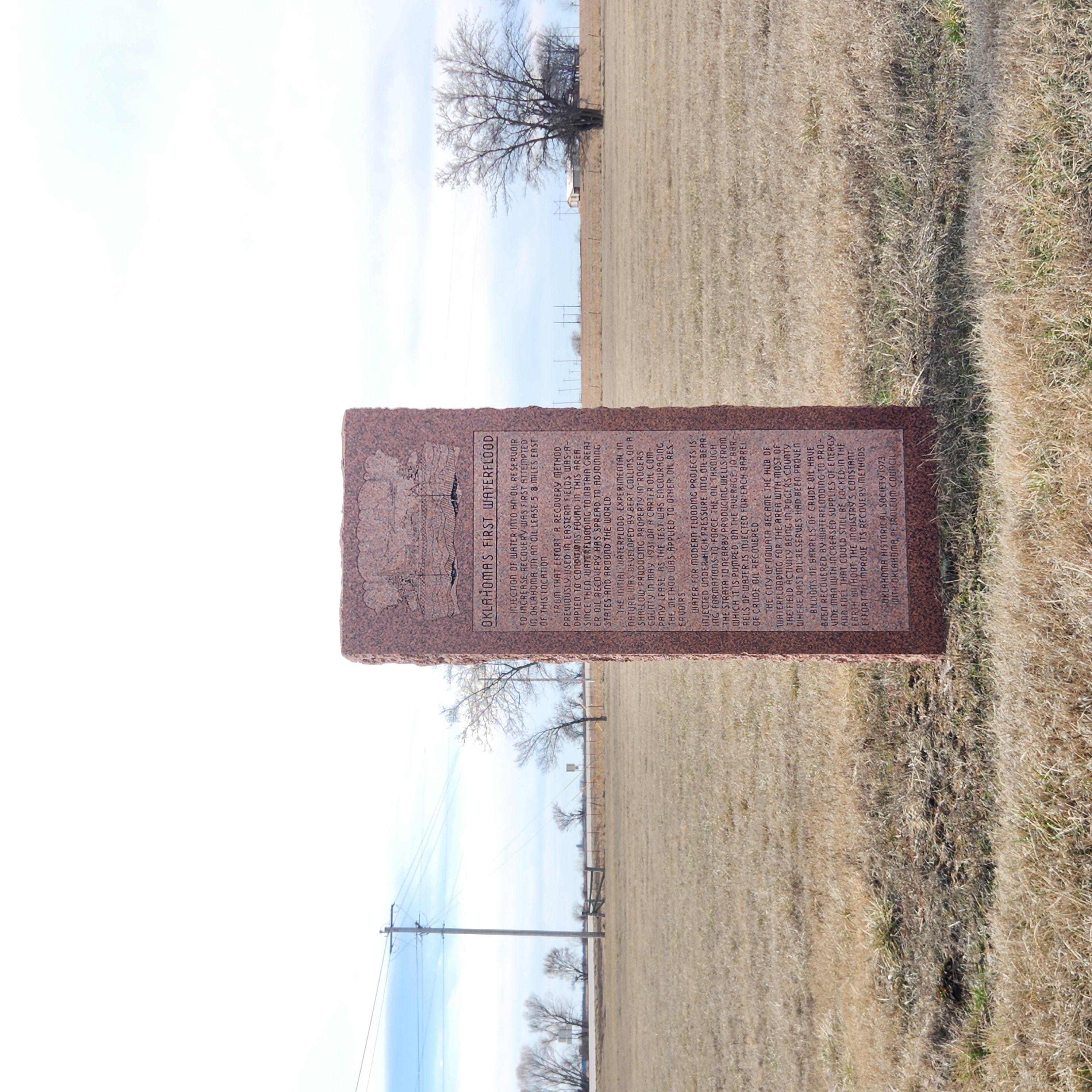
Oklahoma's First Waterflood
Rogers CountyLocation: four miles south of Nowata on US-169 south of County Road 30
Coordinates: 36.583610, -95.670688
Material: Granite
Topics: Early Statehood 1907–1941, Petroleum, Industry/Business, Natural Resources, Water
In May of 1931, Bert Collins first used injection of water into an oil reservoir to increase recovery, a process that became known as water flooding. Billions of barrels of crude oil have been recovered from world oil reserves by water flooding.
Port of the Plains
Rogers CountyLocation: at the crossing of Hwy-66 and the navigation channel
Sponsored by: The Propeller Club
Material: Aluminum
Topics: Transportation, Water, Natural Resources, Industrial Period 1841–1892
Head of navigation for the McClellan-Kerr Arkansas River Navigation System, the Tulsa Port of Catoosa is located one mile upstream from this marker. The McClellan-Kerr Arkansas River Navigation System is a 448-mile channel stretching form the Mississippi River up the Arkansas and Verdigris Rivers to the Tulsa Port of Catoosa. Barges are raised a total of 420 feet via 17 locks and dams from the Mississippi to Catoosa and the entire waterway connects with much of the nation's 29,000 miles of inland waterways.
Will Rogers
Rogers CountyLocation: on grounds of Will Rogers Memorial in Claremore (DAR)
Sponsored by: Daughters of the American Revolution
Topics: Arts, American Indians, Early Statehood 1907–1941, Mass Communication
The famous Oklahoman charmed the world with his wit and wisdom in vaudeville, radio, the movies, and as a newspaper columnist.
Search for Markers
Search by keyword or browse by county to learn about more than 700 historical markers created to recognize key locations, events, and people in Oklahoma history.
Please note that some markers listed in this database may have been moved, damaged, or are no longer standing.
Browse by County
Alfalfa County
Atoka County
Beaver County
Beckham County
Blaine County
Bryan County
Caddo County
Canadian County
Carter County
Cherokee County
Choctaw County
Cimarron County
Cleveland County
Comanche County
Cotton County
Craig County
Creek County
Custer County
Delaware County
Dewey County
Ellis County
Garfield County
Garvin County
Grady County
Grant County
Greer County
Harmon County
Harper County
Haskell County
Hughes County
Jackson County
Jefferson County
Johnston County
Kay County
Kingfisher County
Kiowa County
Le Flore County
Lincoln County
Logan County
Love County
Marshall County
Mayes County
McClain County
McCurtain County
McIntosh County
Murray County
Muskogee County
Noble County
Okfuskee County
Oklahoma County
Okmulgee County
Osage County
Ottawa County
Pawnee County
Payne County
Pittsburg County
Pontotoc County
Pottawatomie County
Pushmataha County
Roger Mills County
Rogers County
Seminole County
Sequoyah County
Stephens County
Texas County
Tillman County
Tulsa County
Wagoner County
Washington County
Washita County
Woods County
Woodward County
To find out more about the Oklahoma Historical Society Historical Marker Program or how to submit an application, please visit the Historical Marker Program page.
Missing or Damaged Markers
Please use our online form to report missing or damaged historical markers.
Report Missing or Damaged Markers
Contact Us
If you have questions, please contact:
Matthew Pearce
Oklahoma Historical Society
800 Nazih Zuhdi Drive
Oklahoma City, OK 73105
405-522-8659
matthew.pearce@history.ok.gov

