Historical Marker Program
Search Results
Your search returned 13 results.

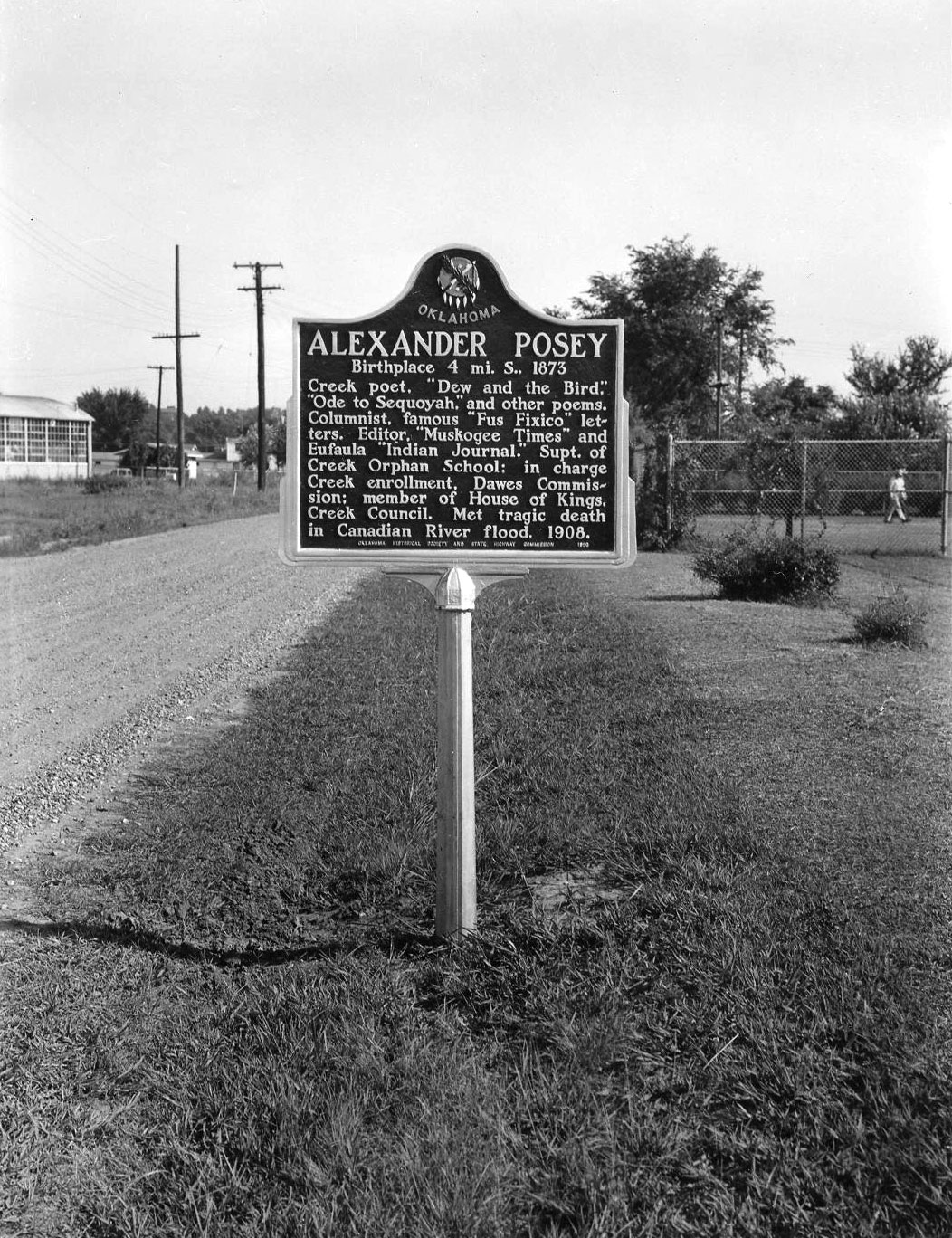
Alexander Posey
McIntosh CountyLocation: on SH9, eight miles west of Eufaula, in Posey Park
Material: Aluminum
Topics: American Indians, Arts, Territorial Period 1861–1907, Mass Communication, Government
This famous Creek poet and journalist's life prematurely ended when he drowned in the North Canadian River near Eufaula on May 27, 1908. Alexander Posey was the editor of newspapers, a member of the Dawes Commission, and widely known for his poems such as "Ode to Sequoyah.
Asbury Manual Labor School
McIntosh CountyLocation: on US-Ubs-69 in Greenwood Cemetery north of Eufaula
Topics: Religion/Philosophy, Education, American Indians
Stones that make up the monument are from the original buildings of the Methodist school for Indian children and youth. The original site of the school lies under Lake Eufaula.
Buckner Cemetery
McIntosh CountyLocation: in Greenwood Cemetery north of Eufaula
Topics: Religion/Philosophy, Family/Household, Westward Expansion 1803–1861
Dr. Henry F. Buckner, called the "apostle to the Creeks," and members of his family are buried here, having been moved from the Buckner home now under Lake Eufaula. Buckner came to the Creeks as a Baptist missionary in 1849.
Creek Council Ground
McIntosh CountyLocation: at Eufaula Indian community at Seventh and Forest in Eufaula
Topics: Military, Government, American Indians, Social/Cultural, Recreational/Service
Confederate Commissioner Albert Pike met with Creek leaders at North Fork Town, now covered by the waters of Lake Eufaula, on July 10, 1861, to sign a treaty in which the Creeks pledged their support to the South in the Civil War.
Green Corn Dance
McIntosh CountyLocation: at Eufaula Indian community at Seventh and Forest in Eufaula
Material: Granite
Topics: American Indians
To the Creeks, the Green Corn dance was a major annual religious celebration of the harvest season. Around a central fire, men, women, and children dressed in colorful costumes, danced, chanted, and sang. After the rites, green corn was served.
Henry Frieland Buckner
McIntosh CountyLocation: in Greenwood Cemetery north of Eufaula
Topics: Religion/Philosophy, Family/Household, Westward Expansion 1803–1861
Commemorates the work of Dr. Henry F. Buckner
Honey Springs Battlefield
McIntosh CountyLocation: six miles northeast of Checotah
Topics: Military, Ethnic Diversity, Government, American Indians, Territorial Period 1861–1907
Six monuments and markers pay tribute to those who fought in the Civil War Battle of Honey Springs on July 17, 1863. Included are Honey Springs Depot, the Texas Confederates, the Indian and Texas troops, Union soldiers, and the First Regiment Kansas Colored Volunteers, one of the first African American units of the Civil War to play a key part in a Union victory.
Nakedhead
McIntosh CountyLocation: in Lake Eufaula State Park
Material: Granite
Topics: Government, Recreational/Service, American Indians, Territorial Period 1861–1907
James Nakedhead was a deputy US marshal killed in the line of duty during Indian Territory days. He was a Cherokee policeman and the first town marshal in Tahlequah in 1890.

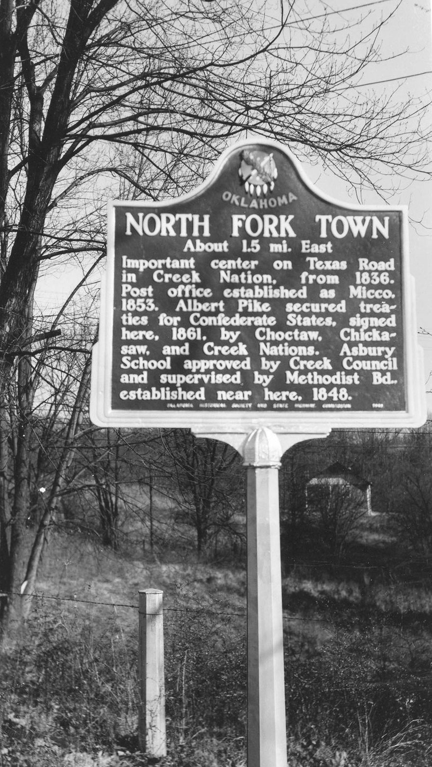
North Fork Town
McIntosh CountyLocation: at the intersection of Elm and Main Streets in Eufaula
Material: Aluminum
Topics: American Indians, Military, Westward Expansion 1803–1861
From 1836, this was an important center on the Texas Road in the Creek Nation. Albert Pike secured treaties between the Creeks, Chickasaws, and Choctaws and the Confederacy here in 1861. See Creek Council Ground.
Rentiesville
McIntosh CountyLocation: in community of Rentiesville
Topics: Ethnic Diversity, Urban Development, Settlement Patterns, Territorial Period 1861–1907, Early Statehood Early Statehood 1907–1941
Rentiesville is one of thirteen All-Black towns, out of more than fifty that once existed, remaining in Oklahoma. While Tullahassee is reportedly the oldest, most were established between 1889 and 1907 as African Americans sought security and control of their own destiny in a segregated world. Most of the towns began to decline in the 1920s and 1930s as rural African Americans faced economic hardships and began to move to urban areas.
Tuskegee Baptist Church
McIntosh CountyLocation: at intersection of OK-9 and NS-411 (OBHC)
Topics: Social/Cultural, Religion/Philosophy, Folklife, Territorial Period 1861–1907
Annie Walker Armstrong was corresponding secretary of the Woman's Missionary Union of the Southern Baptist Convention which sent missionaries to the area. The church was founded here in 1867. Nearby is another marker that notes the rock that Armstrong used to mount her horse during a visit to the church in 1900.
Vernon
McIntosh CountyLocation: in community of Vernon
Topics: Urban Development, Ethnic Diversity, Religion/Philosophy, Early Statehood 1907–1941
Vernon, established in March 1912, is named for William T. Vernon, a minister and bishop in the African Methodist Episcopal Church, who also served as registrar of the United States Treasury from 1906 to 1912 under President Theodore Roosevelt and William Taft.
Walker and Newton
McIntosh CountyLocation: in Lake Eufaula State Park
Topics: Government, Recreational/Service, Social/Cultural, Industrial Period 1841–1892
A tribute to Oklahoma Highway Patrol trooper Bill Walker and Fountainhead State Park superintendent Leo Newton who were gunned down in a shoot-out in 1971.
Search for Markers
Search by keyword or browse by county to learn about more than 600 historical markers created to recognize key locations, events, and people in Oklahoma history.
Please note that some markers listed in this database may have been moved, damaged, or are no longer standing.
Browse by County
Alfalfa County
Atoka County
Beaver County
Beckham County
Blaine County
Bryan County
Caddo County
Canadian County
Carter County
Cherokee County
Choctaw County
Cimarron County
Cleveland County
Comanche County
Cotton County
Craig County
Creek County
Custer County
Delaware County
Dewey County
Ellis County
Garfield County
Garvin County
Grady County
Grant County
Greer County
Harmon County
Harper County
Haskell County
Hughes County
Jackson County
Jefferson County
Johnston County
Kay County
Kingfisher County
Kiowa County
Le Flore County
Lincoln County
Logan County
Love County
Marshall County
Mayes County
McClain County
McCurtain County
McIntosh County
Murray County
Muskogee County
Noble County
Okfuskee County
Oklahoma County
Okmulgee County
Osage County
Ottawa County
Pawnee County
Payne County
Pittsburg County
Pontotoc County
Pottawatomie County
Pushmataha County
Roger Mills County
Rogers County
Seminole County
Sequoyah County
Stephens County
Texas County
Tillman County
Tulsa County
Wagoner County
Washington County
Washita County
Woods County
Woodward County
Contact Us
If you have questions, please contact:
Matthew Pearce
Oklahoma Historical Society
800 Nazih Zuhdi Drive
Oklahoma City, OK 73105
405-522-8659
matthew.pearce@history.ok.gov

