Historical Marker Program
Search Results
Your search returned 1 result.
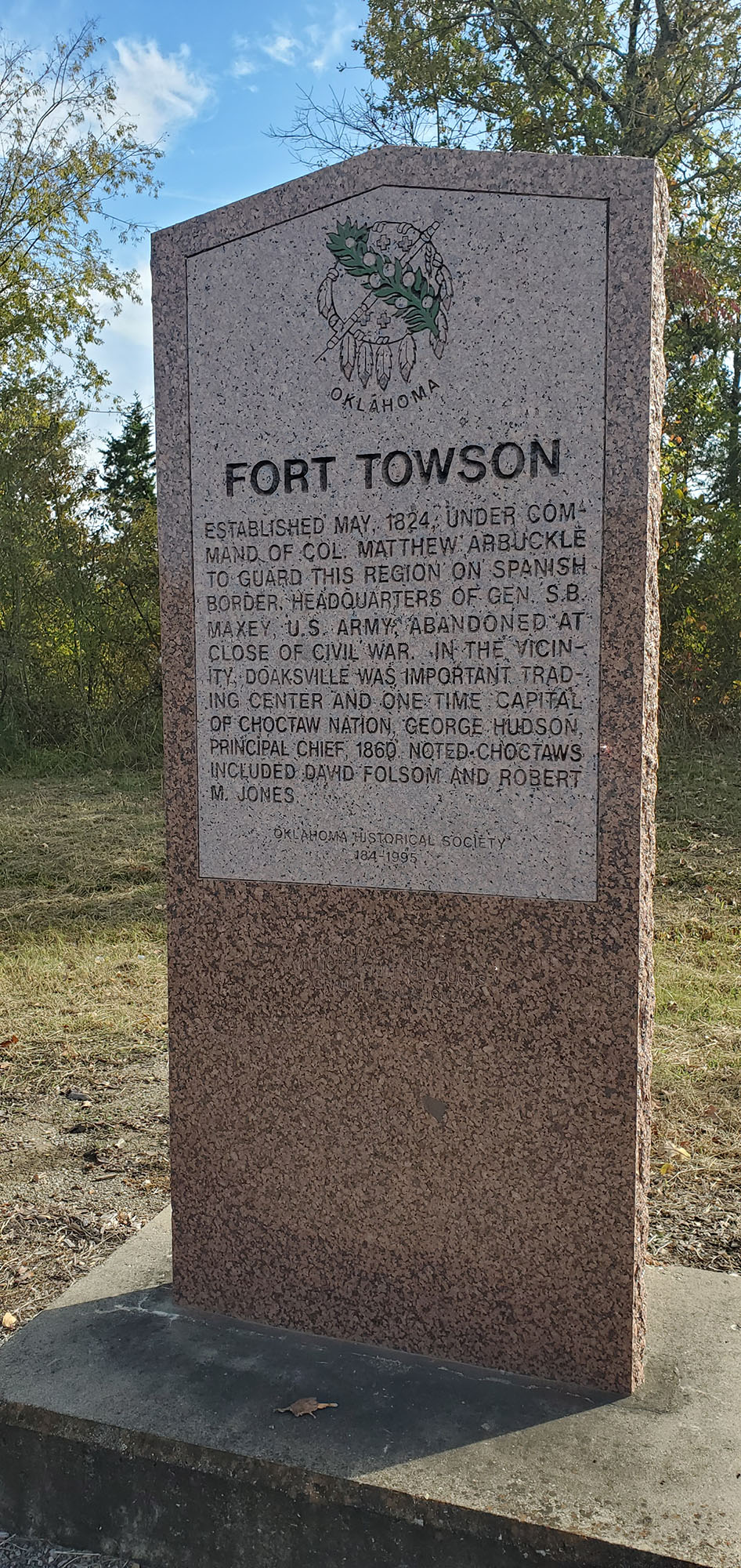
Fort Towson
Choctaw CountyLocation: on US-70 at east edge of Fort Towson
Coordinates: 34.017681, -95.253985
Material: Granite
Sponsor(s): Oklahoma Historical Society
Topics: American Indians; Government; Military; Westward Expansion, 1803–1861
Colonel Matthew Arbuckle ordered the construction of the fort in May 1824 to guard the US boundary with Mexico. After Indian removals to the area in the 1830s, the fort served as a permanent army post until 1854. During the Civil War, the fort was occupied by Confederate forces. Brigadier General Stand Watie surrendered his Confederate troops here in June 1865, the last Confederate general to lay down his arms. Fort Towson was abandoned after the Civil War.
Note: This marker was reported damaged.
View image
(Page 1 of 1)
Marker Search
Use quotation marks to search for an exact phrase.
Browse by County
Adair County
Alfalfa County
Atoka County
Beaver County
Beckham County
Blaine County
Bryan County
Caddo County
Canadian County
Carter County
Cherokee County
Choctaw County
Cimarron County
Cleveland County
Comanche County
Cotton County
Craig County
Creek County
Custer County
Delaware County
Dewey County
Ellis County
Garfield County
Garvin County
Grady County
Grant County
Greer County
Harmon County
Harper County
Haskell County
Hughes County
Jackson County
Jefferson County
Johnston County
Kay County
Kingfisher County
Kiowa County
Latimer County
Le Flore County
Lincoln County
Logan County
Love County
Major County
Marshall County
Mayes County
McClain County
McCurtain County
McIntosh County
Murray County
Muskogee County
Noble County
Nowata County
Okfuskee County
Oklahoma County
Okmulgee County
Osage County
Ottawa County
Pawnee County
Payne County
Pittsburg County
Pontotoc County
Pottawatomie County
Pushmataha County
Roger Mills County
Rogers County
Seminole County
Sequoyah County
Stephens County
Texas County
Tillman County
Tulsa County
Wagoner County
Washington County
Washita County
Woods County
Woodward County
To find out more about the Oklahoma Historical Society Historical Marker Program or how to submit an application, please visit the Historical Marker Program page.
Missing or Damaged Markers
Please use our online form to report missing or damaged historical markers.
Report Missing or Damaged Markers
Contact Us
If you have questions, please contact:
Matthew Pearce
Oklahoma Historical Society
800 Nazih Zuhdi Drive
Oklahoma City, OK 73105
405-522-8659
[email protected]