Historical Marker Program
Search Results
Your search returned 8 results.
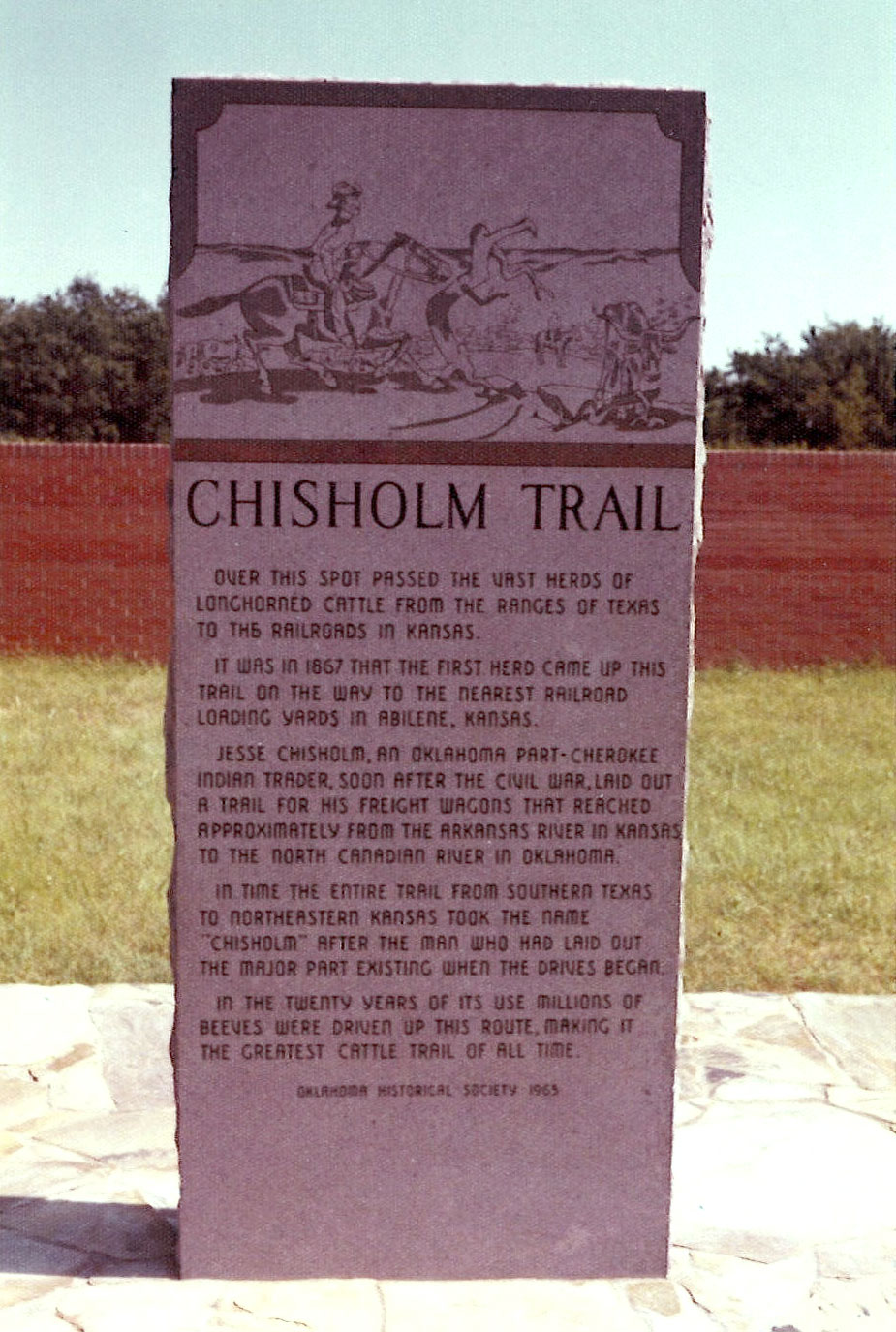
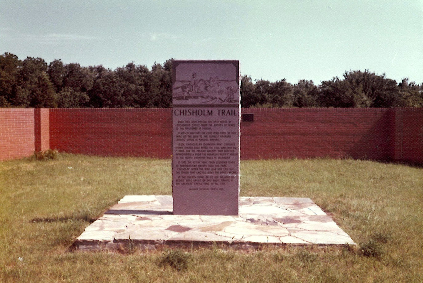
Chisholm Trail
Canadian CountyLocation: on grounds of Mollie Spencer Farm in Yukon
Coordinates: 35.497068, -97.759740
Material: Granite
Sponsor(s): Oklahoma Historical Society
Topics: Ranching; Territorial Period, 1861–1907; Transportation
A pioneer merchant, trader, and explorer, Jesse Chisholm, a Cherokee, established a trail through western Indian Territory before the Civil War. Texas cattlemen used the trail until the late 1880s to move millions of cattle to northern markets. The trail ran from Montague County, Texas, to Abilene, Kansas.
View image
View image
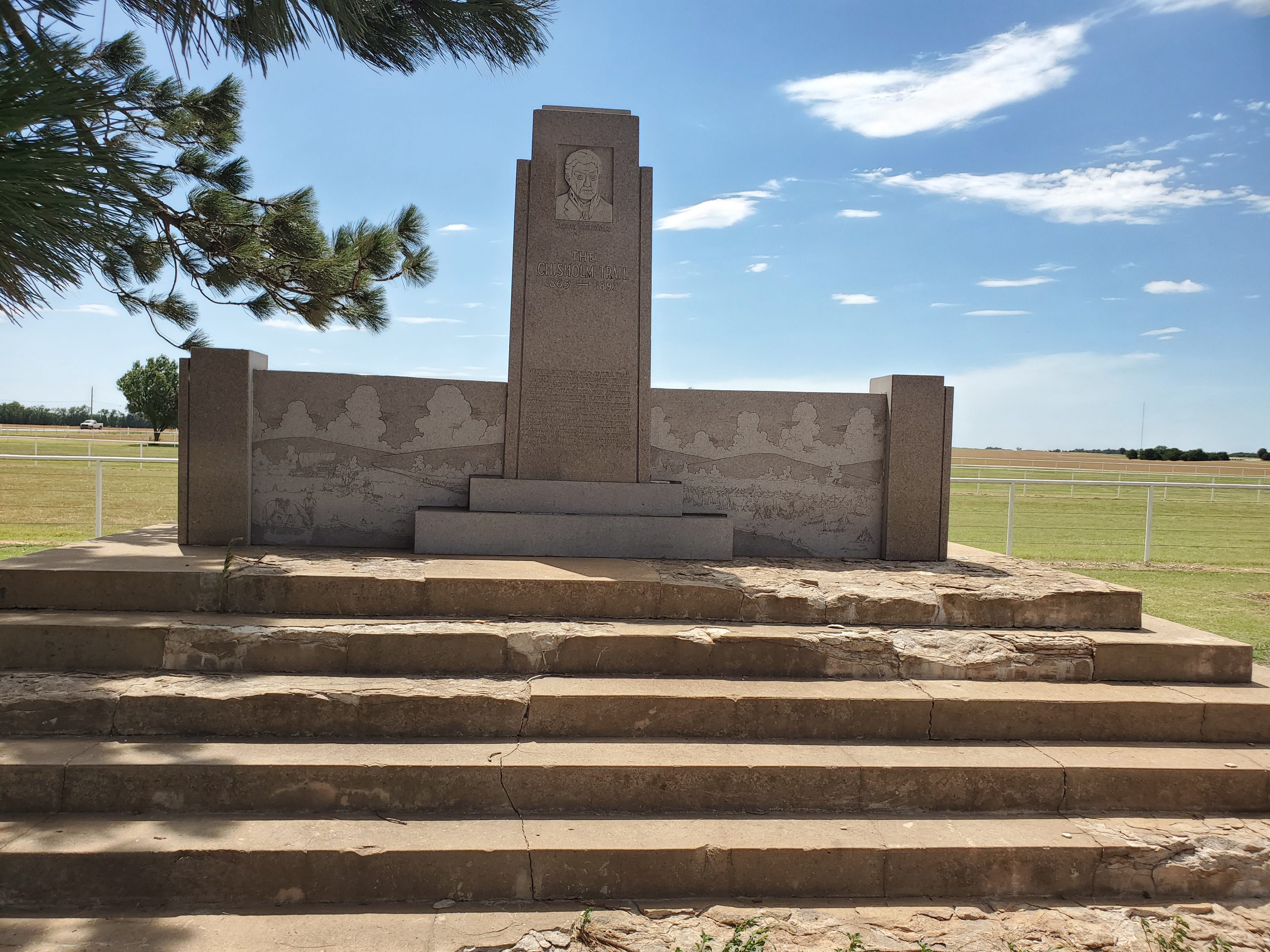
Chisholm Trail
Garfield CountyLocation: in Government Springs Park in Enid
Coordinates: 36.391002, -97.871987
Material: Granite
Sponsor(s): Jesse Chisholm Trail and Memorial Association
Topics: American Indian and Frontier Trade; American Indians; Territorial Period, 1861–1907; Transportation; Westward Expansion, 1803–1861
Here passed the old cattle trail, blazed by Jesse Chisolm, which finally stretched for eight hundred miles, from San Antonio, Texas, to Abilene, Kansas, over which cowboys from the pasturelands of the great southwest drove the herds to the railroads. Many tales of the adventure will perhaps remain untold with the passing of those who traveled the trail. To them, this memorial is dedicated, in the year 1945.
Note: Originally located approximately four miles north of Enid on US-64/US-81. Moved to Government Springs Park in Enid in September 2025.
View image

View image
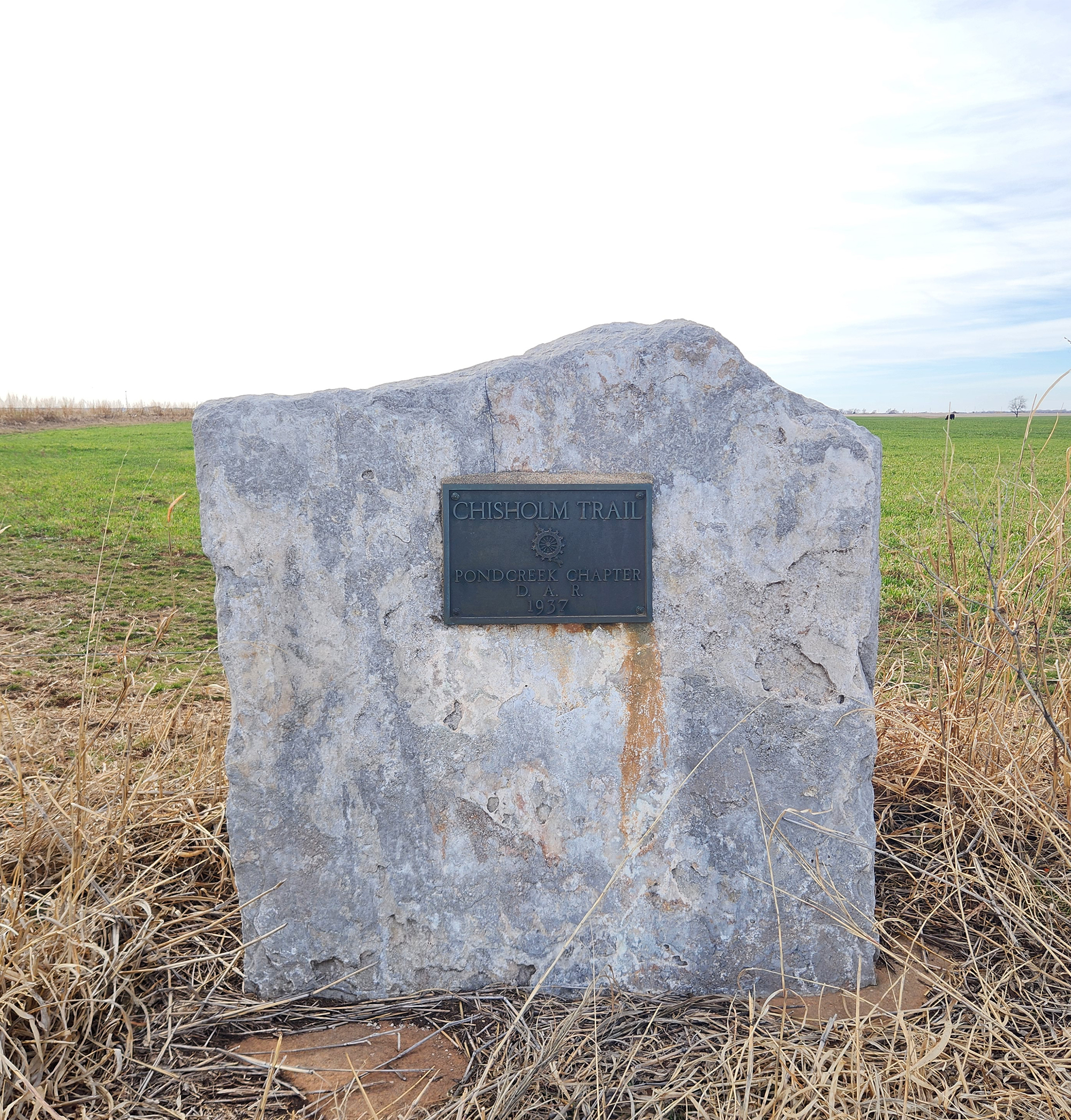
Chisholm Trail
Grant CountyLocation: One mile north of Pond Creek on Highway 81, on the west side of the road
Coordinates: 36.6807398,-97.804301
Material: Other (Stone with bronze plaque)
Sponsor(s): Daughters of the American Revolution
Topics: American Indian and Frontier Trade; American Indians; Ranching; Territorial Period, 1861–1907; Transportation; Westward Expansion, 1803–1861
A pioneer merchant, trader, and explorer, Jesse Chisholm, a Cherokee, established the trail through western Indian Territory before the Civil War. Texas cattlemen used the trail until the late 1880s to move millions of cattle to northern markets. The trail ran from Montague County, Texas, to Abilene, Kansas.
View image
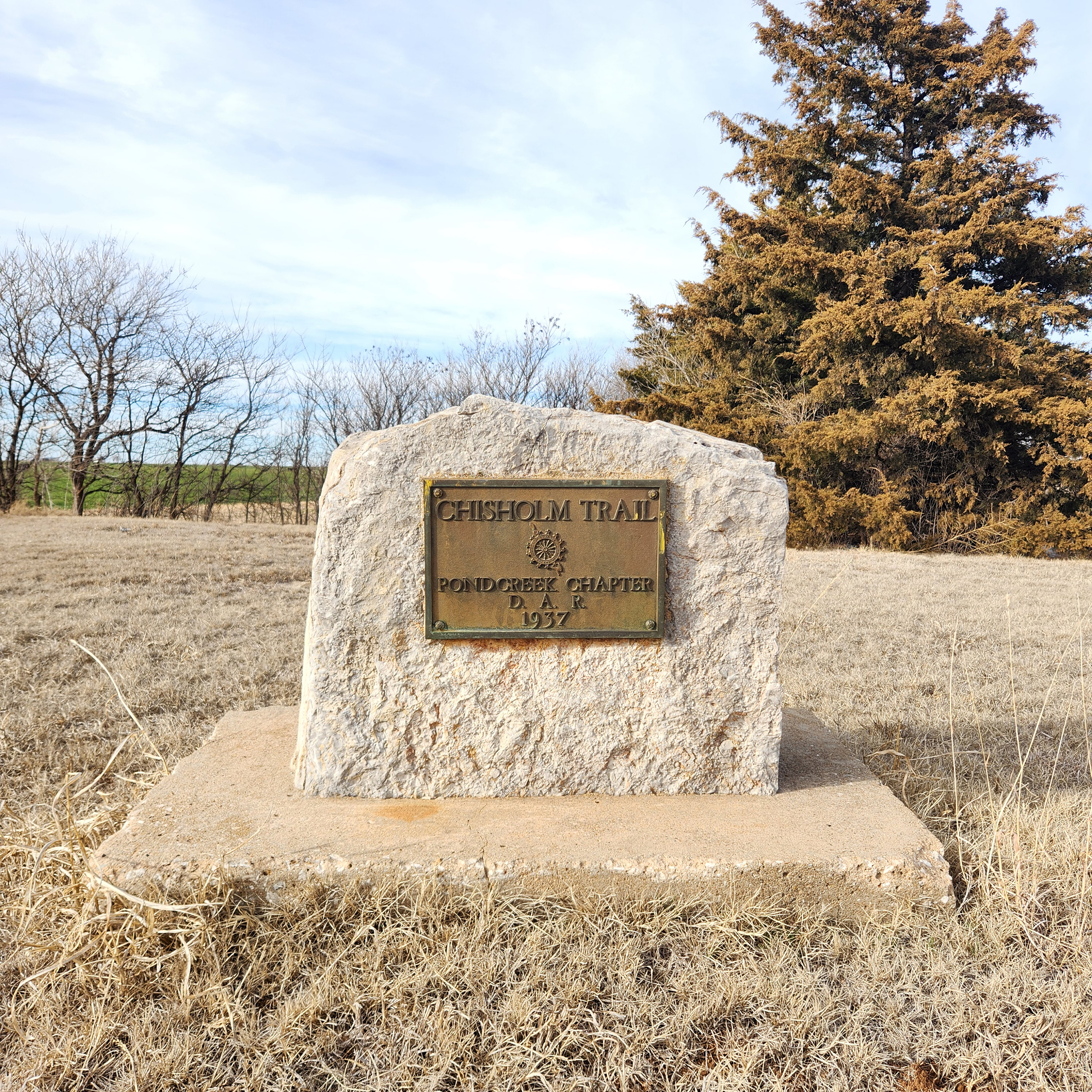
Chisholm Trail
Grant CountyLocation: Approximately 400 feet west of Eighth Street in Pond Creek on Highway 81, on the north side of the road
Coordinates: 36.666028, -97.812611
Material: Other (Stone with bronze plaque)
Sponsor(s): Daughters of the American Revolution
Topics: American Indians; Indian and Frontier Trade; Ranching; Territorial Period, 1861–1907; Transportation; Westward Expansion, 1803–1861
A pioneer merchant, trader, and explorer, Jesse Chisholm, a Cherokee, established the trail through western Indian Territory before the Civil War. Texas cattlemen used the trail until the late 1880s to move millions of cattle to northern markets. The trail ran from Montague County, Texas, to Abilene, Kansas.
View image
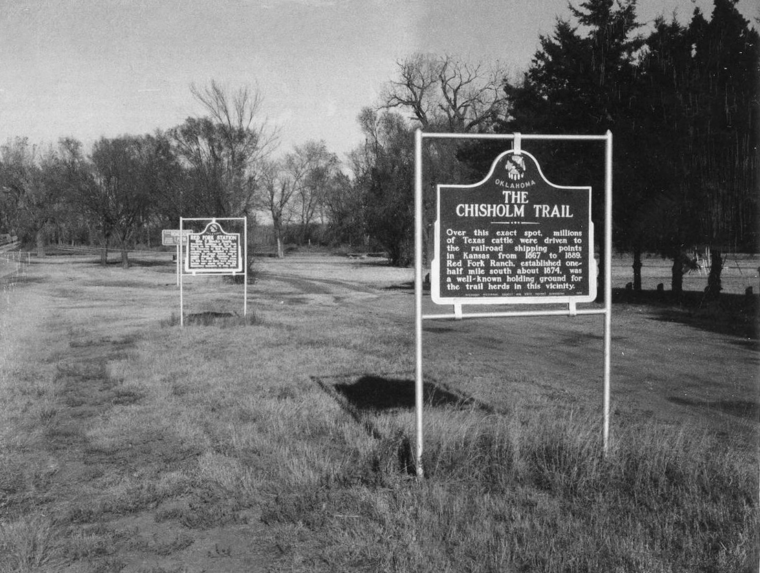
Chisholm Trail
Kingfisher CountyLocation: on US-81 at north edge of Dover
Material: Granite
Sponsor(s): Oklahoma Historical Society and the Oklahoma Department of Transportation
Topics: American Indians; Indian and Frontier Trade; Ranching; Territorial Period, 1861–1907; Transportation; Westward Expansion, 1803–1861
A pioneer merchant, trader, and explorer, Jesse Chisholm, a mixed-blood Cherokee, established a trail through western Indian Territory before the Civil War. Texas cattlemen used the trail until the late 1880s to move millions of cattle to northern markets. The trail ran from Montague County, Texas, to Abilene, Kansas.
Note: This marker could not be located and is presumed missing.
View image
Chisholm Trail
Stephens CountyLocation: on old OK-7, two miles east of Duncan
Coordinates: 34.492117, -97.909259
Material: Stone
Sponsor(s): Kiwanis Club of Duncan
Topics: Ranching; Territorial Period, 1861–1907; Transportation
This stone monument commemorates a crossing of the Chisholm Trail. Cattlemen used the trail until the late 1880s to move millions of cattle to northern markets. The monument was dedicated in 1936 and was reconstructed in 1986. Accompanying it is a granite marker in memory of Ted A. Gilbert, president of the Kiwanis Club chapter when the monument was first built.
Chisholm Trail
Stephens CountyLocation: on US-81 in Memorial Park in Duncan
Coordinates: 34.509367, -97.967365
Material: Granite
Sponsor(s): Oklahoma Historical Society
Topics: Ranching; Territorial Period, 1861–1907; Transportation
Named for Jesse Chisholm, the Chisholm Trail ran two miles east of this marker. William Duncan constructed a store to serve cowboys who stopped along the trail, and later laid out the townsite of Duncan. One of the first commercial dairies in western Oklahoma was established by Theodore Fitzpatrick in the vicinity. He secured cows from the trail herds and sold milk to drovers and the US military at Fort Sill.
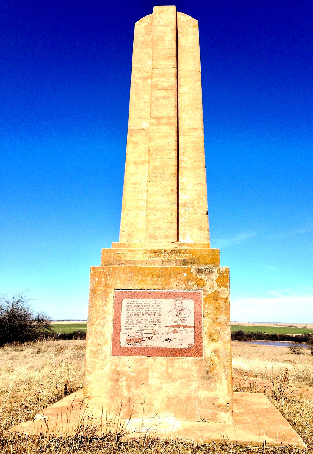
Chisholm Trail Lookout (Monument Hill)
Jefferson CountyLocation: on E1910 Rd (Monument Rd) two miles east of Addington
Coordinates: 34.245275, -97.922307
Material: Other (Concrete obelisk with granite plaques)
Sponsor(s): Pickens County Cowpunchers Association/Oklahoma Centennial Commission
Topics: Ethnic Diversity; Ranching; Territorial Period, 1861–1907; Transportation
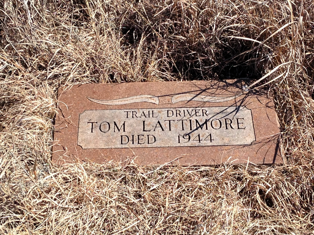
The Pickens County Cowpunchers Association organized support for the construction of a memorial on Monument Hill east of Addington to commemorate cowboys who worked along the Chisholm Trail. Monument Hill was a prominent local landmark for drovers along the trail. The concrete obelisk on site was dedicated in April 1941. Granite plaques honoring Jesse Chisholm and members of the cowpunchers association were added in the early 1980s. The Oklahoma Centennial Commission sponsored the replacement of the granite plaques in 2007. The gravesite of Tom Lattimore, a Black cowboy and ranch hand, is nearby.
View image
View image
(Page 1 of 1)
Marker Search
Use quotation marks to search for an exact phrase.
Browse by County
Adair County
Alfalfa County
Atoka County
Beaver County
Beckham County
Blaine County
Bryan County
Caddo County
Canadian County
Carter County
Cherokee County
Choctaw County
Cimarron County
Cleveland County
Comanche County
Cotton County
Craig County
Creek County
Custer County
Delaware County
Dewey County
Ellis County
Garfield County
Garvin County
Grady County
Grant County
Greer County
Harmon County
Harper County
Haskell County
Hughes County
Jackson County
Jefferson County
Johnston County
Kay County
Kingfisher County
Kiowa County
Latimer County
Le Flore County
Lincoln County
Logan County
Love County
Major County
Marshall County
Mayes County
McClain County
McCurtain County
McIntosh County
Murray County
Muskogee County
Noble County
Nowata County
Okfuskee County
Oklahoma County
Okmulgee County
Osage County
Ottawa County
Pawnee County
Payne County
Pittsburg County
Pontotoc County
Pottawatomie County
Pushmataha County
Roger Mills County
Rogers County
Seminole County
Sequoyah County
Stephens County
Texas County
Tillman County
Tulsa County
Wagoner County
Washington County
Washita County
Woods County
Woodward County
Alfalfa County
Atoka County
Beaver County
Beckham County
Blaine County
Bryan County
Caddo County
Canadian County
Carter County
Cherokee County
Choctaw County
Cimarron County
Cleveland County
Comanche County
Cotton County
Craig County
Creek County
Custer County
Delaware County
Dewey County
Ellis County
Garfield County
Garvin County
Grady County
Grant County
Greer County
Harmon County
Harper County
Haskell County
Hughes County
Jackson County
Jefferson County
Johnston County
Kay County
Kingfisher County
Kiowa County
Latimer County
Le Flore County
Lincoln County
Logan County
Love County
Major County
Marshall County
Mayes County
McClain County
McCurtain County
McIntosh County
Murray County
Muskogee County
Noble County
Nowata County
Okfuskee County
Oklahoma County
Okmulgee County
Osage County
Ottawa County
Pawnee County
Payne County
Pittsburg County
Pontotoc County
Pottawatomie County
Pushmataha County
Roger Mills County
Rogers County
Seminole County
Sequoyah County
Stephens County
Texas County
Tillman County
Tulsa County
Wagoner County
Washington County
Washita County
Woods County
Woodward County
To find out more about the Oklahoma Historical Society Historical Marker Program or how to submit an application, please visit the Historical Marker Program page.
Missing or Damaged Markers
Please use our online form to report missing or damaged historical markers.
Report Missing or Damaged Markers
Contact Us
If you have questions, please contact:
Matthew Pearce
Oklahoma Historical Society
800 Nazih Zuhdi Drive
Oklahoma City, OK 73105
405-522-8659
[email protected]
