Historical Marker Program
Search Results
Your search returned 20 results.
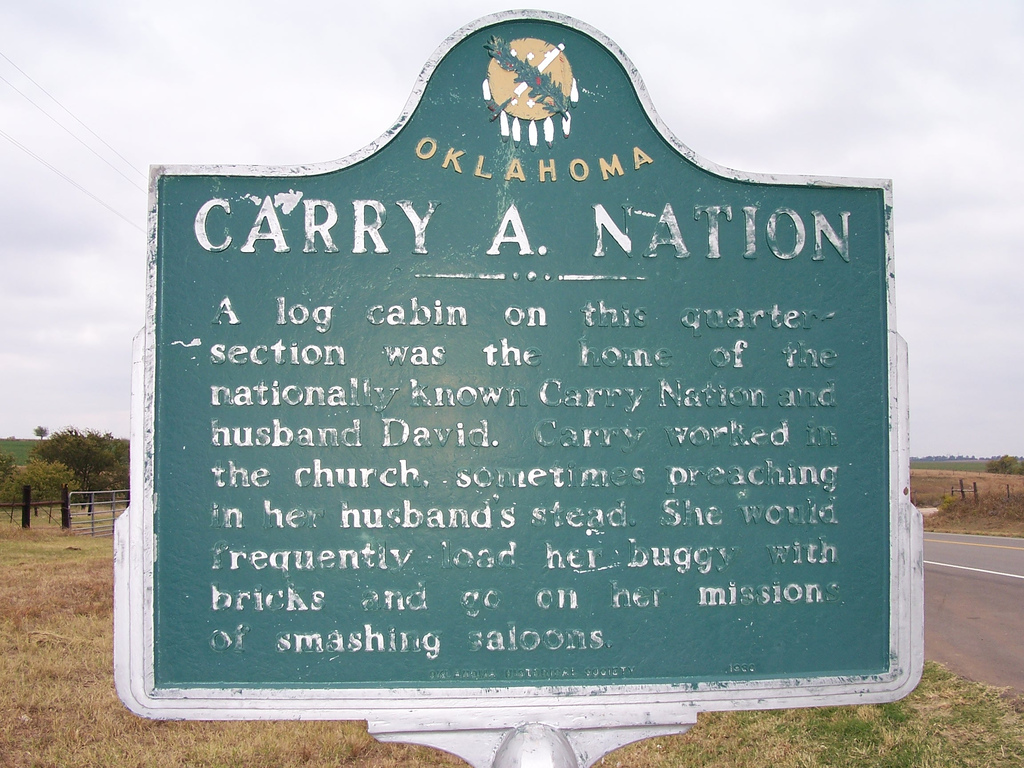
Carry A. Nation
Dewey CountyLocation: on US-183 south of intersection with US-60
Coordinates: 36.140223, -98.955791
Material: Aluminum
Sponsor(s): Seiling Chamber of Commerce
Topics: Family/Household; Settlement Patterns; Social/Cultural
Carry Nation and her husband David lived in a log cabin on this site after the opening of the Cheyenne-Arapaho lands in 1892. After moving to Medicine Lodge, Kansas, in 1899, Nation began her famous crusade against liquor, including using a hatchet to smash saloons.
View image

View image
Chickasaw Council House
Johnston CountyLocation: in Chickasaw Museum, 200 North Fisher, Tishomingo
Topics: American Indians; Government; Social/Cultural; Territorial Period, 1861–1907; Westward Expansion, 1803–1861
A log cabin, now restored to near original condition, served as the official meeting place of Chickasaw leaders from 1856 until 1858 when a new brick building was constructed. Fire destroyed that building in 1890, and the final Chickasaw capitol, now the Johnston County Courthouse, was built in 1897.
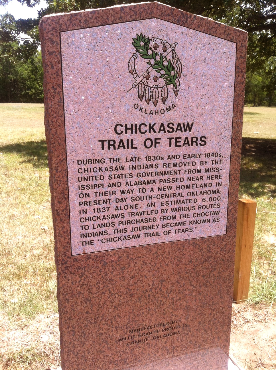
Chickasaw Trail of Tears
McCurtain CountyLocation: on US Hwy 70 between Broken Bow and Arkansas state line
Topics: American Indians; Government; Settlement Patterns; Transportation; Westward Expansion, 1803–1861
During the late 1830s and early 1840s, Chickasaws removed by the United States government from Mississippi and Alabama passed near here on their way to a new homeland in present-day south-central Oklahoma. In 1937 an estimated 6,000 Chickasaws traveled by various routes to lands purchased from the Choctaws. This journey became known as the Chickasaw Trail of Tears.
View image
Choctaw Nation Capitol Building
Pushmataha CountyLocation: on OK-2, one mile north of US-271 junction
Topics: American Indians; Government; Territorial Period, 1861–1907
The last Choctaw capitol was erected here in 1884. The tribal government was housed in the building until statehood. The Choctaw Nation's headquarters are now located in Durant.
Choctaw-Chickasaw Woman’s Missionary Union
Pittsburg CountyLocation: at the intersection of Monroe Street and Strong Boulevard in McAlester (OBHC)
Topics: American Indians; Religion/Philosophy; Territorial Period, 1861–1907
Baptist women's work in Oklahoma began in 1876 with the organization of the Choctaw-Chickasaw Woman's Missionary Union.
The City of Altus B-47 Bomber
Jackson CountyLocation: at Park Lane and East Broadway Street in Altus
Coordinates: 34.637951, -99.316829
Material: Granite
Sponsor(s): Air Force Association Chapter 342
Topics: Industrial Period, 1941–1982; Military
On April 22, 1955, Col. Audrin R. Walker, 96th Bombardment Wing Commander, landed the first bomber on the runway of Altus Air Force Base. In a special ceremony, the bomber was christened “The City of Altus.” The US Air Force gave the bomber to the city of Altus on Armed Services Day, May 14, 1961.

View image

View image
The City of Norman and the Cleveland County Historical Museum
Cleveland CountyLocation: 508 North Peters Avenue in Norman
Coordinates: 35.225647, -97.444612
Material: Aluminum
Sponsor(s): Cleveland County Historical Society
Topics: Family/Household; Territorial Period, 1861–1907
Constructed in 1895, six years after the 1889 Land Run, this house, known as the Harry Lindsey Home, has been restored as a classic example of pre-statehood architecture.
Note: This marker has been replaced by the Moore-Lindsay Historic House Museum historical marker.
Cleveland-Pioneer Oil City
Pawnee CountyLocation: on US-64 and OK-99 in Cleveland
Topics: American Indians; Natural Resources; Petroleum; Territorial Period, 1861–1907; Urban Development
Cleveland, established in 1894, was named for President Grover Cleveland. It became an early boomtown after oil was discovered in the immediate vicinity and in nearby Osage County in the early twentieth century.
Dodge City Trail
Dewey CountyLocation: on US-60, five miles west of Vici
Coordinates: Unknown
Material: Aluminum
Sponsor(s): Unknown
Topics: Ranching; Territorial Period, 1861–1907; Transportation
Millions of cattle and horses were driven from Texas through Indian Territory on this route between 1874 and 1894. Also called the Western Trail, the route supplied stock pens in Dodge City, Kansas. Thousands of head were also driven further north to ranches in Nebraska, Wyoming, Montana, and Canada.
Note: This marker no longer exists.

View image
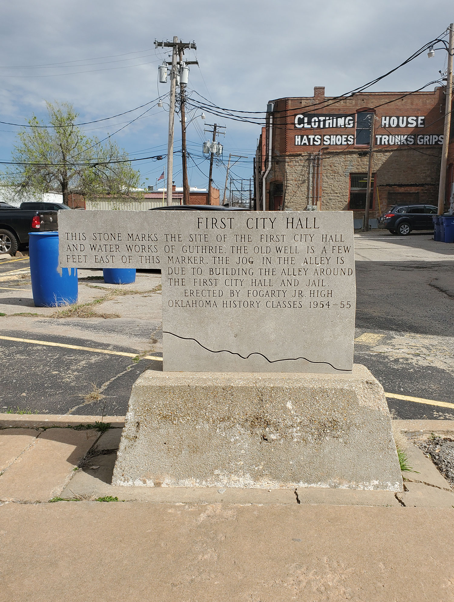
First City Hall
Logan CountyLocation: on North First Street and West Oklahoma Avenue in Guthrie
Coordinates: 35.878517, -97.426500
Material: Other (Stone)
Sponsor(s): Fogarty Jr. High School
Topics: Government; Territorial Period, 1861–1907; Urban Development
This stone marks the site of the first city hall and water works of Guthrie. The old well is a few feet east of this marker. The jog in the alley is due to the building the alley around the first city hall and jail.
View image
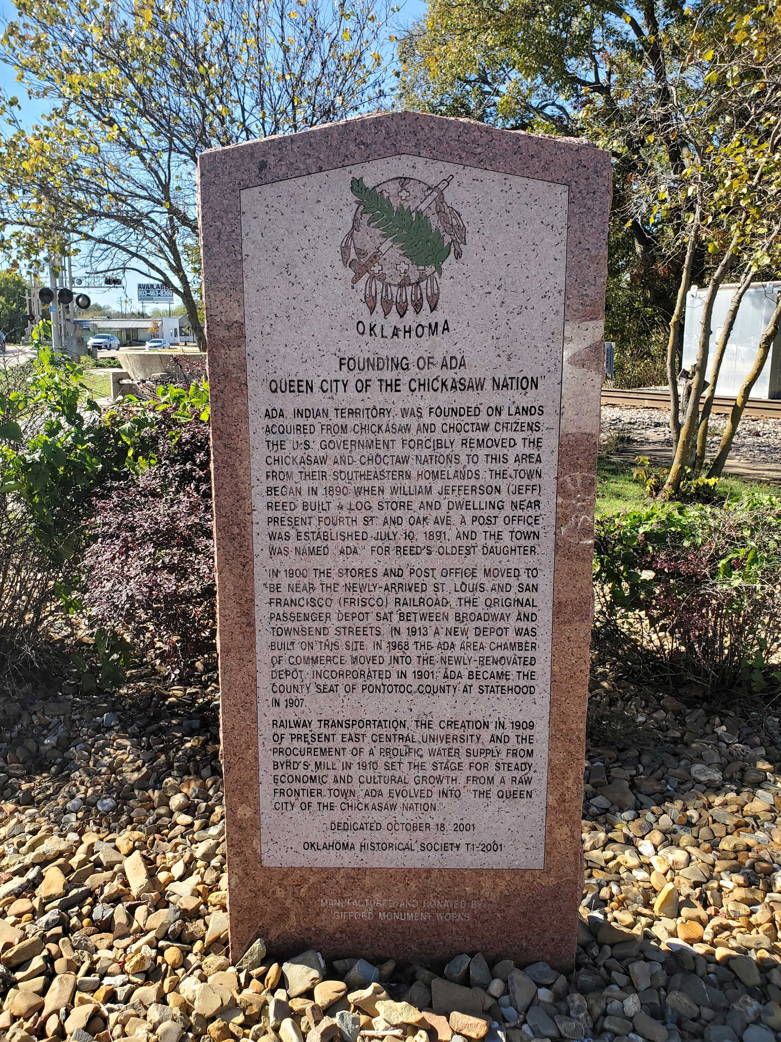
Founding of Ada, “Queen City of the Chickasaw Nation”
Pontotoc CountyLocation: northwest of the intersection of West Main Street and South Stockton Avenue in Ada
Coordinates: 34.774680, -96.682323
Material: Granite
Sponsor(s): Dr. Marvin Kroeker and the Oklahoma Historical Society
Topics: Early Statehood, 1907–1941; Government; Mass Communication; Retail; Territorial Period, 1861–1907; Urban Development
Ada was established in 1890 on lands acquired from Chickasaw and Choctaw citizens by William Jefferson Reed, who built a log store and dwelling near present Fourth Street and Oak Avenue. A post office was established on July 10, 1891, and named for Reed’s oldest daughter, Ada. The city was incorporated in 1901 and became the county seat of Pontotoc County at statehood in 1907. Railway transportation, the establishment of present East Central University, and the procurement of a water supply from Byrd’s Mill set the stage for the town’s economic and cultural growth into “The Queen City of the Chickasaw Nation.”
View image
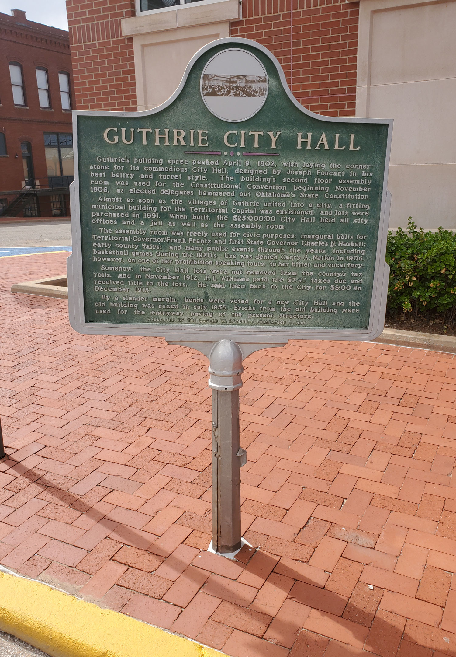
Guthrie City Hall
Logan CountyLocation: at Second Street and Oklahoma Avenue in Guthrie
Coordinates: 35.878163, -97.427701
Material: Aluminum
Sponsor(s): Donald W. Reynolds Foundation
Topics: Government; Territorial Period, 1861–1907
The cornerstone for the Guthrie City Hall building was laid on April 9, 1902. The second floor of the structure was used for Oklahoma's Constitutional Convention beginning in November 1906. The city hall was razed in 1955, and a new building was constructed.
View image
Oil in the Osage Indian Nation and the “Million Dollar Elm”
Osage CountyLocation: on grounds of the Osage Nation Museum in Pawhuska
Coordinates: 36.667616, -96.339443
Material: Granite
Sponsor(s): Oklahoma Historical Society and Oklahoma Petroleum Council
Topics: American Indians; Early Statehood, 1907–1941; Folklife; Industrial Period, 1941–1982; Natural Resources; Petroleum; Social/Cultural; Territorial Period, 1861–1907
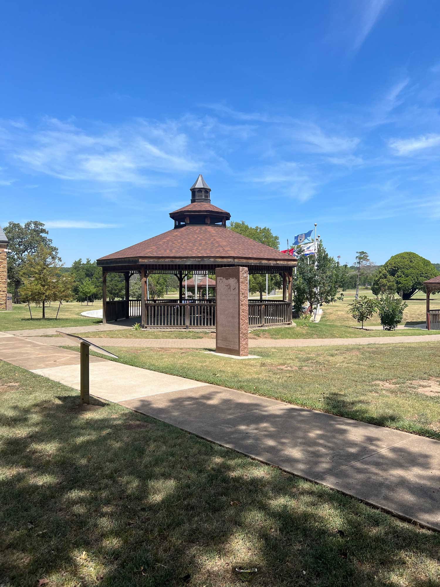
Symbolic of the impact oil had on the people of the Osage Indian Nation is the so-called “Million Dollar Elm.” It was given this name because in its shade millions of dollars worth of Osage oil leases were auctioned. It was planted at this site sometime during the latter part of the 19th century as an ornament and for shade. The name was not given by tribal leaders but by reporters and magazine writers who were dramatizing the events when important heads and founders of the world's greatest oil companies came in person to bid. The auctioneer himself, the histrionic Colonel Walters, became famous because of his success in getting top bids. The drilling of the first well in the Osage Nation occurred in 1897. The first tract to bring one million dollars or more was acquired in March 1922. On March 29, 1924, Midland Oil Company bid almost two million dollars for a tract. By November 1969, Osage lands had produced one billion barrels of oil.

View image
View image
Oklahoma City DAR Chapter
Oklahoma CountyLocation: on grounds of St. Lukes Methodist Church in Oklahoma City
Coordinates: 35.484658, -97.516389
Material: Other (Stone with bronze plaque)
Sponsor(s): Daughters of the American Revolution
Topics: Recreational/Service; Social/Cultural; Territorial Period, 1861–1907
Oklahoma City Chapter, National Society Daughters of the American Revolution, was organized at the home of Mrs. Robert P. Carpenter, 212 NW 15th Street, on December 14, 1904.

View image
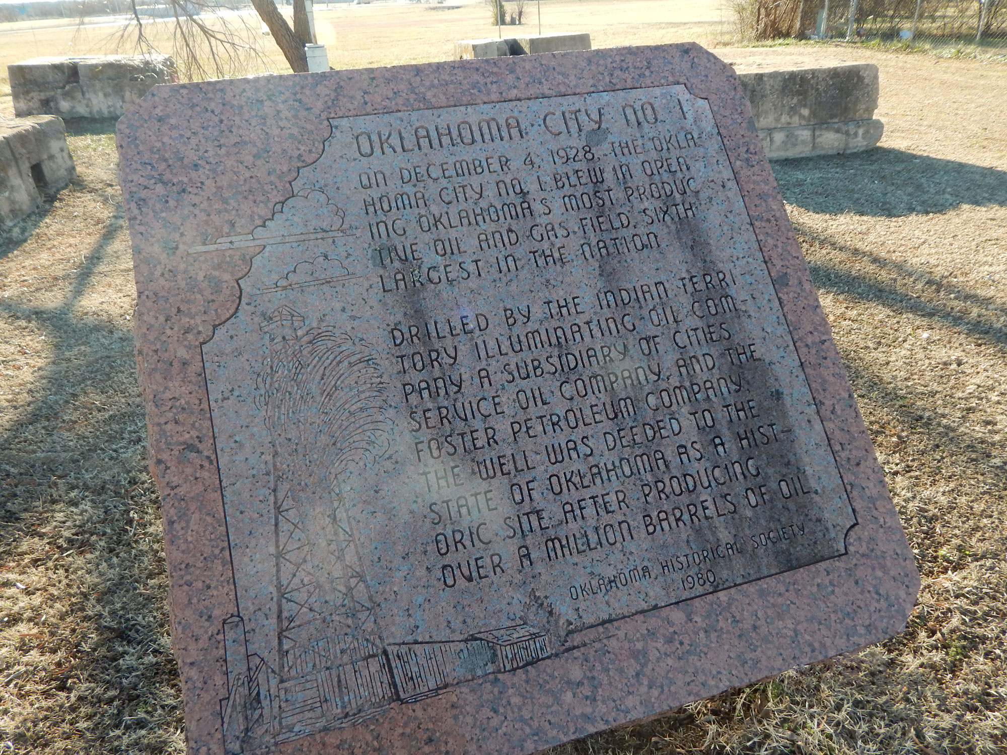
Oklahoma City No. 1
Oklahoma CountyLocation: near the intersection of Southeast 59th and Bryant
Material: Granite
Topics: Early Statehood, 1907–1941; Industry/Business; Natural Resources; Petroleum
On December 4, 1928, the Oklahoma City No. 1 blew, opening Oklahoma's most productive oil and gas field and the sixth largest in the nation. It was drilled by the Indian Territory Illuminating Oil Company, a subsidiary of Cities Service Oil Company and the Foster Petroleum Company. The well was deeded to the State of Oklahoma as a historic site after producing over a million barrels of oil.
View image
Oklahoma City Oil Field
Oklahoma CountyLocation: northeast corner of the Flag Plaza at State Capitol
Material: Granite
Topics: Early Statehood, 1907–1941; Industry/Business; Natural Resources; Petroleum
The discovery of the famous Oklahoma City Oil Field was made by H. V. Foster, president of the Indian Territory Illuminating Oil Company, on December 4, 1928, when Oklahoma City No. 1 began production. Located at Southeast 57th Street and Indian Territory Illuminating Oil Company Boulevard, this well marked the beginning of a great rush for "black gold" in the area. The site is now under the control of the Oklahoma Historical Society.
Oklahoma City Zoo
Oklahoma CountyLocation: at Oklahoma City Zoo, NE 50th and Eastern in Oklahoma City
Material: Granite
Topics: Recreational/Service; Social/Cultural; Territorial Period, 1861–1907
First in the southwest, the Oklahoma City Zoo was established in Wheeler Park in 1904. It was destroyed by the flood of 1923. It was then moved to Lincoln Park.
Oklahoma’s Pioneer Oil City
Cleveland CountyTopics: American Indians; Land Openings; Petroleum; Territorial Period, 1861–1907
On July 2, 1904, the Lowery #1 came in just south of Cleveland, opening the Cleveland Sand and creating Oklahoma's first oil boom town. Here also was Jordan's Fort, built in 1886 by Colonel J. W. Jordan, Cherokee agent and deputy US marshal, to keep Boomers out of the Cherokee Outlet.
Ponca City Military Academy
Kay CountyLocation: 1501-1509 Summers Place, Ponca City, OK
Material: Aluminum
Topics: Education; Industry/Business; Military
Ponca Military Academy was established in 1940 by the late Colonel William V. Cox and his wife Blanche. PMA made a vibrant contribution to the Ponca City community and to the state of Oklahoma. Dedicated to the growth and advancement of young men, Ponca Military Academy opened their doors to not only young men from Oklahoma, but throughout the country. Originally located on 56 acres of land, the academy occupied what was a former training facility and country club for E.W. Marland's oil company which became the Continental Oil Company (Conoco). An administration building, barracks, gym, parade grounds, athletic fields, tennis courts, and a playground encompassed the academy. They were located one-half mile south of this location at the end of Academy Road and along Cadet Road. At its height PMA had 150 student cadets and 14 faculty. After 34 years of operation the decision was made to close the academy in 1974. Approximately 4,000 young men attended PMA through its 34 years.
Silver City Trading Post
Grady CountyLocation: at intersection of OK-37 and Cimarron Road in Tuttle
Sponsor(s): Daughters of the American Revolution
See Chisholm Trail
(Page 1 of 1)
Marker Search
Use quotation marks to search for an exact phrase.
Browse by County
Adair County
Alfalfa County
Atoka County
Beaver County
Beckham County
Blaine County
Bryan County
Caddo County
Canadian County
Carter County
Cherokee County
Choctaw County
Cimarron County
Cleveland County
Comanche County
Cotton County
Craig County
Creek County
Custer County
Delaware County
Dewey County
Ellis County
Garfield County
Garvin County
Grady County
Grant County
Greer County
Harmon County
Harper County
Haskell County
Hughes County
Jackson County
Jefferson County
Johnston County
Kay County
Kingfisher County
Kiowa County
Latimer County
Le Flore County
Lincoln County
Logan County
Love County
Major County
Marshall County
Mayes County
McClain County
McCurtain County
McIntosh County
Murray County
Muskogee County
Noble County
Nowata County
Okfuskee County
Oklahoma County
Okmulgee County
Osage County
Ottawa County
Pawnee County
Payne County
Pittsburg County
Pontotoc County
Pottawatomie County
Pushmataha County
Roger Mills County
Rogers County
Seminole County
Sequoyah County
Stephens County
Texas County
Tillman County
Tulsa County
Wagoner County
Washington County
Washita County
Woods County
Woodward County
Alfalfa County
Atoka County
Beaver County
Beckham County
Blaine County
Bryan County
Caddo County
Canadian County
Carter County
Cherokee County
Choctaw County
Cimarron County
Cleveland County
Comanche County
Cotton County
Craig County
Creek County
Custer County
Delaware County
Dewey County
Ellis County
Garfield County
Garvin County
Grady County
Grant County
Greer County
Harmon County
Harper County
Haskell County
Hughes County
Jackson County
Jefferson County
Johnston County
Kay County
Kingfisher County
Kiowa County
Latimer County
Le Flore County
Lincoln County
Logan County
Love County
Major County
Marshall County
Mayes County
McClain County
McCurtain County
McIntosh County
Murray County
Muskogee County
Noble County
Nowata County
Okfuskee County
Oklahoma County
Okmulgee County
Osage County
Ottawa County
Pawnee County
Payne County
Pittsburg County
Pontotoc County
Pottawatomie County
Pushmataha County
Roger Mills County
Rogers County
Seminole County
Sequoyah County
Stephens County
Texas County
Tillman County
Tulsa County
Wagoner County
Washington County
Washita County
Woods County
Woodward County
To find out more about the Oklahoma Historical Society Historical Marker Program or how to submit an application, please visit the Historical Marker Program page.
Missing or Damaged Markers
Please use our online form to report missing or damaged historical markers.
Report Missing or Damaged Markers
Contact Us
If you have questions, please contact:
Matthew Pearce
Oklahoma Historical Society
800 Nazih Zuhdi Drive
Oklahoma City, OK 73105
405-522-8659
[email protected]
