Historical Marker Program
Search Results
Your search returned 43 results.
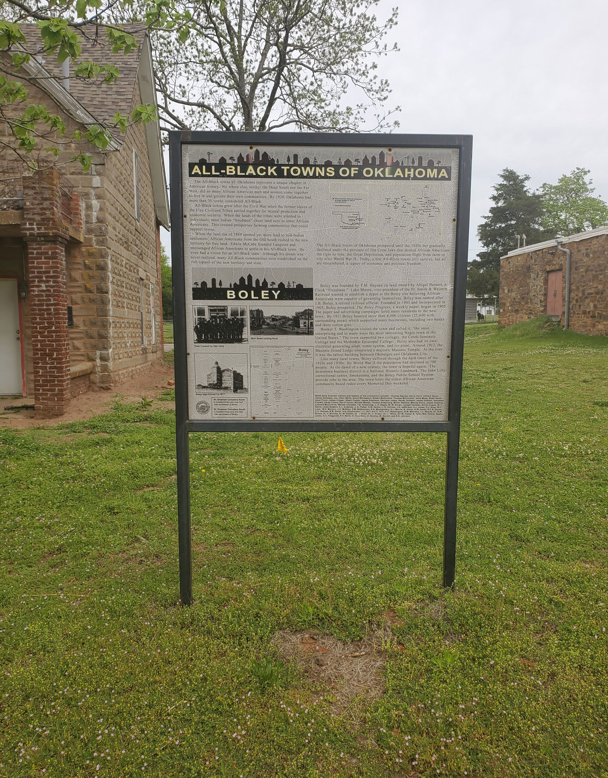
Boley
Okfuskee CountyLocation: in community of Boley
Coordinates: 35.493390, -96.484182
Material: Other (Interpretive panel)
Sponsor(s): Oklahoma Historical Society
Topics: American Indians; Ethnic Diversity; Government; Territorial Period, 1861–1907; Transportation; Urban Development
Boley is one of 13 All-Black towns, out of more than 50 that once existed, remaining in Oklahoma. While Tullahassee is reportedly the oldest, most were established between 1889 and 1907 as African Americans sought security and control of their own destiny in a segregated world. Boley was established in 1903 on land owned by a Muscogee (Creek) Freedwoman, Abigail Barnett. Boley was incorporated on May 11, 1905. By 1911 it boasted more than 4,000 citizens (25,000 in surrounding areas) and many businesses, including two banks and three cotton gins. The town hosts the oldest African American community-based rodeo every Memorial Day weekend.
View image
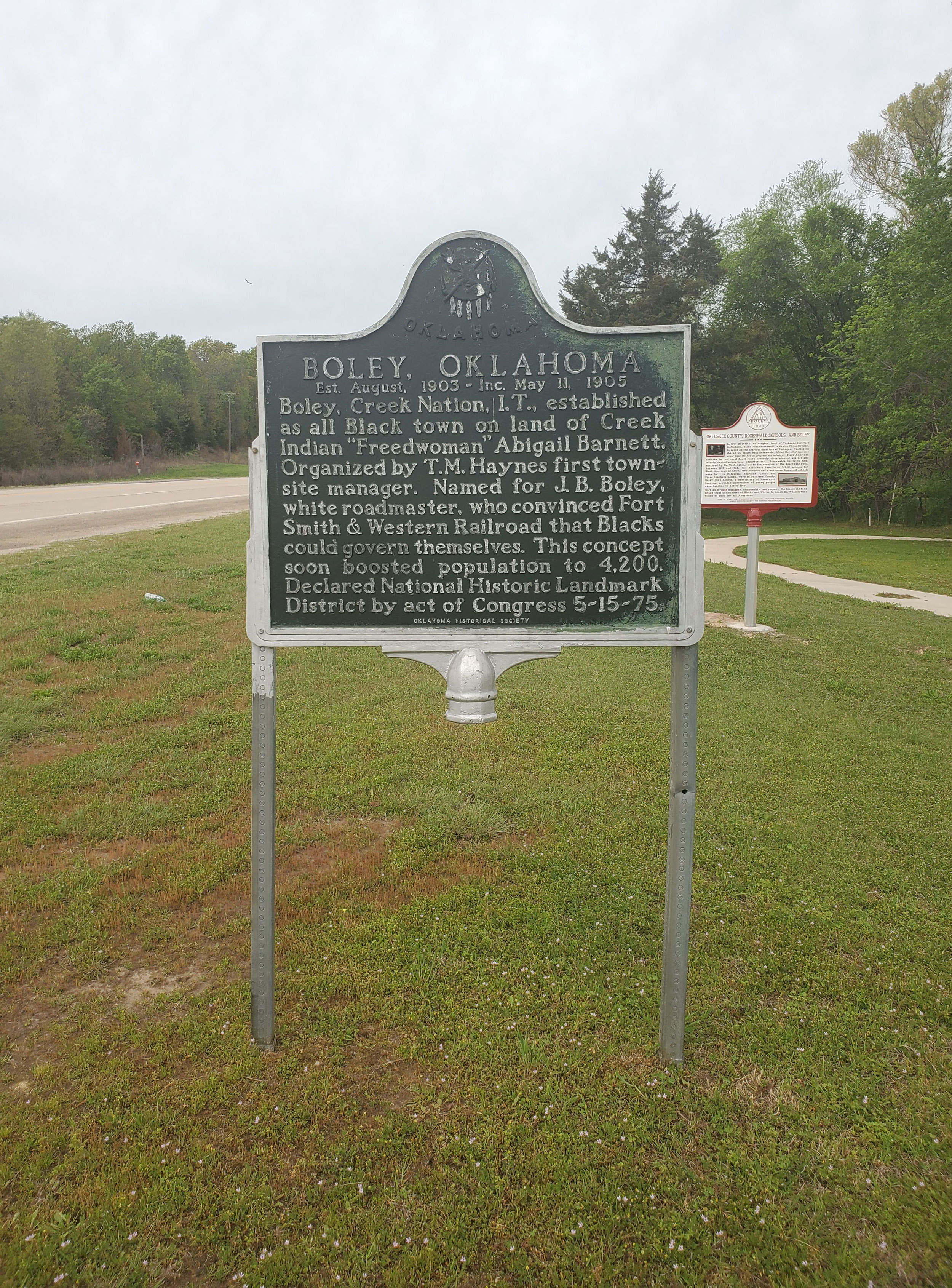
Boley, Oklahoma
Okfuskee CountyLocation: on US-62 in Boley
Coordinates: 35.488219, -96.484095
Material: Aluminum
Sponsor(s): Oklahoma Historical Society/Town of Boley
Topics: American Indians; Ethnic Diversity; Government; Territorial Period, 1861–1907; Transportation; Urban Development
Boley, Creek Nation, Indian Territory, established as an all Black town on land of Creek Indian Freedwoman Abigail Barnett. Organized by T.M. Haynes first townsite manager. Established August 1903. Incorporated May 11, 1905. Declared National Historic Landmark May 15, 1975.
View image
Booker T. Washington High School
McCurtain CountyLocation: at the former Booker T. Washington School campus in Idabel
Coordinates: 33.893863, -94.838091
Material: Aluminum
Sponsor(s): Booker T. Washington-Slater-Riverside Alumni Association
Topics: Early Statehood, 1907–1941; Ethnic Diversity; Government; Industrial Period, 1941–1982; Social/Culture
Booker T. Washington High School began independently in one room of the Masonic Hall. Around 1908, the school moved into an old store. In 1911, it was under the County Superintendent and moved into a two-room building on this site. T.F. Spigner became principal in 1925 and increased the grades steadily through 1931 when three girls graduated 12th grade. The wood building mysteriously burned in l936 and was replaced by the WPA with a stone building costing $21,735. Groundbreaking was held on August 24, 1936, and the building was dedicated on March 24, 1937.
Booker T. Washington High School
Tulsa CountyLocation: on south edge of OSU-Tulsa campus
Material: Granite
Topics: Civil Rights; Early Statehood, 1907–1941; Education; Ethnic Diversity
The original school for African American students in Tulsa was a four-room wood building constructed in 1913. In 1919, a brick building was built on the same site and was one of the few structures to survive the 1921 Race Riot. The school moved to its present site in 1950.
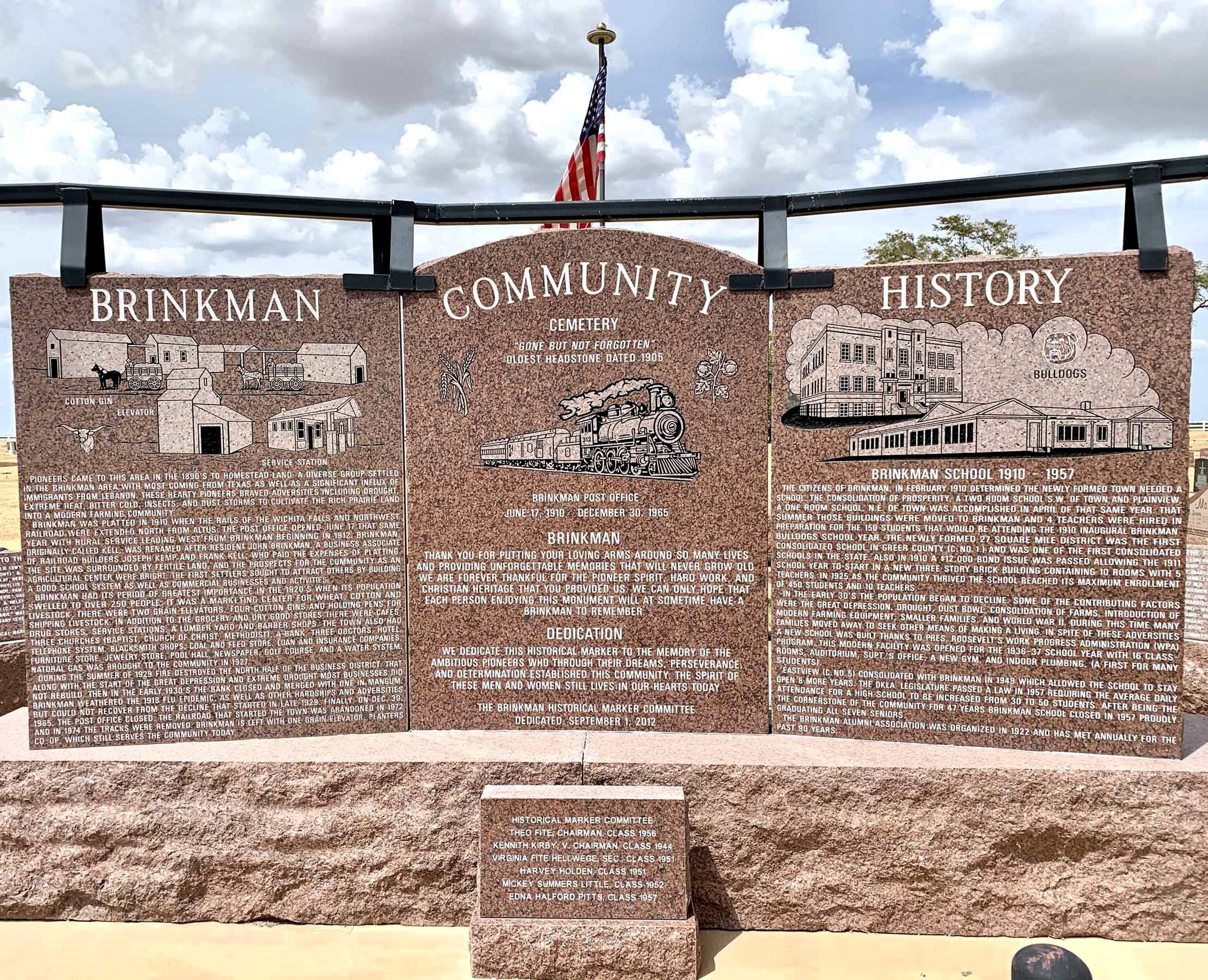
Brinkman
Greer CountyLocation: one mile west of US-283 on E1380 Rd in Brinkman Cemetery
Coordinates: 35.016636, -99.509926
Material: Granite
Sponsor(s): Brinkman Historical Marker Committee
Topics: Agriculture ; Early Statehood, 1907–1941; Ethnic Diversity; Settlement Patterns
Settlers from Texas and immigrants from Lebanon began homesteading in the area in the 1890s. The town of Brinkman was platted in 1910 upon the arrival of the Wichita Falls and Northwest Railroad. Originally known as Kell, the town was renamed after resident John Brinkman. The town’s population peaked in the 1920s as a marketing center for wheat, cotton, and livestock. The combination of a devastating fire in 1929, the Great Depression, and drought prompted a significant decline in the town’s fortunes. Brinkman School closed in 1957, followed by the post office in 1965. A single grain elevator continues to serve the community today.
View image
Brooksville
Pottawatomie CountyLocation: in community of Brooksville
Topics: Early Statehood, 1907–1941; Ethnic Diversity; Land Openings; Settlement Patterns; Territorial Period, 1861–1907; Urban Development
Brooksville is one of 13 All-Black towns, out of more than 50 that once existed, remaining in Oklahoma. While Tullahassee is reportedly the oldest, most were established between 1889 and 1907 as African Americans sought security and control of their own destiny in a segregated world. Most of the towns began to decline in the 1920s and 1930s as rural African Americans faced economic hardships and began to move to urban areas. Brooksville had a post office from 1909 to 1955 and is named for the first postmaster, Alfred H. Brooks.
Camp Tonkawa Prisoner of War Camp
Kay CountyLocation: original entrance into the camp, which is north of Tonkawa between Public and Main Streets
Topics: Agriculture; Ethnic Diversity; Government; Industrial Period, 1941–1982; Military; Social/Cultural
Between October and December of 1942 more than nine hundred construction workers labored twenty-four hours a day to build Camp Tonkawa on the quarter section immediately north of this marker (SE1/2 Sec. 28-26N-1W). The 160-acre site contained more than 180 wooden structures for 3,000 German prisoners of war (POWs), as well as five hundred US Army guard troops, service personnel, and civilian employees. Activated in January 1943, the post received its first POWs in August: German troops of the Afrika Corps captured in North Africa. The facility operated at or near capacity throughout its existence. Prisoners worked on area farms and ranches as well as at an alfalfa dryer plant in Tonkawa. In November 1943, a disturbance among the prisoners resulted in the death of one German soldier. Eight POWs escaped from the camp but all were recaptured. Camp Tonkawa closed in September 1945, and the POWs were returned to Europe.
Chisholm Trail Lookout (Monument Hill)
Jefferson CountyLocation: on E1910 Rd (Monument Rd) two miles east of Addington
Coordinates: 34.245275, -97.922307
Material: Other (Concrete obelisk with granite plaques)
Sponsor(s): Pickens County Cowpunchers Association/Oklahoma Centennial Commission
Topics: Ethnic Diversity; Ranching; Territorial Period, 1861–1907; Transportation
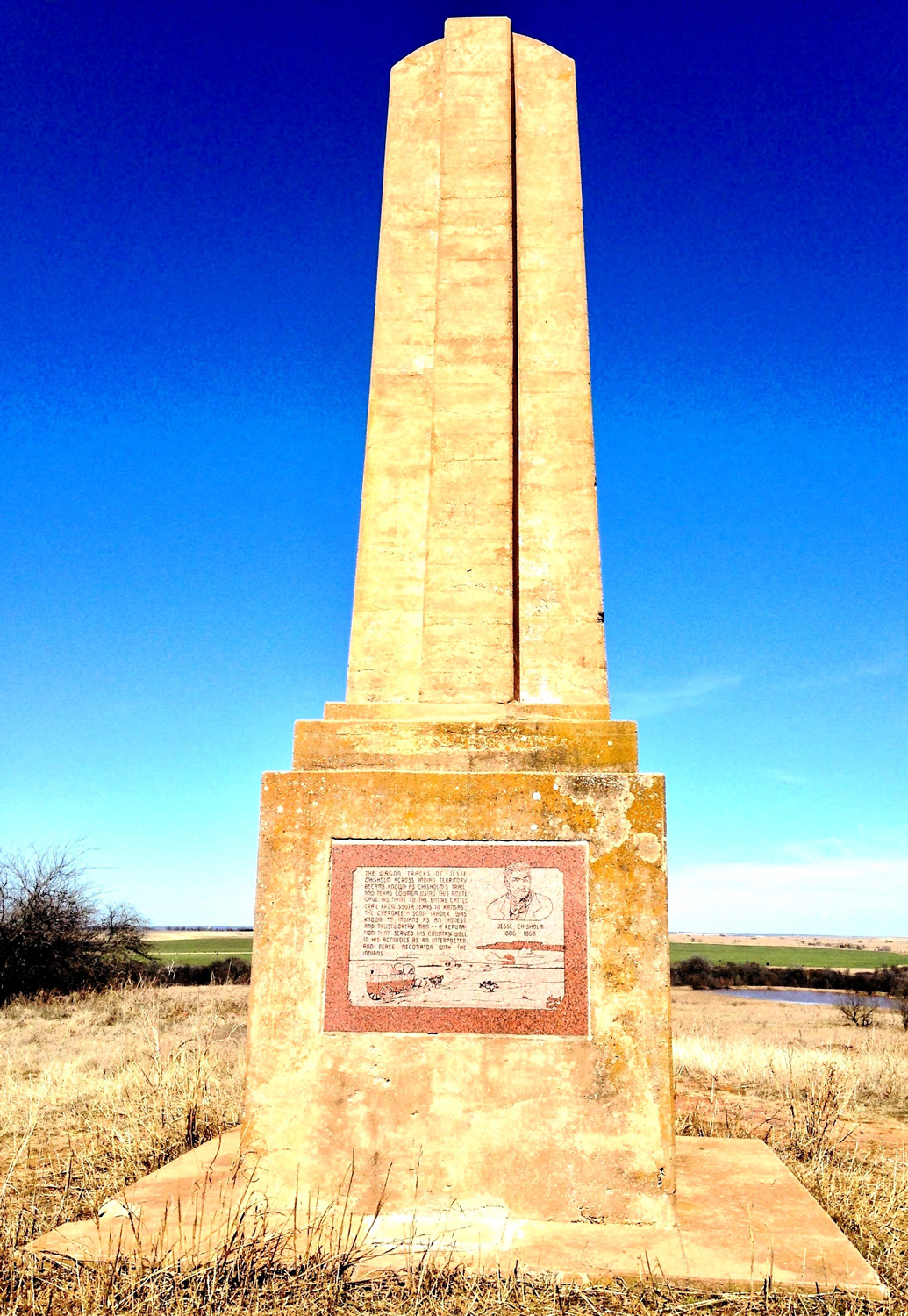
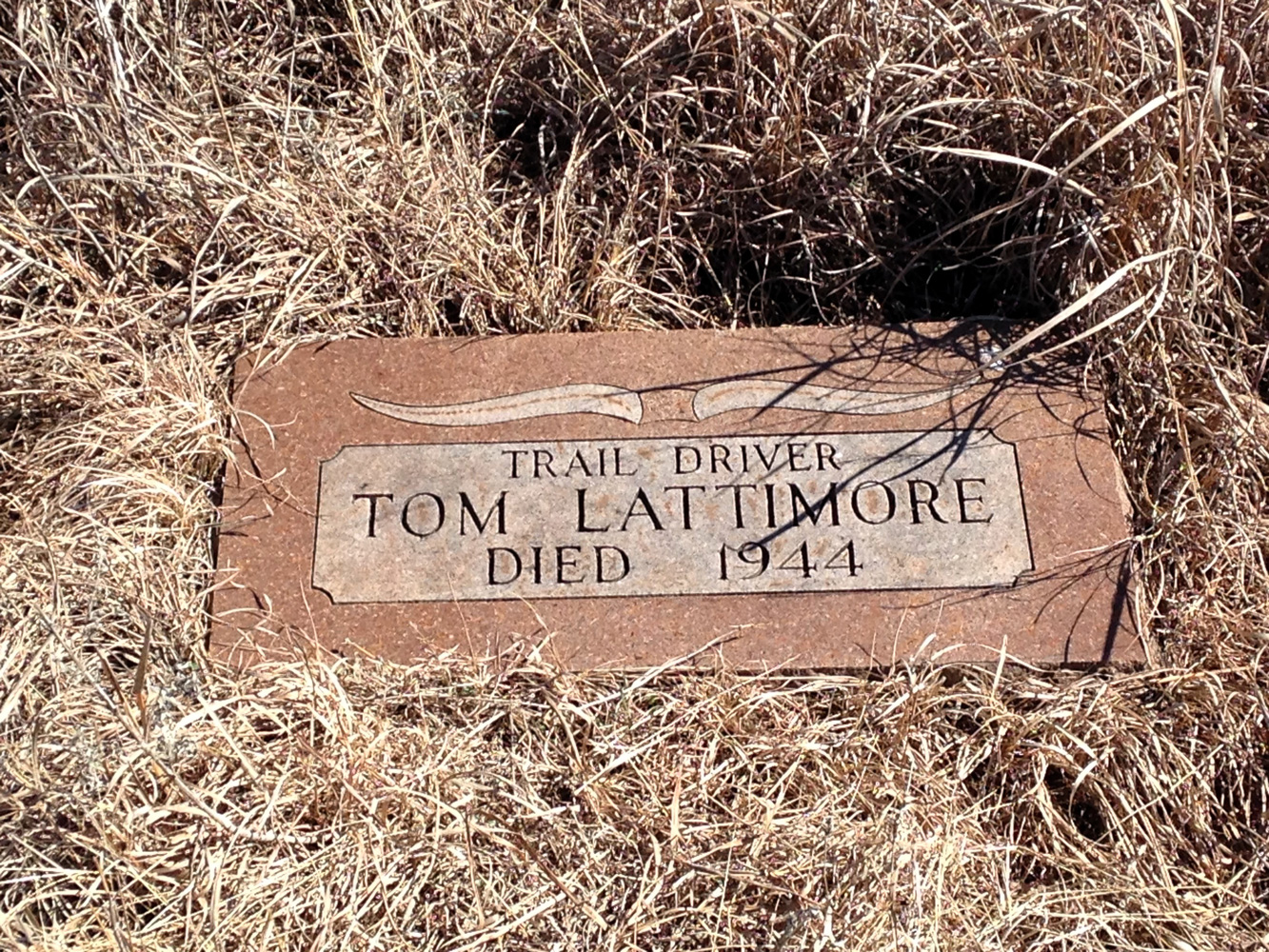
The Pickens County Cowpunchers Association organized support for the construction of a memorial on Monument Hill east of Addington to commemorate cowboys who worked along the Chisholm Trail. Monument Hill was a prominent local landmark for drovers along the trail. The concrete obelisk on site was dedicated in April 1941. Granite plaques honoring Jesse Chisholm and members of the cowpunchers association were added in the early 1980s. The Oklahoma Centennial Commission sponsored the replacement of the granite plaques in 2007. The gravesite of Tom Lattimore, a Black cowboy and ranch hand, is nearby.
View image
View image
Clara Mae Luper
Okmulgee CountyLocation: on grounds of Grayson Town Hall and Community Center
Coordinates: 35.504761, -95.866354
Material: Granite
Sponsor(s): Town of Grayson
Topics: Civil Rights; Ethnic Diversity; Industrial Period, 1941–1982
Known as the mother of the Civil Rights Movement in Oklahoma, Clara Mae Luper was born in Okfuskee County, Oklahoma, on May 3, 1923. She grew up in Hoffman and graduated from Grayson High School. She was well known by many as a courageous schoolteacher, pioneering leader in the Civil Rights Movement, and a civic leader.

View image

View image
Clear Creek Water Mill
McCurtain CountyLocation: on US-70, west of Valliant
Coordinates: 34.006301, -95.119547
Material: Granite
Sponsor(s): Oklahoma Historical Society
Topics: Arts; Ethnic Diversity; Industry/Business; Territorial Period, 1861–1907; Water; Westward Expansion, 1803–1861
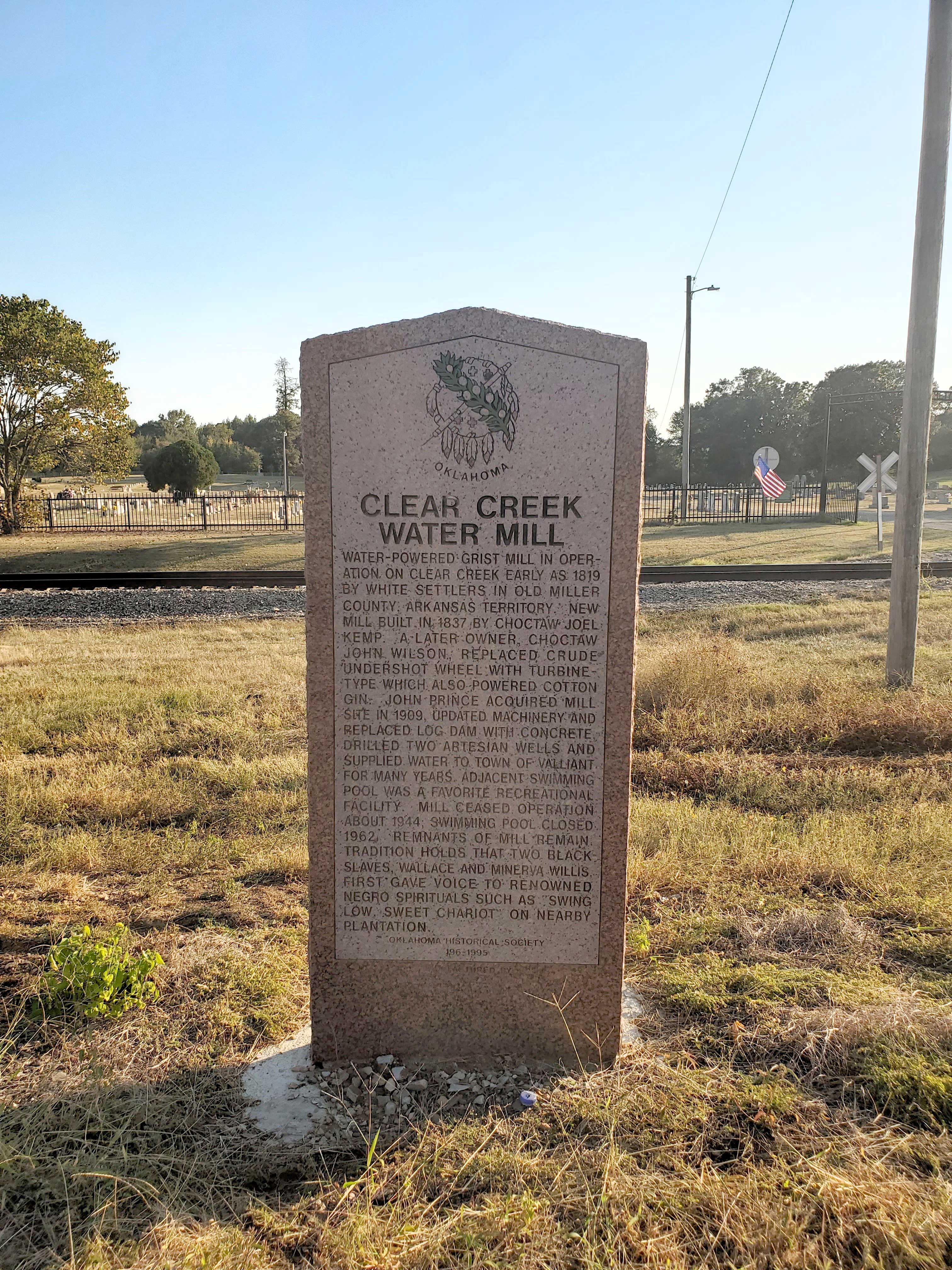
Water-powered grist mill in operation on Clear Creek early as 1819 by white settlers in old Miller County, Arkansas Territory. New mill built in 1837 by Joel Kemp (Choctaw). A later owner, John Wilson (Choctaw), replaced crude undershot wheel with a turbine-type wheel, which also powered a cotton gin. John Prince acquired mill site in 1909, updated machinery and replaced log dam with concrete, drilled two artesian wells and supplied water to town of Valliant for many years. Adjacent swimming pool was a favorite recreational facility. Mill ceased operation about 1944 and the swimming pool closed 1962. Remnants of the mill remain. Tradition holds that two Black enslaved people, “Uncle” Wallace and “Aunt” Minerva Willis, first gave voice to renowned spirituals such as “Swing Low, Sweet Chariot” on nearby plantation.
View image
Clearview
Okfuskee CountyLocation: on ground of Clearview School in Clearview
Coordinates: 35.398074, -96.190880
Material: Other (Interpretive panel)
Sponsor(s): Oklahoma Historical Society
Topics: Ethnic Diversity; Government; Mass Communication; Territorial Period, 1861–1907; Urban Development
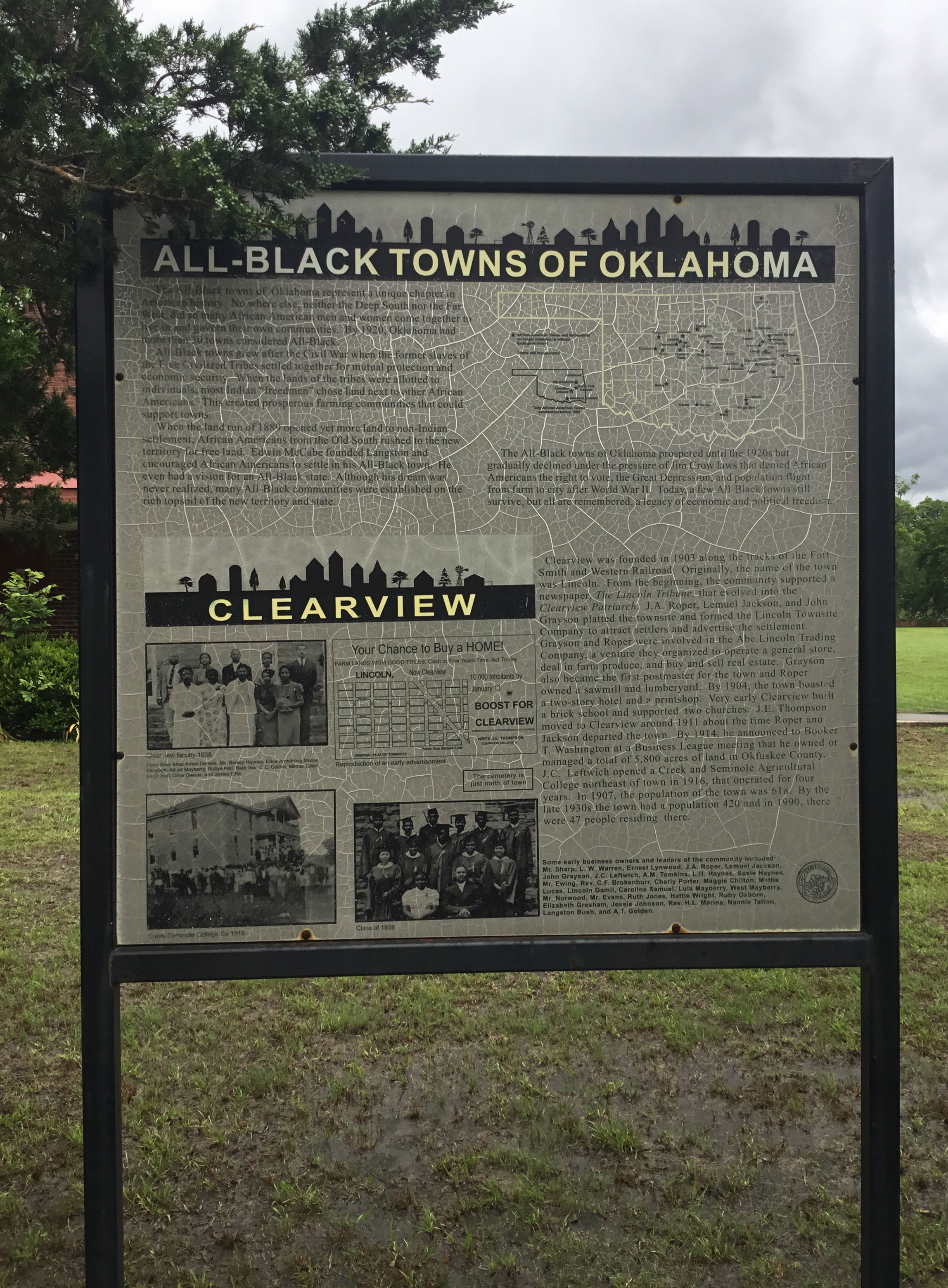
Clearview is one of 13 All-Black towns, out of more than 50 that once existed, remaining in Oklahoma. While Tullahassee is reportedly the oldest, most were established between 1889 and 1907 as African Americans sought security and control of their own destiny in a segregated world. Clearview was founded in 1903 along the tracks of the Fort Smith and Western Railroad. J. A. Roper, Lemuel Jackson, and John Grayson platted the townsite and formed the Lincoln Townsite Company to attract settlers and advertise settlement.
View image
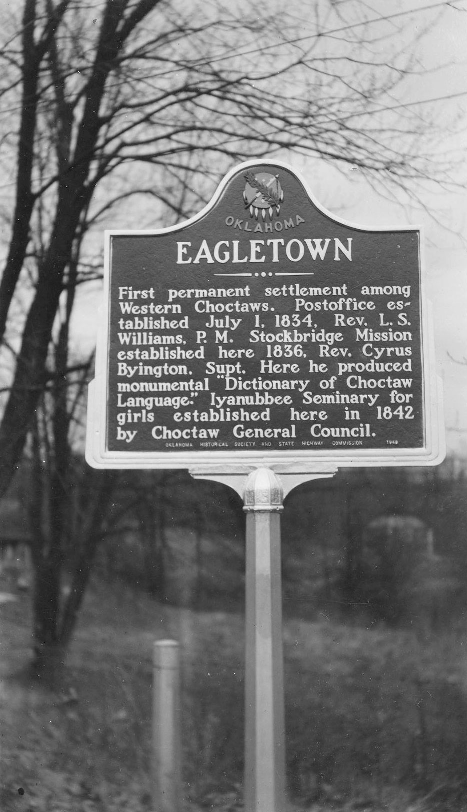
Eagletown
McCurtain CountyLocation: on US-70 west of Mountain Fork River at Eagletown
Material: Granite
Topics: American Indians; Early Statehood;, 1907–1941; Education; Ethnic Diversity; Government; Religion/Philosophy; Westward Expansion, 1803–1861
The first permanent settlement among Western Choctaws was west of Mountain Fork River, but the present town was platted east of the river in 1821. Oklahoma's first post office was established here on July 1, 1834.
View image
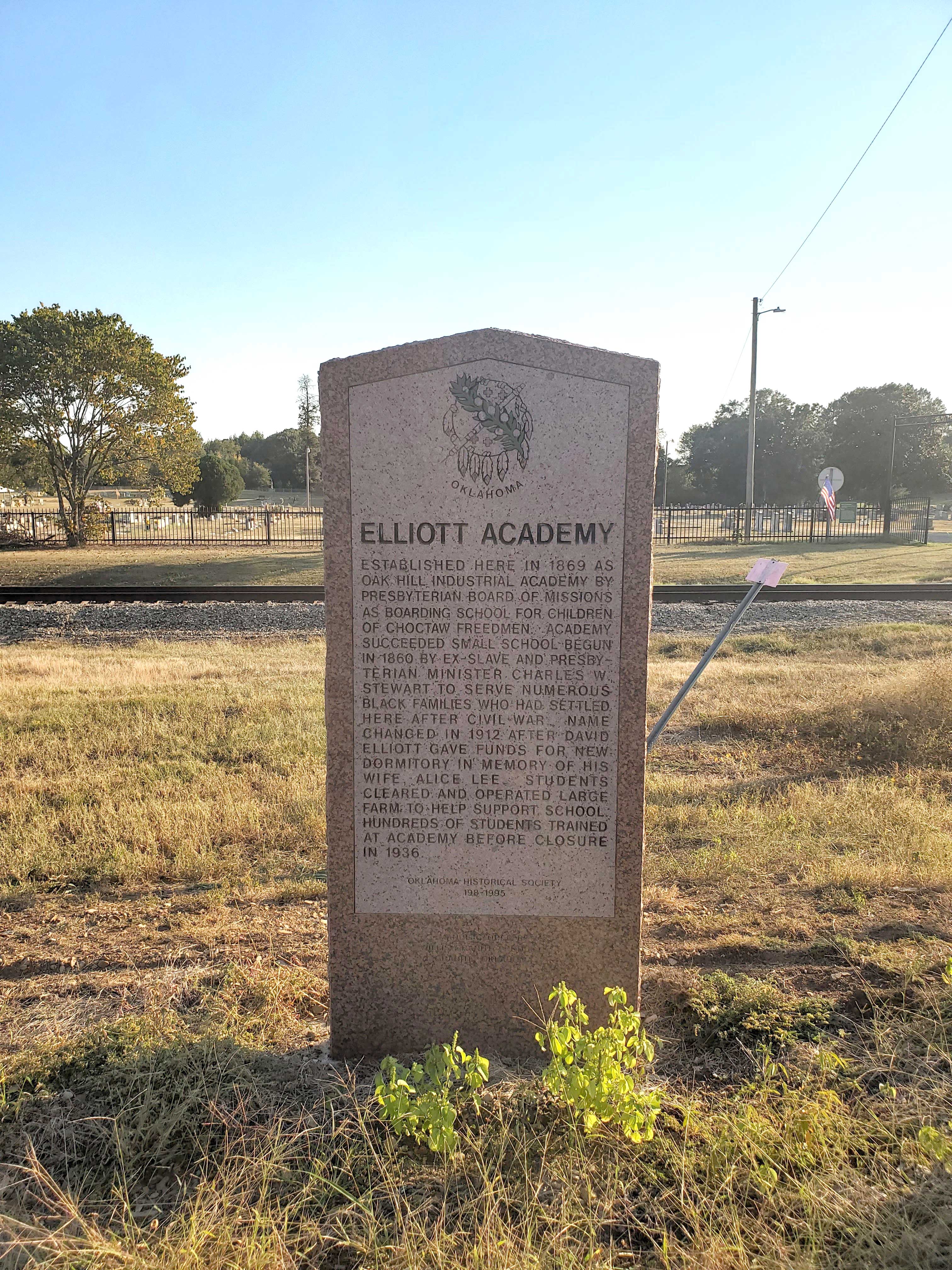
Elliott Academy
McCurtain CountyLocation: on US-70, west of Valliant
Coordinates: 34.006301, -95.119515
Material: Granite
Sponsor(s): Oklahoma Historical Society
Topics: Early Statehood, 1907–1941; Education; Ethnic Diversity; Territorial Period, 1861–1907
Established here in 1869 as Oak Hill Industrial Academy by Presbyterian Board of Missions as boarding school for children of Choctaw Freedmen. Academy succeeded a small school begun in 1860 by ex-slave and Presbyterian Minister Charles W. Stewart to serve numerous Black families who had settled here after Civil War. The academy’s name changed in 1912 after David Elliott gave funds for a new dormitory in memory of his wife, Alice Lee. Students cleared and operated a large farm to help support school. Hundreds of students trained at the academy before it closed in 1936.
View image
First Baptist Convention in Indian Territory
Cherokee CountyLocation: at corner of College and Downing Streets in Tahlequah. OHBC
Topics: Education; Ethnic Diversity; Religion/Philosophy
American Indian, African American, and white Baptists convened here in June 1883 to form the Missionary and Educational Convention, Oklahoma's first Baptist Convention.
Grayson
Okmulgee CountyLocation: in community of Grayson
Topics: Early Statehood, 1907–1941; Ethnic Diversity; Land Openings; Settlement Patterns; Territorial Period, 1861–1907; Urban Development
Grayson is one of 13 All-Black towns, out of more than 50 that once existed, remaining in Oklahoma. While Tullahassee is reportedly the oldest, most were established between 1889 and 1907 as African Americans sought security and control of their own destiny in a segregated world. Most of the towns began to decline in the 1920s and 1930s as rural African Americans faced economic hardships and began to move to urban areas.
Honey Springs Battlefield
McIntosh CountyLocation: on grounds of Honey Springs Battlefield Historic Site, near Rentiesville
Coordinates: 35.530309, -95.486041
Material: Granite
Sponsor(s): See marker description
Topics: American Indians; Ethnic Diversity; Government; Military; Territorial Period, 1861–1907
Five granite markers commemorate those who fought in the Battle of Honey Springs on July 17, 1863. Markers are dedicated to Union soldiers, regiments from the Five Tribes, the First Regiment of Kansas Colored Volunteers, Confederate soldiers, and Confederate soldiers from Texas. Sponsors include the Oklahoma Historical Society, the Intertribal Council of the Five Civilized Tribes, the Community Heritage Recognition Committee, and United Daughters of the Confederacy.

View image
Lake Creek
Greer CountyLocation: on county road, two miles west of OK-6 north of Granite
Material: Granite
Topics: Agriculture; Education; Environmental/Cultural Ecology; Ethnic Diversity; Government; Religion/Philosophy; Settlement Patterns; Territorial Period, 1861–1907; Transportation
Pioneers settled the Lake Creek area beginning in 1898. The consolidated Lake Creek School served area children until 1957. The community included the oldest church in Greer County, the Lake Creek Baptist Church, founded in 1888.
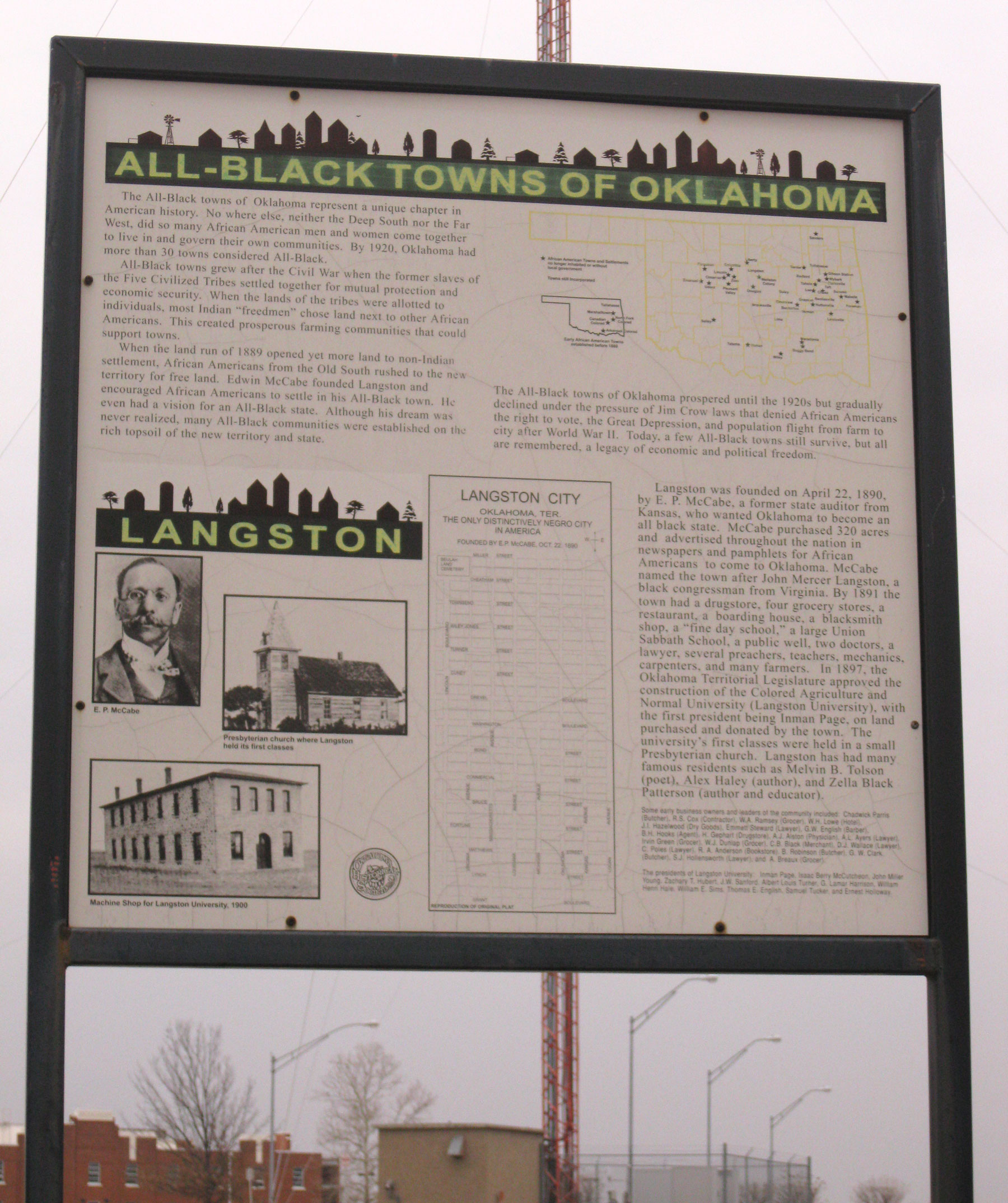
Langston
Logan CountyLocation: on Langston University campus in Langston
Coordinates: 35.942474, -97.260493
Material: Other (Interpretive panel)
Sponsor(s): Oklahoma Historical Society
Topics: Education; Ethnic Diversity; Land Openings; Settlement Patterns; Urban Development
Langston is one of 13 All-Black towns, out of more than 50 that once existed, remaining in Oklahoma. While Tullahassee is reportedly the oldest, most were established between 1889 and 1907 as African Americans sought security and control of their own destiny in a segregated world. Most of the towns began to decline in the 1920s and 1930s as rural African Americans faced economic hardships and began to move to urban areas. Langston was organized in 1890 by E. P. McCabe, who also boosted Oklahoma as an All-Black state. It takes its name from John M. Langston, a well-known educator and member of Congress. Langston became home to the Colored Agricultural and Normal University (Langston University) in 1897.
View image
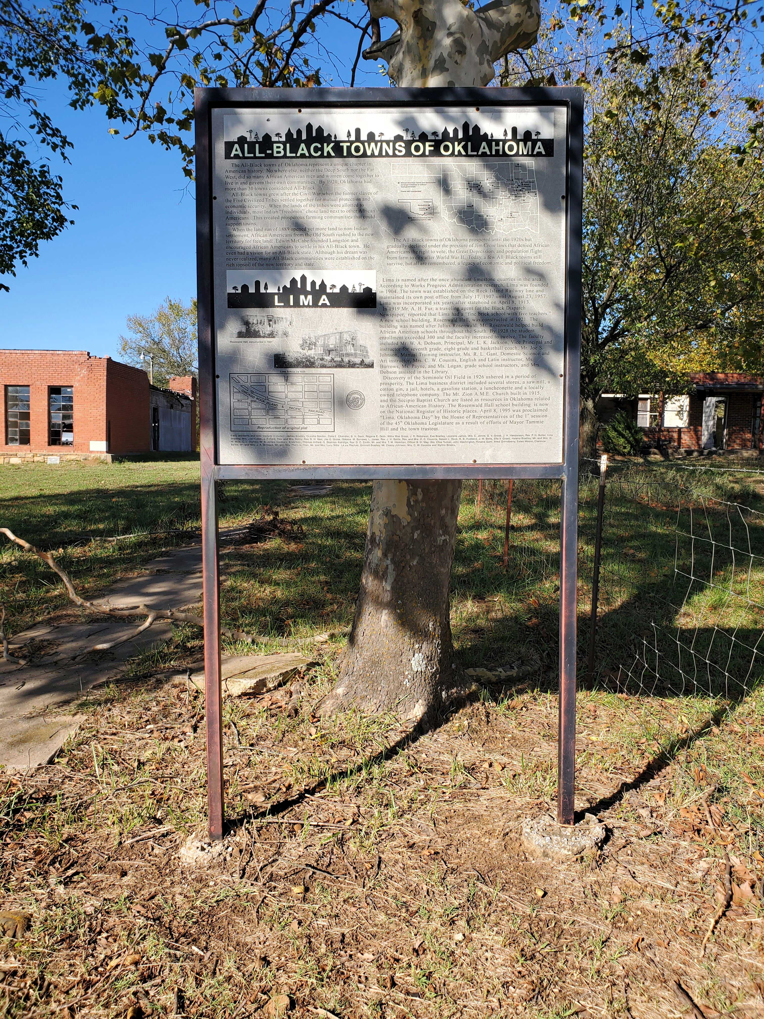
Lima
Seminole CountyLocation: on the grounds of Rosenwald Hall in Lima
Coordinates: 35.173979, -96.598470
Material: Other (Interpretive panel)
Sponsor(s): Oklahoma Historical Society
Topics: Early Statehood, 1907–1941; Education; Ethnic Diversity; Settlement Patterns; Territorial Period, 1861–1907; Urban Development
Lima is one of 13 All-Black towns, out of more than 50 that once existed, remaining in Oklahoma. While Tullahassee is reportedly the oldest, most were established between 1889 and 1907 as African Americans sought security and control of their own destiny in a segregated world. Most of the towns began to decline in the 1920s and 1930s as rural African Americans faced economic hardships and began to move to urban areas. Named for the once abundant limestone quarries in the area, Lima was founded in 1904 and maintained a post office. It is the site of Rosenwald Hall, which was constructed in 1921 with funding from Julius Rosenwald, president of Sears, Roebuck and Company and trustee of the Tuskegee Institute.
View image
Lugert
Kiowa CountyLocation: on the west side of Hwy 44 near the Lugert grain elevator
Sponsor(s): Terri Stern
Topics: Early Statehood, 1907–1941; Ethnic Diversity; Government; Industrial Period, 1941–1982; Land Openings; Retail; Territorial Period, 1861–1907; Water
Austrian immigrant Frank Lugert (1868–1958) founded the town of Lugert when the Kiowa-Comanche-Apache Reservation opened for settlement in 1901. Mr. Lugert ran the post office, train depot, and a general store. The town thrived until 1912 when a tornado destroyed it. In 1947 the dam was completed, covering the townsite.
Martha Centennial Memorial and Martha Public School
Jackson CountyLocation: on Church Street in Martha
Coordinates: 34.725058, -99.384785
Material: Other
Sponsor(s): Unknown
Topics: Education; Settlement Patterns; Territorial Period, 1861–1907
There are two monuments located on the grounds of the former Martha School building. A granite historical marker commemorates the town of Martha’s centennial (1896–1996). A few yards to the south is a brick monument with a school bell and flagpole commemorating the centennial of Martha Public School (1888–1988).

View image

View image
Newkirk
Kay CountyLocation: in downtown pocket parks in Newkirk
Topics: Ethnic Diversity; Land Openings; Petroleum; Recreational/Service; Settlement Patterns; Urban Development
Enameled historical markers with photographs commemorate the Cherokee Outlet, Cherokee allotments, the Oil Boom, the Fire of 1901, Newkirk Country Club, Kay County Fair, Newkirk African-Americans, and the history of Newkirk.
Norge, Oklahoma
Grady CountyLocation: on Highway 92, Norge, where the 98th meridian intersects the highway
Topics: American Indians; Ethnic Diversity; Urban Development
Norge, formerly Allie, is located on the 98th meridian, separating the old Chickasaw Nation to the east and the Kiowa, Comanch,e and Apache Reserve to the west. The town received its name from a Norwegian settlement in the area. Situated on a high plain not far from the Keechi Hills, Norge is four miles southwest of Chickasha.
Nuyaka Mission
Okmulgee CountyLocation: on OK-56, nine miles west of Okmulgee
Coordinates: 35.624754, -96.149639
Material: Granite
Sponsor(s): Oklahoma Historical Society and the Oklahoma Department of Transportation
Topics: American Indians; Education; Government; Territorial Period, 1861–1907
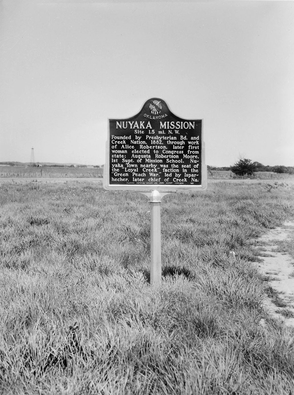
Nuyaka Mission was founded by the Presbyterian Board and the Muscogee (Creek) Nation in 1882 through the efforts of educator Alice Robertson, who also served as Oklahoma’s first female member of Congress. Augusta Robertson Moore was the first superintendent of the mission school. Nuyaka Town, located nearby, was the site of political violence and unrest during the Green Peach War of 1882.
View image

View image
Office of E. P. McCabe
Logan CountyLocation: at South 2nd Street and West Harrison Avenue in Guthrie
Coordinates: 35.877367, -97.427667
Material: Aluminum
Sponsor(s): Donald W. Reynolds Foundation
Topics: Ethnic Diversity; Government; Territorial Period, 1861–1907
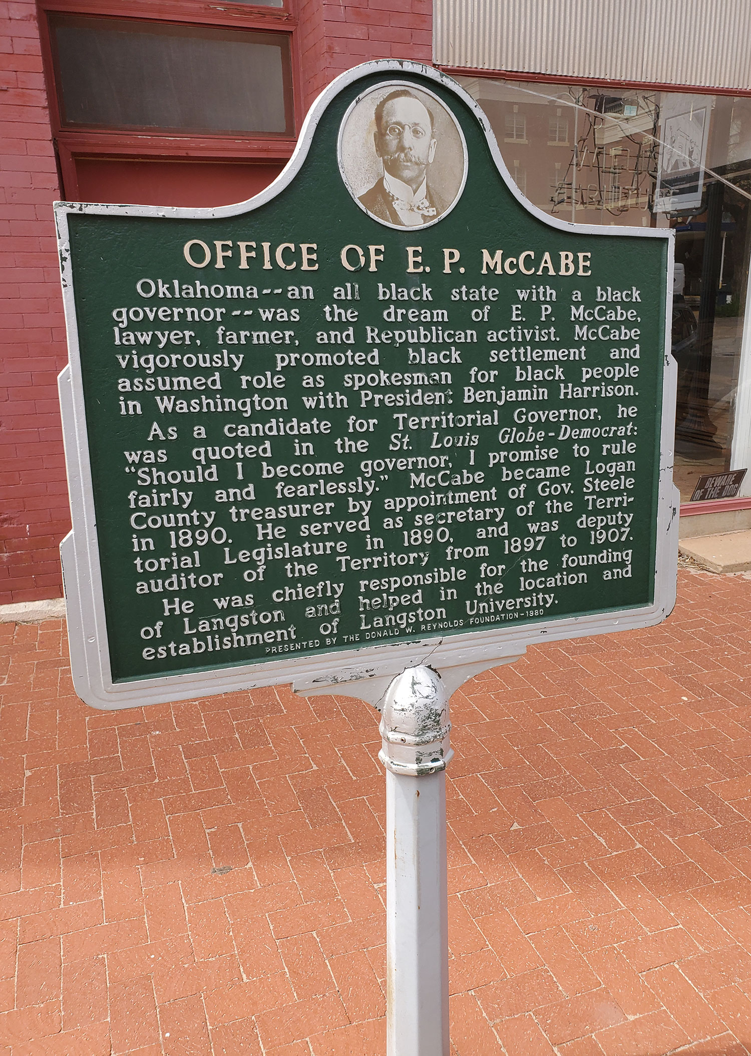
Oklahoma–an all black state with a black governor–was the dream of E. P. McCabe, lawyer, farmer, and Republican activist. McCabe vigorously promoted black settlement and assumed role as spokesman for black people in Washington with President Benjamin Harrison. As a candidate for Territorial Governor, he was quoted in the St. Louis Globe - Democrat: Should I become governor, I promise to rule fairly and fearlessly." McCabe became Logan County treasurer by appointment of Gov. Steele in 1890. He served as secretary of the Territorial Legislature in 1890. and was deputy auditor of the Territory from 1897 to 1907. He was chiefly responsible for the founding of Langston and helped in the location and establishment of Langston University.
View image
Okfuskee County, Rosenwald Schools, and Boley
Okfuskee CountyLocation: on US-62 in Boley
Coordinates: 35.488227, -96.484178
Material: Aluminum
Sponsor(s): Jewish American Society for Historic Preservation/Town of Boley
Topics: Early Statehood, 1907–1941; Education; Ethnic Diversity; Religion/Philosophy
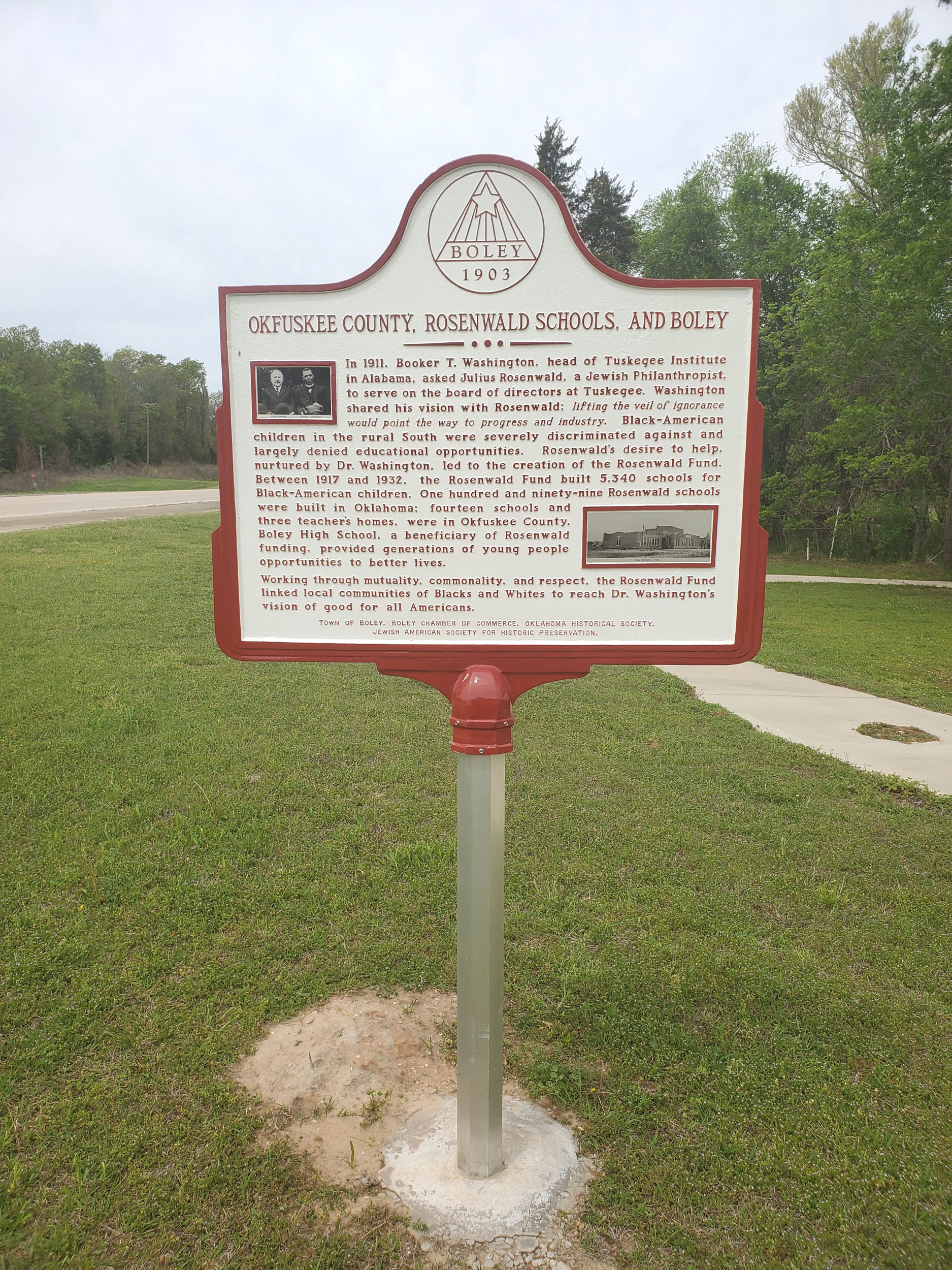
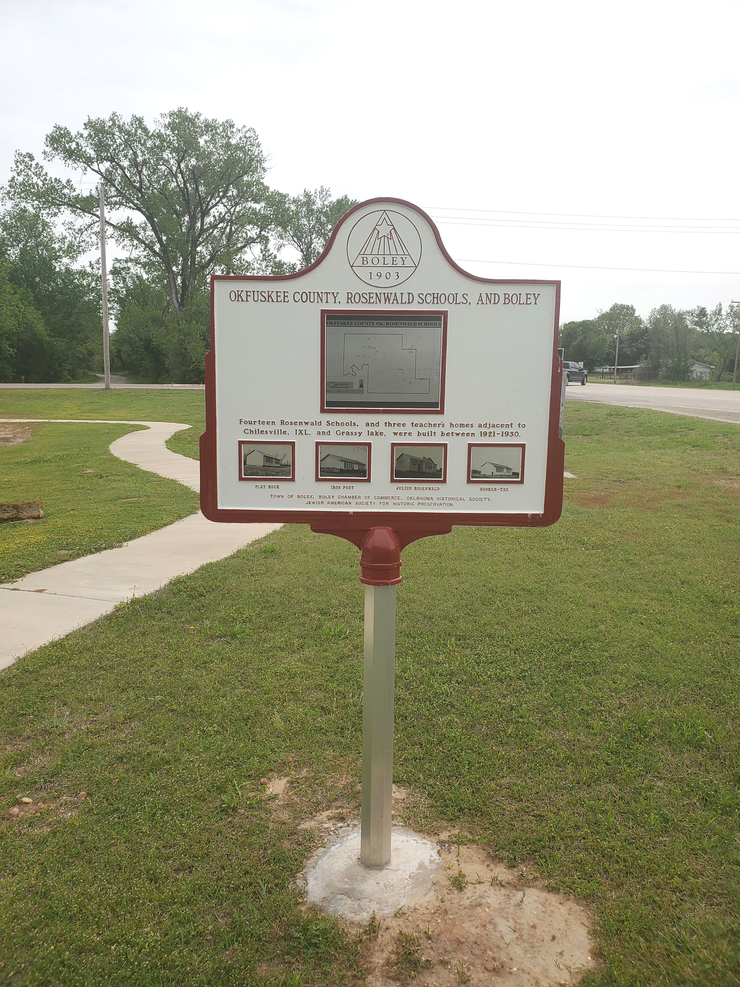
In 1911, Booker T. Washington, head of Tuskegee Institute in Alabama, asked Julius Rosenwald, a Jewish Philanthropist, to serve on the board of directors at Tuskegee. Rosenwald's desire to help, nurtured by Dr. Washington, led to the creation of the Rosenwald Fund. Between 1917 and 1932, the Rosenwald Fund built 5,340 schools for Black-American children. One hundred and ninety-nine Rosenwald schools were built in Oklahoma: fourteen schools and three teacher's homes were in Okfuskee County. Boley High School, a beneficiary of Rosenwald funding, provided generations of young people opportunities to better lives.
View image
View image
Okmulgee Colored Hospital
Okmulgee CountyLocation: 210 N. Wood Dr. in Okmulgee
Coordinates: 35.625388, -95.960514
Material: Granite
Sponsor(s): Landmark for All Generations
Topics: Early Statehood, 1907–1941; Ethnic Diversity; Social/Cultural
In 1922, Okmulgee’s Black citizens secured $25,000 in donations to fund construction of the first "colored hospital" to be opened in the state of Oklahoma. Black citizens formed the Colored Hospital Association in 1924. The hospital housed 18–20 beds with living quarters for a staff of six to seven nurses. It closed in 1957 when Okmulgee integrated its health facilities. The building was listed in the National Register of Historic Places in 1984.

View image
Old Spencer Academy
Choctaw CountyLocation: on grounds of old Spencer Academy, 8 miles north of Sawyer
Coordinates: 34.145919, -95.357897
Material: Granite
Sponsor(s): Oklahoma Historical Society
Topics: American Indians; Arts; Education; Ethnic Diversity; Westward Expansion, 1803–1861
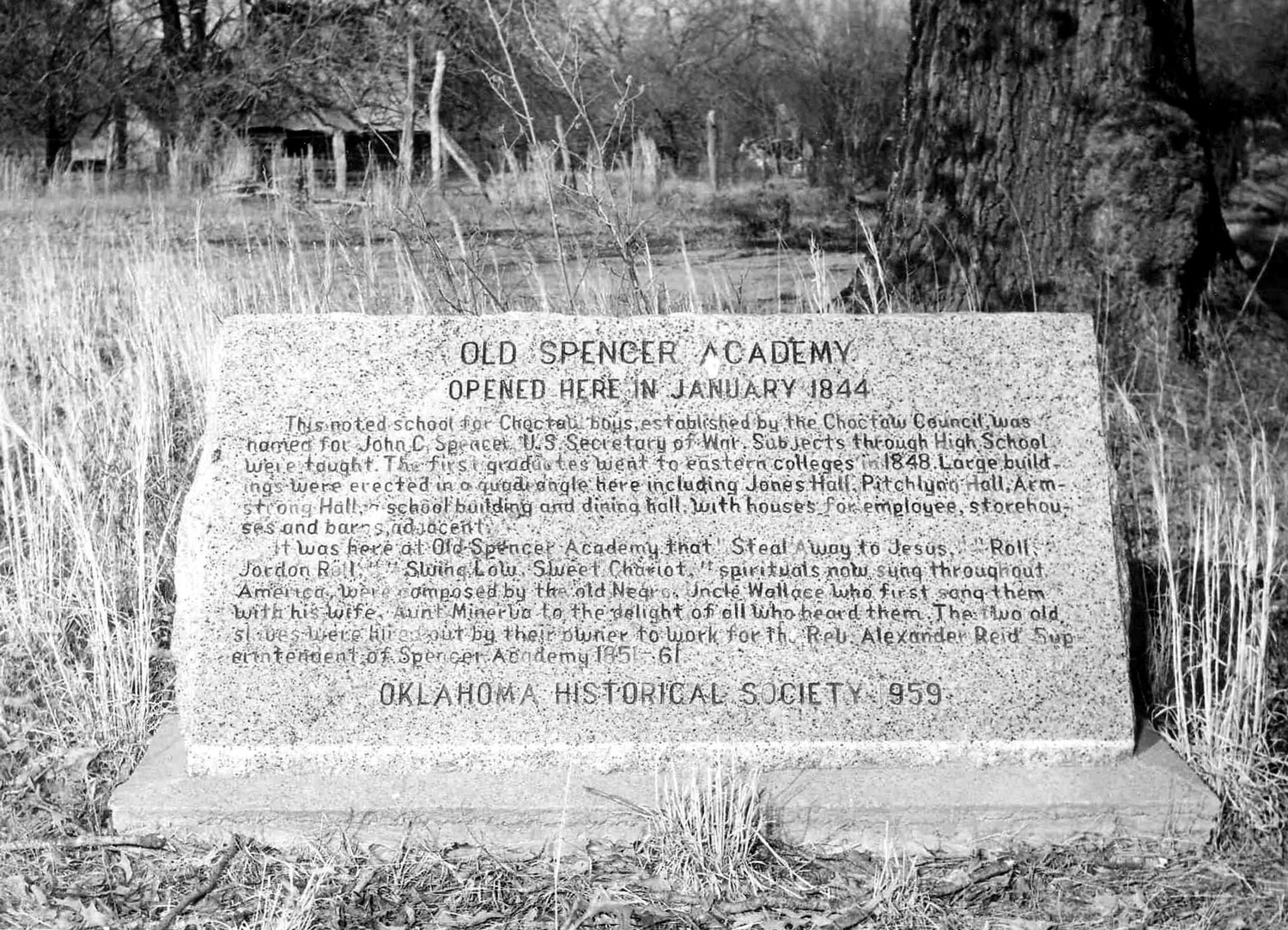
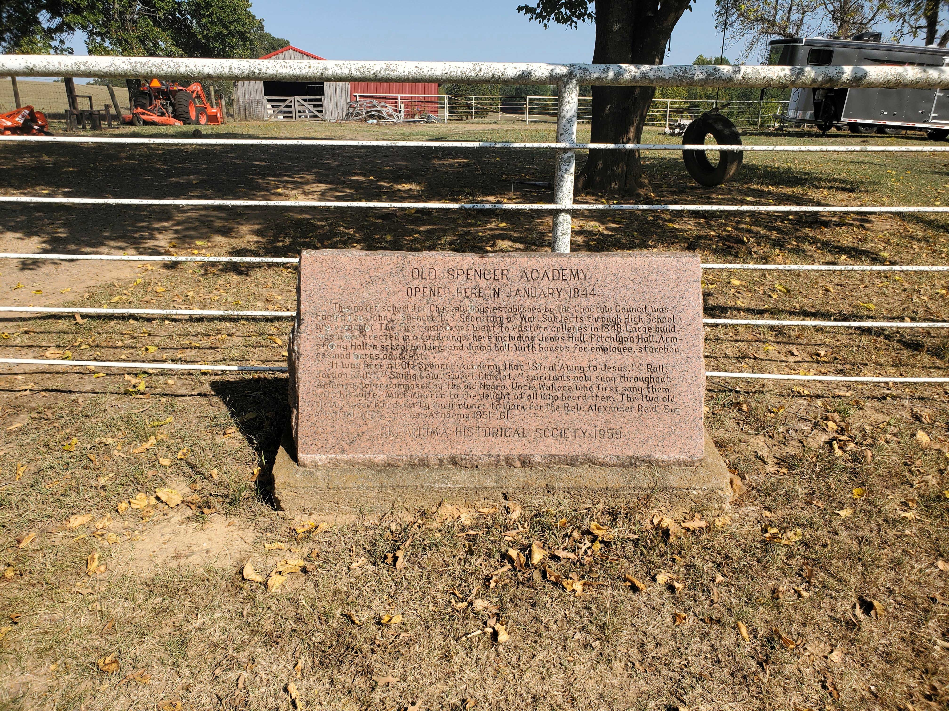
Spencer Academy opened at this location in January 1844. This noted school for Choctaw boys, established by the Choctaw Council, was named for John C. Pencer, US Secretary of War. Subjects through high school were taught. The first graduates went to eastern colleges in 1848. Large buildings were erected in a quadrangle here including Jones Hall, Pitchlynn Hall, Armstrong Hall, a school building and dining hall, with houses for employees, storehouses and barns adjacent. It was here that the spirituals “Steal Away to Jesus,” “Roll, Jordon Roll,” and “Swing Low, Sweet Chariot” were composed. “Uncle” Wallis and “Aunt” Minerva Willis, spiritual composers, were enslaved in the Choctaw Nation and hired out by their owner to work for school superintendent Rev. Alexander Reid. Also see “Spencer Academy.”
Note: This marker incorrectly identifies Wallace and Minerva Willis as husband and wife when, in fact, they were father and daughter.
View image
View image
Old Stone Corral
Comanche CountyLocation: at the Fort Sill Museum
Sponsor(s): Daughters of the American Revolution
Topics: American Indians; Ethnic Diversity; Military; Territorial Period, 1861–1907; Transportation
Known originally as the Quartermaster Corral, this structure, which replaced an earlier wooden corral, is located southeast of the original post quadrangle near Key Gate. The 10th Cavalry constructed the corral in 1870 to hold the horses, oxen, and mules used by the quartermaster for transport of men and supplies and for jobs such as road building. After 1875 the army used the corral for temporary incarceration of Plains Indians. In the 1880s, as boomers tried to enter and settle in the Indian Territory, the military rounded up and held the illegal settlers in the corral until the party was large enough to warrant military escort out of the area.
Red Bird
Wagoner CountyLocation: in community of Red Bird
Coordinates: 35.885676, -95.589588
Material: Other (Interpretive panel)
Sponsor(s): Oklahoma Historical Society
Topics: Civil Rights; Early Statehood, 1907–1941; Ethnic Diversity; Government; Settlement Patterns; Territorial Period, 1861–1907; Urban Development
Red Bird is one of 13 All-Black towns, out of more than 50 that once existed, remaining in Oklahoma. While Tullahassee is reportedly the oldest, most were established between 1889 and 1907 as African Americans sought security and control of their own destiny in a segregated world. Most of the towns began to decline in the 1920s and 1930s as rural African Americans faced economic hardships and began to move to urban areas. Red Bird was established with a post office in June 1902. The Red Bird Investment Company formed to recruit African Americans to settle in the town. I. W. Lane, a Red Bird resident, successfully challenged laws enacted by Oklahoma that sought to prevent African Americans from voting.

View image
Red Wheat Allotment
Custer CountyLocation: east of Clinton on OK-66
Coordinates: 35.513783, -98.936039
Material: Granite
Sponsor(s): Cheyenne Cultural Center and the Oklahoma Historical Society
Topics: Agriculture; American Indians; Ethnic Diversity; Territorial Period, 1861–1907
Prior to the Cheyenne and Arapaho Reservation land run of April 19, 1892, this quarter-section of land was allotted to a Cheyenne woman named Red Wheat. Wheat was not of the Cheyenne culture but was associated with Mennonite immigrants from Russia who introduced 'Turkey red' winter wheat to northwest Oklahoma. Mennonites were among the first to do educational work with the Cheyenne and Arapaho people. 'Red Wheat,' although a mistranslation of an Indian woman’s name, is meaningful to two distinct peoples who lived and interacted with each other during the reservation period and through Oklahoma statehood after 1907.

View image
Rentiesville
McIntosh CountyLocation: in community of Rentiesville
Coordinates: 35.522796, -95.496731
Material: Other (Interpretive panel)
Sponsor(s): Oklahoma Historical Society
Topics: Early Statehood Early Statehood, 1907–1941; Ethnic Diversity; Settlement Patterns; Territorial Period, 1861–1907; Urban Development
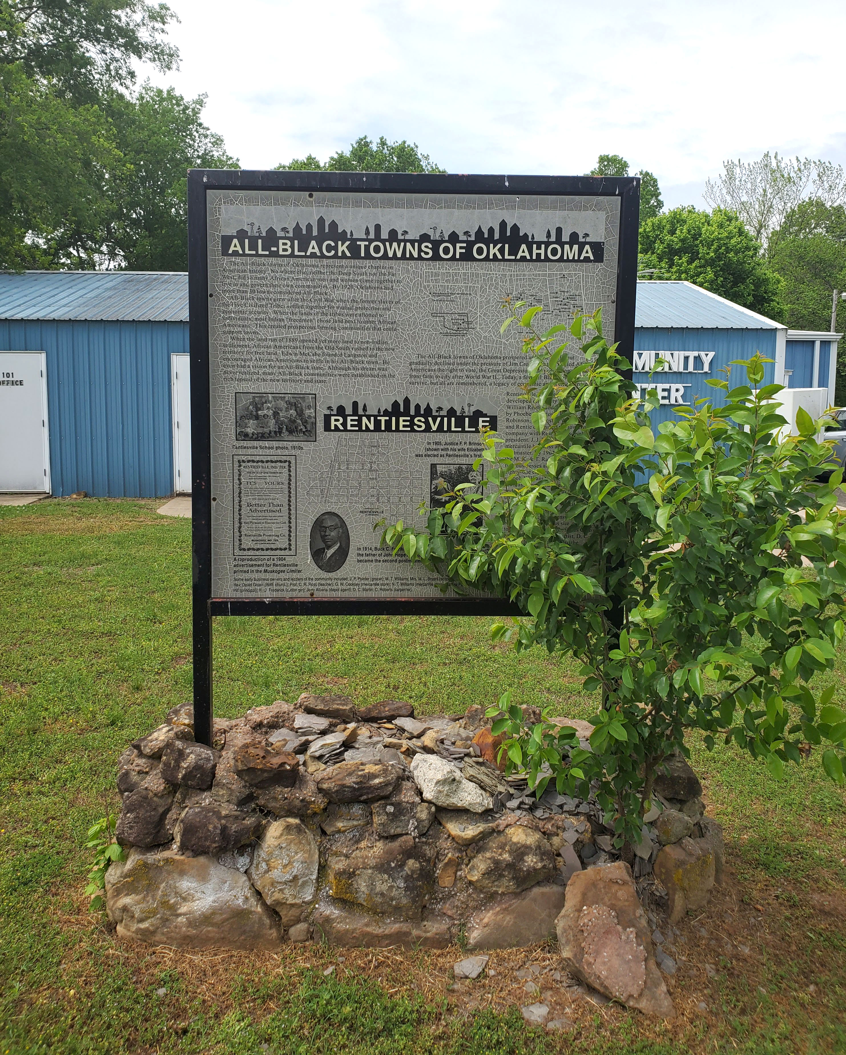
Rentiesville is one of 13 All-Black towns, out of more than 50 that once existed, remaining in Oklahoma. While Tullahassee is reportedly the oldest, most were established between 1889 and 1907 as African Americans sought security and control of their own destiny in a segregated world. Rentiesville was founded in 1903 and a post office opened in 1904. The town soon boasted a lumber store, cotton gin, and several businesses. It is the birthplace of historian John Hope Franklin and hosts the Dusk ’til Dawn Blues Festival each year.
View image
Rose Hill Plantation
Choctaw CountyLocation: on US-70, two miles east of Hugo
Coordinates: 33.997524, -95.450655
Material: Aluminum
Sponsor(s): Oklahoma Historical Society and the Oklahoma Department of Transportation
Topics: Agriculture; American Indians; Ethnic Diversity; Westward Expansion. 1803–1861
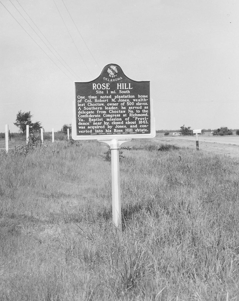
Rose Hill was one of six plantations along the Red River owned by Robert M. Jones (Choctaw) before the Civil War. The two-story mansion at Rose Hill served as a summer residence and was renowned across the region for its extravagance. Enslaved Black laborers, as well as free whites and Choctaws, worked on a plantation that contained a steam gin, saltworks, gristmill, store, and cotton and corn fields. Jones died at Rose Hill on February 22, 1873. Descendants of those formerly enslaved by Jones continue to reside in the area.
Note: The Rose Hill site and Jones family cemetery is approximately one mile south of this marker's location.
View image

View image
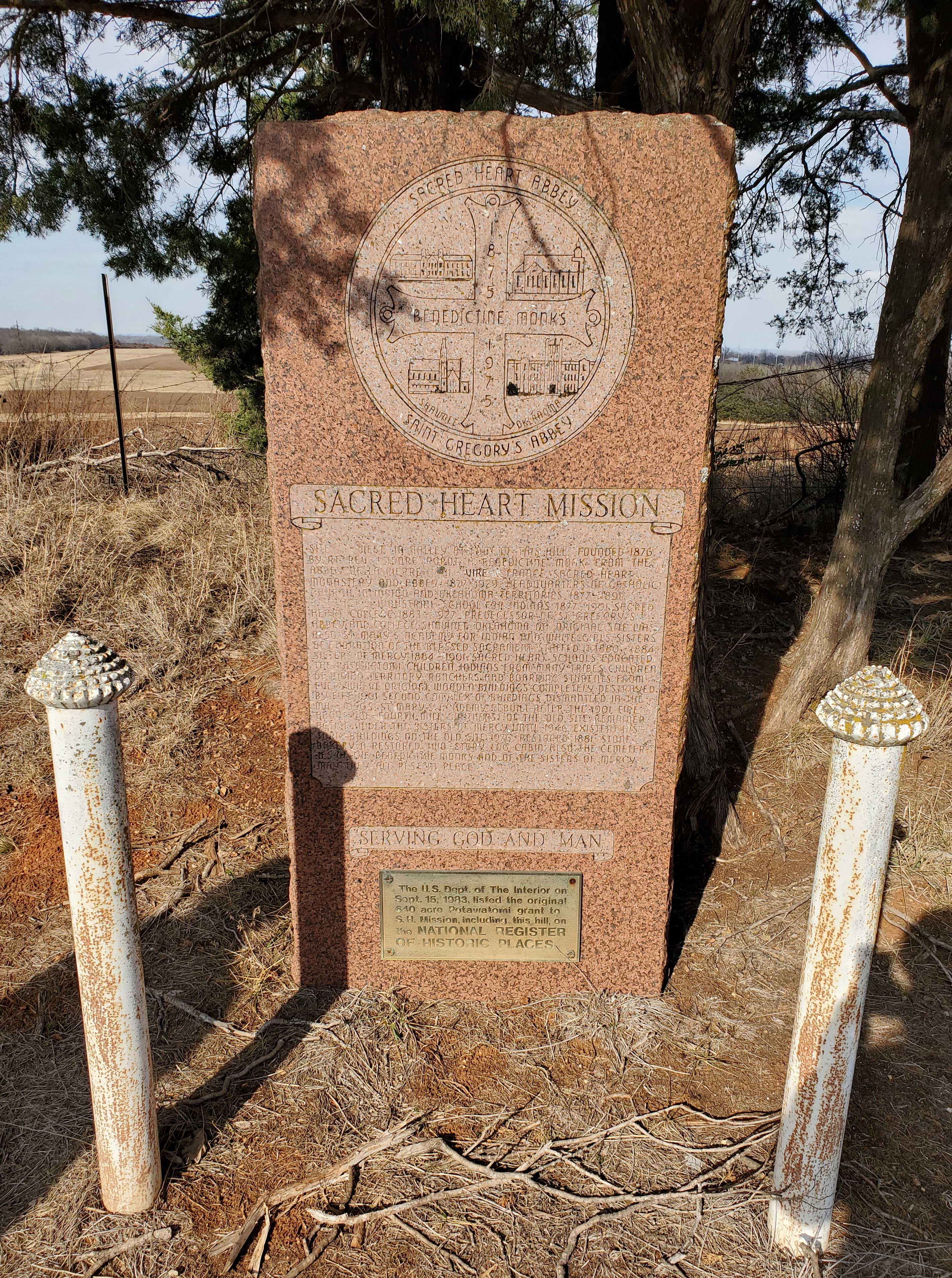
Sacred Heart Mission
Pottawatomie CountyLocation: at Sacred Heart Catholic Church, six miles east of Asher
Coordinates: 34.999126, -96.810716
Material: Granite
Topics: American Indians; Early Statehood, 1907–1941; Education; Religion/Philosophy; Territorial Period, 1861–1907
Site west in valley at foot of this hill founded 1876 by Rt. Rev. Isidore Robot, a Benedictine monk from the abbey of La Pierre. Sacred Heart Monastery and Abbey, 1877–1929. Headquarters of Catholic Church in Indian and Oklahoma territories, 1877–1891. St. Benedict Industrial School for Indians, 1877-1901. Sacred Heart College 1883–1927. Predecessor of St. Gregory’s Abbey and College, Shawnee, Oklahoma.
View image
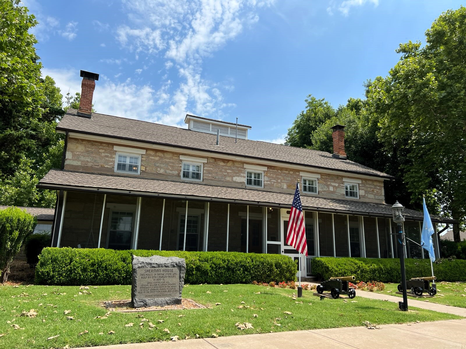
Sherman House
Comanche CountyLocation: on grounds of Fort Sill
Coordinates: 34.671783, -98.386217
Material: Granite
Sponsor(s): Oklahoma Historical Society
Topics: American Indians; Ethnic Diversity; Military; Territorial Period, 1861–1907
Constructed of native stone by members of the 10th Cavalry, this structure was home to General William Tecumseh Sherman when he conducted a tour of frontier army posts in the early 1870s. He narrowly escaped assassination by Kiowa warriors on the porch in May 1871.
View image
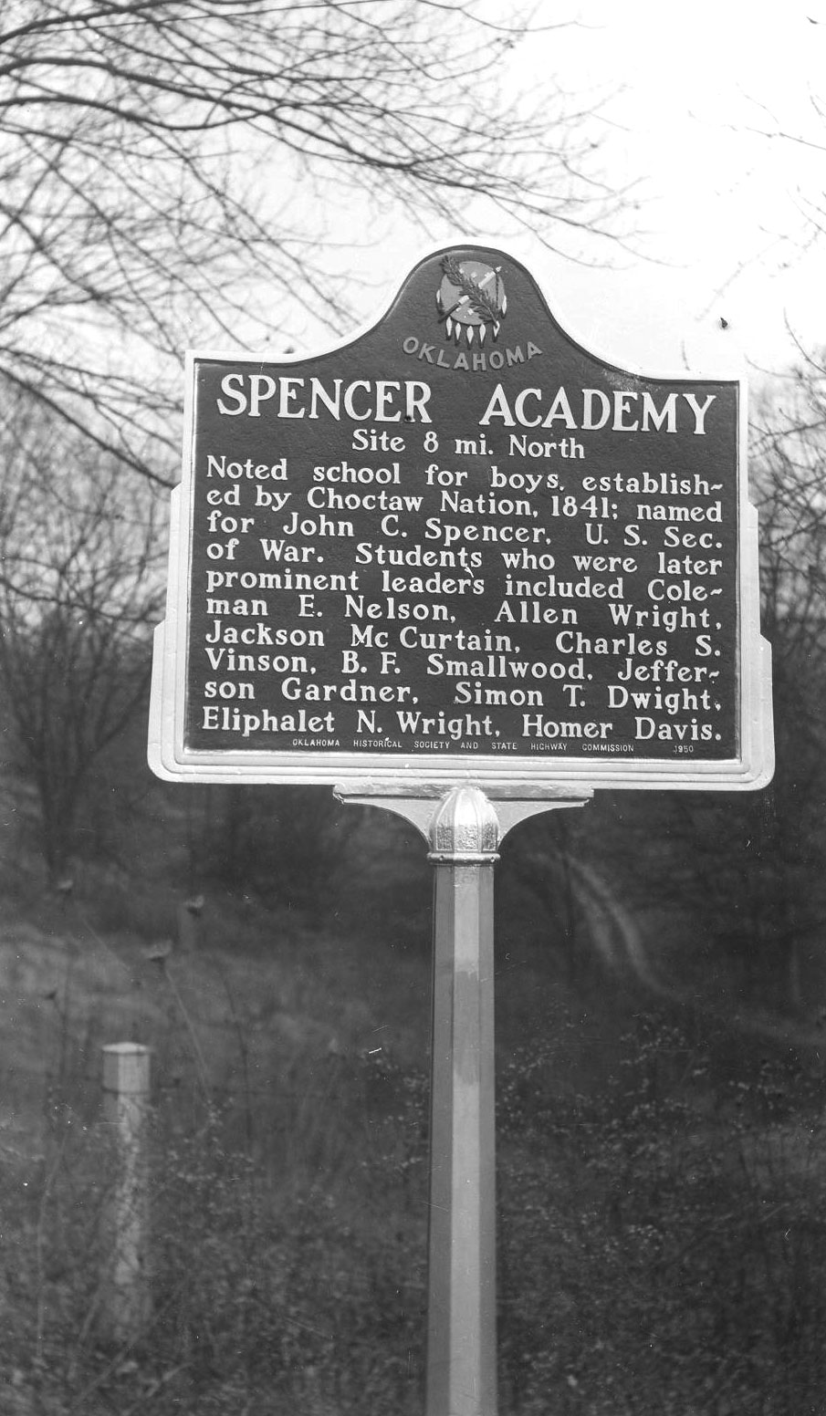
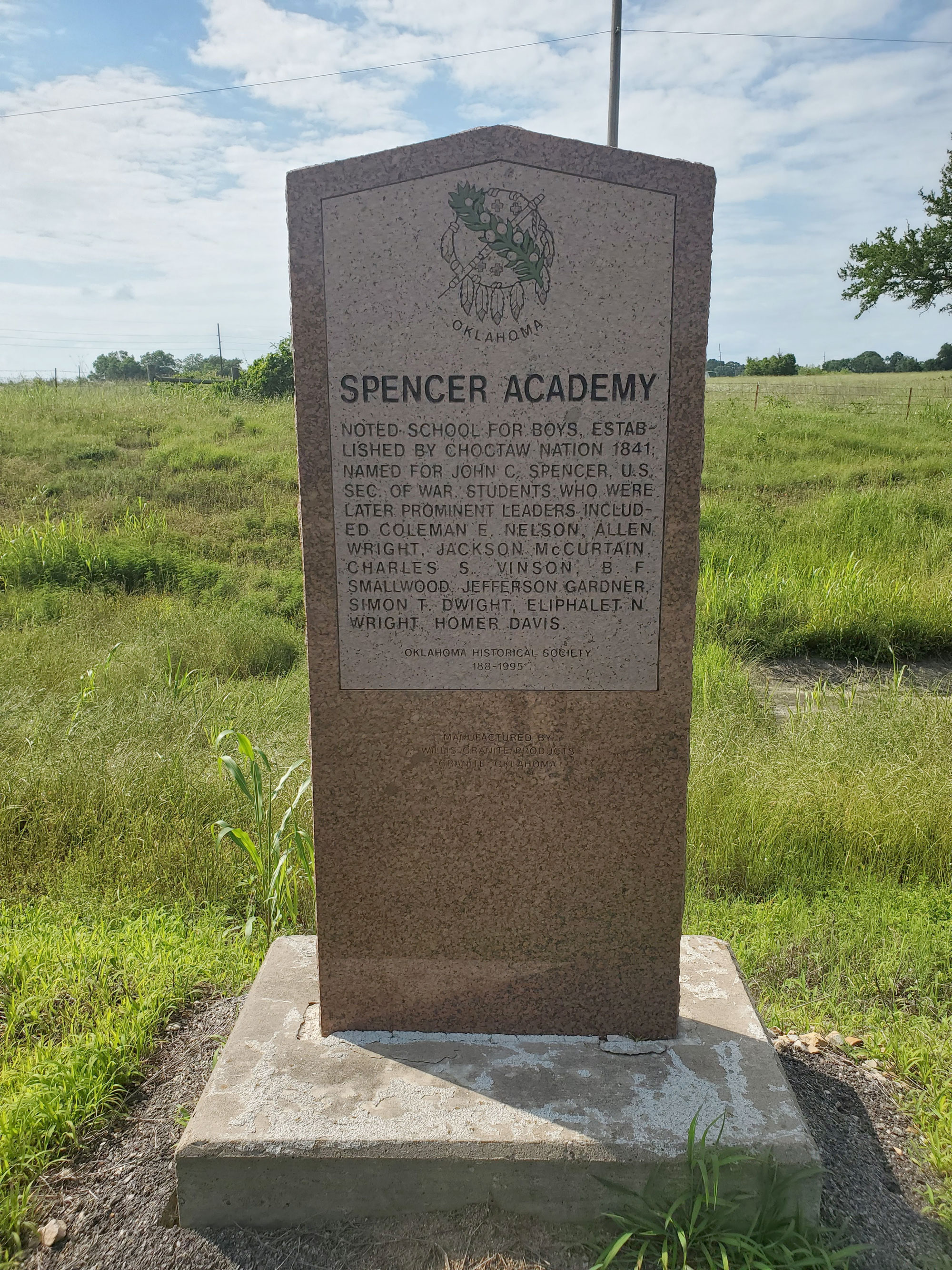
Spencer Academy
Choctaw CountyLocation: on US-70 east of Sawyer
Coordinates: 34.017945, -95.364481
Material: Granite
Sponsor(s): Oklahoma Historical Society and the Oklahoma Department of Transportation
Topics: American Indians; Arts; Education; Ethnic Diversity; Westward Expansion, 1803–1861
A noted school for boys, Spencer Academy was established by the Choctaw Nation in 1841 and named for Secretary of War John C. Spencer. Students who were later prominent Choctaw leaders included Coleman E. Nelson, Allen Wright, Jackson McCurtain, Charles S. Vinson, B. F. Smallwood, Jefferson Gardner, Simon T. Dwight, Eliphalet N. Wright, and Homer Davis.
View image
View image
Summit
Muskogee CountyLocation: in the community of Summit
Coordinates: 35.668461, -95.423847
Material: Other (Interpretive panel)
Sponsor(s): Oklahoma Historical Society
Topics: Early Statehood, 1907–1941; Ethnic Diversity; Government; Recreational/Service; Settlement Patterns; Social/Culture; Territorial Period, 1861–1907; Urban Development
Summit is one of 13 All-Black towns, out of more than 50 that once existed, remaining in Oklahoma. While Tullahassee is reportedly the oldest, most were established between 1889 and 1907 as African Americans sought security and control of their own destiny in a segregated world. Most of the towns began to decline in the 1920s and 1930s as rural African Americans faced economic hardships and began to move to urban areas. Summit had a post office as early as 1896 and was platted in 1910. It may have been named Summit because it was the highest point on the Missouri, Kansas and Texas Railroad between the Arkansas River and the North Canadian River. There were many businesses in Summit before World War II, including a cotton gin, filling station, grocery, and garage. Summit was incorporated in 1980.

View image
Taft
Muskogee CountyLocation: at City Hall in Taft
Coordinates: 35.761912, -95.549480
Material: Other (Interpretive panel)
Sponsor(s): Oklahoma Historical Society
Topics: Early Statehood, 1907-1941; Ethnic Diversity; Government; Recreational/Service; Settlement Patterns; Social/Culture; Territorial Period, 1861-1907; Urban Development
Taft is one of 13 All-Black towns, out of more than 50 that once existed, remaining in Oklahoma. While Tullahassee is reportedly the oldest, most were established between 1889 and 1907 as African Americans sought security and control of their own destiny in a segregated world. Most of the towns began to decline in the 1920s and 1930s as rural African Americans faced economic hardships and began to move to urban areas. Initially named Twine after resident W. H. Twine, the town name changed to Taft in 1904 to honor William Howard Taft, secretary of war and later president of the United States. Taft was home to several state-operated facilities for the state’s African American population, including the Industrial Institute for the Deaf, Blind, and Orphans of the Colored Race, State Training School for Negro Girls, and State Hospital for the Negro Insane.
Tatums
Carter CountyLocation: at Bethel Missionary Baptist Church in Tatums
Coordinates: 34.482406, -97.461651
Material: Other (Interpretive panel)
Sponsor(s): Oklahoma Historical Society
Topics: Early Statehood, 1907–1941; Ethnic Diversity; Government; Law and Order; Petroleum; Settlement Patterns; Social/Culture; Territorial Period, 1861–1907; Urban Development
Tatums is one of 13 All-Black towns, out of more than 50 that once existed, remaining in Oklahoma. While Tullahassee is reportedly the oldest, most were established between 1889 and 1907 as African Americans sought security and control of their destiny in a segregated world. Most of the towns began to decline in the 1920s and 1930s as rural African Americans faced economic hardships and began to move to urban areas. Tatums was established in 1895 and is named for Lee Tatum, the first postmaster and a US marshal. Oil wells were drilled in the vicinity during the 1920s. The silent movie Black Gold was filmed in Tatums in 1927.

View image
Temple B’Nai Israel
Oklahoma CountyLocation: 50 Broadway Circle, Oklahoma City
Sponsor(s): Goldring/Woldenberg Institute of Southern Jewish Life; Jewish American Society for Historical Preservation.
Topics: Ethnic Diversity; Religion/Philosophy; Territorial Period, 1861–1907
Jews have lived in Oklahoma since the mid-nineteenth century. In 1903, Jews in Oklahoma City organized Temple B'Nai Israel. During its first few years, the congregation met at several local churches. The synagogue, located at 50 Broadway Circle, was dedicated on January 17, 1908. Temple B'Nai Israel remained in this building until 1955, when they moved to a new synagogue on North Pennsylvania Street. Temple B'Nai Israel affirmed the American principals of freedom of religion and assembly in Oklahoma.
Tullahassee
Wagoner CountyLocation: in community of Tullahassee
Coordinates: 35.833994, -95.438361
Material: Other (Interpretive panel)
Sponsor(s): Oklahoma Historical Society
Topics: Early Statehood, 1907–1941; Education; Ethnic Diversity; Government; Settlement Patterns; Territorial Period, 1861–1907; Urban Development
Tullahassee is one of 13 All-Black towns, out of more than 50 that once existed, remaining in Oklahoma. While Tullahassee is reportedly the oldest, most were established between 1889 and 1907 as African Americans sought security and control of their own destiny in a segregated world. Most of the towns began to decline in the 1920s and 1930s as rural African Americans faced economic hardships and began to move to urban areas. Tullahassee now occupies the site of Tullahassee Manual Labor School, established in the Muscogee (Creek) Nation in 1850 by Reverend Robert M. Loughridge under the auspices of the Presbyterian Board of Foreign Missions. A school for Freedmen was established in 1883, and a post office was established 1899. Flipper-Key-Davis University, established in 1914, was the only private Black institution of higher education in Oklahoma until it closed in 1936.

View image

View image
Vernon
McIntosh CountyLocation: in community of Vernon
Coordinates: 35.216608, -95.926825
Material: Other (Interpretive panel)
Sponsor(s): Oklahoma Historical Society
Topics: Early Statehood, 1907–1941; Ethnic Diversity; Government; Settlement Patterns; Urban Development
Vernon is one of 13 All-Black towns, out of more than 50 that once existed, remaining in Oklahoma. While Tullahassee is reportedly the oldest, most were established between 1889 and 1907 as African Americans sought security and control of their own destiny in a segregated world. Vernon, established in March 1912, is named for William T. Vernon, a minister and bishop in the African Methodist Episcopal Church, who also served as registrar of the United States Treasury from 1906 to 1912 under Presidents Theodore Roosevelt and William Taft.

View image
Yukon Czech Hall (Bohemian Hall)
Canadian CountyLocation: 205 North Czech Hall Road in Yukon
Coordinates: 35.468757, -97.742769
Material: Granite
Sponsor(s): LaVerne Benda
Topics: Early Statehood, 1907–1941; Ethnic Diversity; Recreational/Service
Bohemian Hall was established in 1899 by early Czech settlers. The original structure was replaced by the present building in 1925. Bohemian Hall is the focal point of Czech social and musical functions in Oklahoma, including traditional weddings, reunions, and family gatherings. Czech plays were performed until 1940. Czech dances have been held on Saturday nights since 1925.
(Page 1 of 1)
Marker Search
Use quotation marks to search for an exact phrase.
Browse by County
Adair County
Alfalfa County
Atoka County
Beaver County
Beckham County
Blaine County
Bryan County
Caddo County
Canadian County
Carter County
Cherokee County
Choctaw County
Cimarron County
Cleveland County
Comanche County
Cotton County
Craig County
Creek County
Custer County
Delaware County
Dewey County
Ellis County
Garfield County
Garvin County
Grady County
Grant County
Greer County
Harmon County
Harper County
Haskell County
Hughes County
Jackson County
Jefferson County
Johnston County
Kay County
Kingfisher County
Kiowa County
Latimer County
Le Flore County
Lincoln County
Logan County
Love County
Major County
Marshall County
Mayes County
McClain County
McCurtain County
McIntosh County
Murray County
Muskogee County
Noble County
Nowata County
Okfuskee County
Oklahoma County
Okmulgee County
Osage County
Ottawa County
Pawnee County
Payne County
Pittsburg County
Pontotoc County
Pottawatomie County
Pushmataha County
Roger Mills County
Rogers County
Seminole County
Sequoyah County
Stephens County
Texas County
Tillman County
Tulsa County
Wagoner County
Washington County
Washita County
Woods County
Woodward County
Alfalfa County
Atoka County
Beaver County
Beckham County
Blaine County
Bryan County
Caddo County
Canadian County
Carter County
Cherokee County
Choctaw County
Cimarron County
Cleveland County
Comanche County
Cotton County
Craig County
Creek County
Custer County
Delaware County
Dewey County
Ellis County
Garfield County
Garvin County
Grady County
Grant County
Greer County
Harmon County
Harper County
Haskell County
Hughes County
Jackson County
Jefferson County
Johnston County
Kay County
Kingfisher County
Kiowa County
Latimer County
Le Flore County
Lincoln County
Logan County
Love County
Major County
Marshall County
Mayes County
McClain County
McCurtain County
McIntosh County
Murray County
Muskogee County
Noble County
Nowata County
Okfuskee County
Oklahoma County
Okmulgee County
Osage County
Ottawa County
Pawnee County
Payne County
Pittsburg County
Pontotoc County
Pottawatomie County
Pushmataha County
Roger Mills County
Rogers County
Seminole County
Sequoyah County
Stephens County
Texas County
Tillman County
Tulsa County
Wagoner County
Washington County
Washita County
Woods County
Woodward County
To find out more about the Oklahoma Historical Society Historical Marker Program or how to submit an application, please visit the Historical Marker Program page.
Missing or Damaged Markers
Please use our online form to report missing or damaged historical markers.
Report Missing or Damaged Markers
Contact Us
If you have questions, please contact:
Matthew Pearce
Oklahoma Historical Society
800 Nazih Zuhdi Drive
Oklahoma City, OK 73105
405-522-8659
[email protected]
